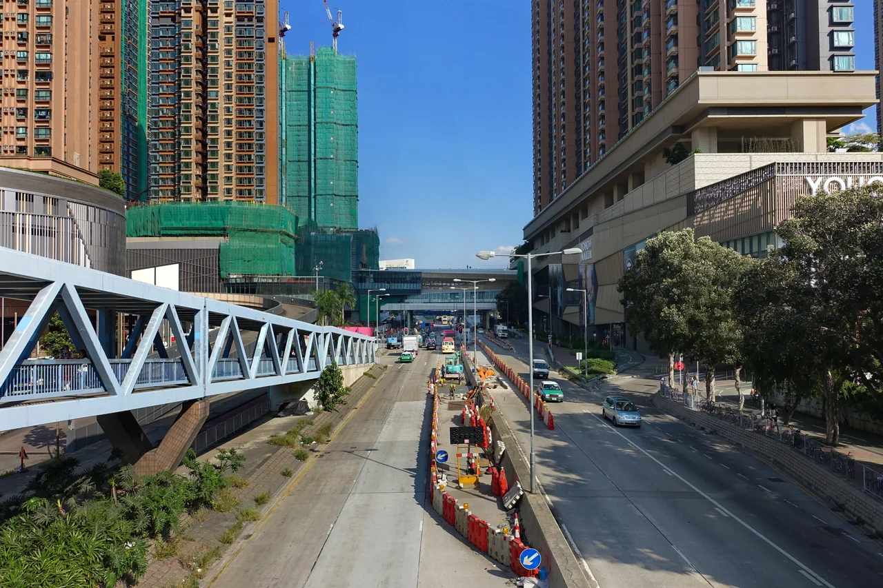

Yuen Long New Town
Yuen Long New Town has always been on Hong Kong's list — just never quite at the top of it. When the government formally designated it a new town in 1972 and began planning large-scale housing estates, the project was reasonable on paper but awkward in practice: Yuen Long sat in the far northwest of the New Territories, reachable only by Castle Peak Road or Tuen Mun Road, and when either route closed due to accidents, the entire community was effectively cut off. Buses took commuters via roundabout paths through other districts. The first housing development started in 1974. It was not until late 2003 — nearly thirty years later — that the West Rail line finally connected Yuen Long to the broader Hong Kong rail network. The town that had been waiting for the train became, almost immediately, a different place.
From Market to New Town
The seed of Yuen Long New Town was the old market settlement now known as Yuen Long San Hui — the new market, in contrast to the older Kau Hui that preceded it. This traditional market town occupied the centre of the Yuen Long Plain, which made it the natural hub for surrounding villages to bring crops and fish. The Hong Kong government recognised the potential of the site's central position within the flat, open plain and added it to its new town programme in 1972. By 1978 it was classified as a second-generation new town, a step behind the pioneering developments at Sha Tin and Tuen Mun. Development through the 1970s and early 1980s absorbed the market town itself, added Long Ping Estate, the Yuen Long Industrial Estate, the Tong Tau Industrial Area, and later the Yoho Town complex. The market's geography became the new town's geometry.
The Long Wait for Rail
Distance from Kowloon was not the only obstacle. Through the 1980s and 1990s, while Tin Shui Wai New Town — the adjacent development to Yuen Long's west — was being built at speed, Yuen Long remained dependent on roads. The road network improved significantly by the late 1990s, partly as a consequence of Tin Shui Wai's own growth forcing infrastructure investment. But the transformative moment came with the completion of the West Rail line in late 2003. Two Tuen Ma line stations now serve the new town: Long Ping, near Long Ping Estate in the west, and Yuen Long, at the eastern end of the main built-up area. Yuen Long station doubles as the interchange between the Tuen Ma line and the Light Rail network, which runs along Castle Peak Road — locally known simply as Yuen Long Main Road — through the heart of the town.
Industry on the North Side
Yuen Long's industrial activity is concentrated on the town's northern flank, within Yuen Long Industrial Estate and the Tong Tau Industrial Area. Both are managed by Hong Kong Science and Technology Parks Corporation, which restricts tenancy to new and innovative companies rather than traditional manufacturing. The Light Rail system threads through this northern industrial zone as well as the residential south, making it a connector across the town's distinct functional areas. The western part of the new town is predominantly residential under government planning designations — public housing estates for the large population that the new town absorbed through the 1980s and 1990s.
A Quieter Corner: Parks and Performing Arts
Southwest of the main commercial strip, the pace of Yuen Long New Town noticeably slows. Yuen Long Park occupies this quieter quarter, its seven-storey pagoda enclosing an aviary that has become one of the area's most recognisable landmarks. Adjacent facilities — Yuen Long Stadium, Yuen Long Theatre, and Yuen Long Swimming Pool — form a civic cluster that serves as the arts and recreation centre for the New Territories northwest. Yuen Long Theatre opened in May 2000, its bamboo-accented foyer courtyard designed to project calm into what is otherwise one of Hong Kong's denser residential environments. The park itself sits close enough to the Light Rail line that the sound of trams is never far away, but inside its boundaries the pagoda, the birds, and the water features belong to a different rhythm entirely.
The Plain That Connects
Yuen Long New Town is oriented outward as much as inward. To its west lies Ping Shan; to the south, Shap Pat Heung; to the east, Kam Tin; and to the north, the wetlands of Nam Sang Wai. The Light Rail network connects the new town not just to its own districts but to Tin Shui Wai and Tuen Mun, forming a local transit web across the flat northwest New Territories that predates the Tuen Ma line by decades. Standing on the platform at Yuen Long station today, with express trains heading toward Kowloon and trams departing for Tin Shui Wai, the isolation that defined the town's first thirty years seems almost impossible to imagine. The waiting is over. The town has caught up with its own ambitions.
From the Air
Yuen Long New Town sits at approximately 22.46°N, 114.019°E, visible from the air as a dense urban cluster on the Yuen Long Plain in the northwest New Territories. At 2,000–4,000 feet, the distinction between the town's tight residential towers and the surrounding agricultural and wetland land is clear. The Light Rail tracks cutting along Castle Peak Road are visible in good visibility. Nearest airport is VHHH (Hong Kong International Airport) on Lantau Island, approximately 12 km to the southwest. The town lies on the approach corridor for runway 07R/07L arrivals.
Nearby Stories
- Chapel of St. Francis Xavier 3.5 km away
- Cuiheng 4.1 km away
- 2015 Shenzhen Landslide 16 km away
- Shunde 31 km away
- Wanshan Archipelago 37 km away
- Nanxiong Formation 96 km away
- Heyuan 149 km away
- Checheng Fu'an Temple 629 km away