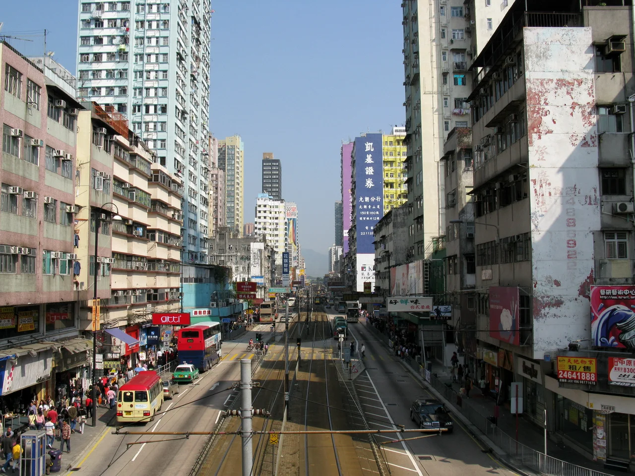

Yuen Long
The name comes from an old map. According to the Gazetteer of Xin'an County, Yuen Long was originally written as 圓蓢 — literally, "round basin" or "round lowland." It described a large plain cupped by hills: from Oyster Hill in the east to Tai Tau Shan in Tuen Mun to the west, the land dips and flattens in a bowl shape that in ancient times was a swampy lowland threaded with water. The name survived every dynasty change and administrative reorganisation. It survived the British lease. It survived the high-rises. Walk into Yuen Long today and you are walking into a place that still wears its oldest description, even as everything around it has been remade.
The Shape of the Place
Yuen Long town sits in the western north New Territories, with Hung Shui Kiu, Tin Shui Wai, Lau Fau Shan, and Ha Tsuen to its west; Shap Pat Heung and Tai Tong to the south; Au Tau and Kam Tin to the east; and the Nam Sang Wai wetlands to the north. The town occupies the centre of the alluvial plain that its name has always described. Castle Peak Road, locally known as Yuen Long Main Road, runs through the heart of it — a long commercial street where minibuses, Light Rail trams, and pedestrians share the same overloaded corridor. Above the street, residential towers have replaced what was once market-town scale. Below the street, in the warren of lanes and covered passages off the main road, something of the old density persists.
Where the Name Comes From, Where the People Come From
Yuen Long's residents are predominantly local ethnic Han Cantonese, but the town also has a notable community of Hoa people — ethnic Chinese who came to Hong Kong as refugees from Vietnam between the 1970s and 1990s. Their arrival added a layer of Southeast Asian Chinese culture to a place that was already complicated by the overlapping histories of Tang clan villages, British colonial administration, and rapid urbanisation. The largest residential development in the town today is the YOHO complex — Grand YOHO, YOHO Town, and THE YOHO HUB II — clustered around Yuen Long MTR station. These towers represent the post-2003 era of development that the rail connection made possible, rising above a town that has always been defined, at some level, by who moves through it and why.
The Border's Shadow
Proximity to Shenzhen has shaped Yuen Long's recent decades in ways both mundane and charged. From 2012 onward, the town became one of the focal points for what Hong Kong residents called parallel trading — the practice of large numbers of visitors from mainland China buying goods in bulk, particularly infant formula, and carrying them across the border for resale. Local shortages of milk powder followed. Community tension grew. Protests against parallel trading mounted at Yuen Long in 2015 under the slogan "Liberate Yuen Long," part of a broader pattern of localist-movement demonstrations in border-adjacent towns. The Hong Kong–Shenzhen Western Corridor bridge, opened in 2007 at Ngau Hom Shek on the northwest edge of the district, made the physical crossing easier — and made Yuen Long's position at the junction of two economic systems more tangible than ever.
A Night That Changed How the Town Is Remembered
On 21 July 2019, a mob of more than 100 people dressed in white attacked commuters inside Yuen Long MTR station. The victims included elderly passengers, children, journalists, lawmakers, and people returning from pro-democracy protests held earlier that evening in Sheung Wan. At least 45 people were injured, among them a pregnant woman. The attack lasted for extended minutes. Police arrived significantly later. The events of that night — the white-shirted attackers, the crowded station platform, the delayed response — entered Hong Kong's recent history as one of the most disturbing episodes of a deeply disturbing year. Yuen Long, a town that had for most people been associated with sweetheart cakes and traditional markets, became a place whose name carried new weight.
On Screen and in the Streets
Yuen Long has appeared in Hong Kong popular culture as a setting with texture rather than glamour. The 2003 TVB drama Vigilante Force was set here. The 2015 film Little Big Master drew on the true story of a tiny kindergarten in Yuen Kong Tsuen, which had dwindled to five students in 2009 before recovering to 64 by 2011. The school survived, and the film was made. These small stories — a kindergarten that refused to close, a street market that persisted through urban redevelopment, festivals that continued despite everything — are as much a part of Yuen Long's character as its proximity to Shenzhen or the towers that now frame its skyline.
From the Air
Yuen Long town lies at approximately 22.44°N, 114.026°E, at the centre of the Yuen Long Plain in the northwest New Territories. From cruising altitude the round-basin geography of the name is apparent — the flat alluvial plain is clearly bounded by the hill ranges to the south and east. The town's dense commercial core along Castle Peak Road is visible at 2,000–3,000 feet. Nearest airport is VHHH (Hong Kong International) on Lantau, approximately 15 km to the southwest. The Light Rail lines running north from the town toward Tin Shui Wai are visible in good visibility.
Nearby Stories
- Chapel of St. Francis Xavier 3.5 km away
- Cuiheng 4.1 km away
- 2015 Shenzhen Landslide 16 km away
- Shunde 31 km away
- Wanshan Archipelago 37 km away
- Nanxiong Formation 96 km away
- Heyuan 149 km away
- Checheng Fu'an Temple 629 km away