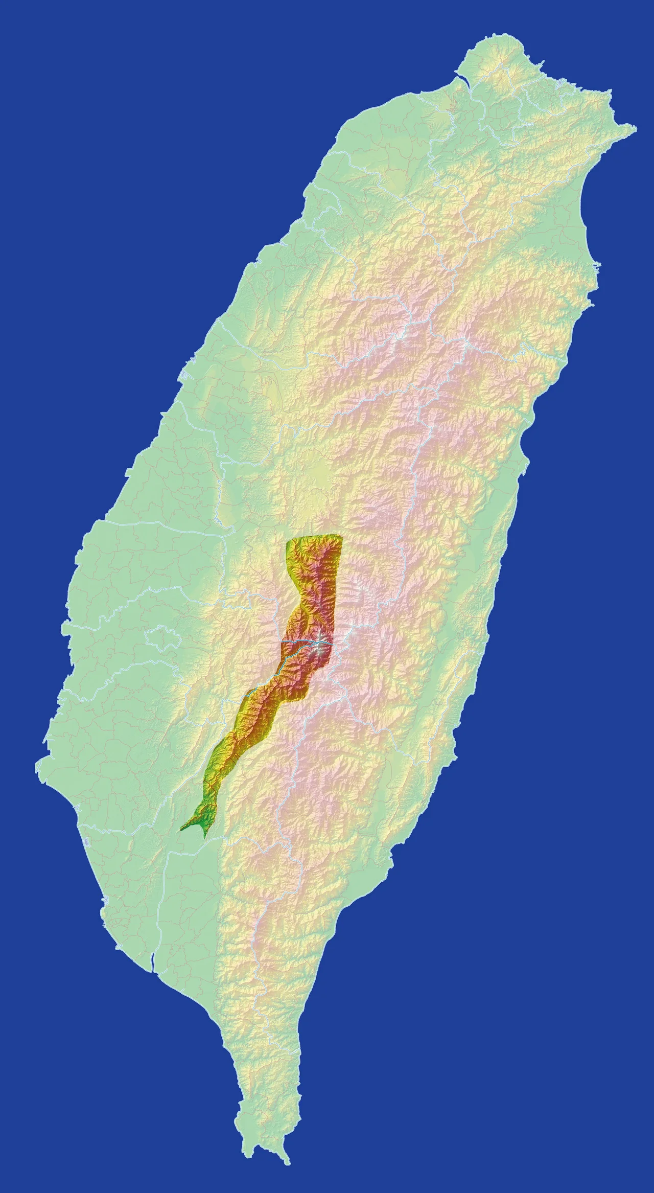

Yushan Range
Taiwan is a small island with enormous mountains, and the Yushan Range is the reason. Running through the central-southern interior — spanning Chiayi County, Kaohsiung City, and Nantou County — this range holds 22 peaks above 3,000 meters, including twelve of Taiwan's designated 'Top 100 Peaks.' At its center stands Yushan, also called Jade Mountain, at 3,952 meters. That single number makes this range significant far beyond Taiwan: Yushan is the highest point in East Asia outside the Himalayan region. The range that holds it takes the shape of a rough crucifix, with one ridge running roughly east-west and a longer one running north-south, the two arms intersecting at Yushan's main summit.
The Shape of the Range
From the air, the Yushan Range has a distinctive geometry. The shorter east-west ridge runs perhaps 20 kilometers at its core; the longer north-south ridge extends much further, carrying peaks that step down gradually from the central massif. Where these two ridges meet — at Yushan itself — the terrain reaches its maximum height and its maximum drama. The range is bounded by natural features that define its edges clearly: to the east, the Central Mountain Range faces it across the valleys between them; to the west, the Qishan River separates it from the Alishan Range. These three ranges — Yushan, Central, and Alishan — form the spine of southern Taiwan, each one a distinct geological entity even as they appear from a distance like a continuous wall. Yushan National Park was established partly to protect the highest terrain of the Yushan Range, covering the summit massif and its immediate surroundings.
The Peaks
The highest ground in the range clusters around the main Yushan massif. The main peak tops out at 3,952 meters. Four subsidiary peaks of Yushan itself — the Eastern Peak at 3,869 m, the Northern Peak at 3,858 m, the Southern Peak at 3,844 m, and the Western Peak at 3,467 m — surround the main summit. These five collectively form the Yushan group, all contained within a few kilometers of each other. Further along the range, separate peaks carry their own names and identities: Dongxiaonanshan at 3,744 m, Nanyushan at 3,383 m, Badongguanshan at 3,245 m, Jundashan at 3,265 m, Yushan Forward Peak at 3,239 m, Xiluandashan at 3,081 m. In Taiwan's mountaineering culture, climbing all 100 of the officially designated 'Top 100 Peaks' is a serious undertaking, and twelve of those peaks lie within this range.
Where the Weather Breaks
The Yushan Range's height makes it a climate divider as much as a geographical one. Moisture from the Pacific moving westward hits the Central Mountain Range first, then what remains crosses and hits the Yushan Range, which wrings out much of what's left. The western slopes, facing the Taiwan Strait, receive less precipitation than the eastern approaches. At the highest elevations, winter brings snow, and the Yushan main peak is frequently snow-covered between November and March. This is unusual in subtropical Taiwan — the island sits between 22 and 25 degrees north latitude, subtropical by most measures, yet its central mountains reach into genuinely alpine conditions. The contrast between the warm coastal plains and the frigid summit world makes altitude change feel compressive: a short drive from the coast gains you several climatic zones.
Jade Mountain in Culture
Yushan's alternative name — Jade Mountain, a translation of the Chinese *Yushan* — reflects how the peak was perceived: something precious and rare, set apart from ordinary terrain. During the Japanese colonial period, the mountain was called Niitakayama, New High Mountain, after it was confirmed as the highest point in the Japanese Empire following Taiwan's annexation. The phrase 'Niitaka yama nobore,' meaning 'Climb Mount Niitaka,' became the coded message transmitted to the Japanese fleet authorizing the attack on Pearl Harbor in 1941. The mountain's wartime meaning was discarded after 1945; Yushan and its range returned to their Chinese names. Today the peak is a national symbol, and climbing it is understood by many Taiwanese as something approaching a civic duty — a journey to the highest point of the island.
Five Ranges, One Island
Taiwan's geographers organize the island's mountains into five major ranges, running roughly parallel north-to-south. The Yushan Range is one of them — along with the Snow Mountain Range to the north, the Central Mountain Range, the Alishan Range, and the East Rift Valley Range. Together these five define the island's remarkable topography: a place where, in under 100 kilometers, you move from sea level beaches to 3,952-meter summits. The Yushan Range occupies a central position in that lineup, both geographically and symbolically. Its summit is the island's highest point. Its twelve Top 100 Peaks draw climbers from across Taiwan. And Yushan National Park, which wraps around much of the range's highest terrain, preserves one of Taiwan's most significant alpine ecosystems.
From the Air
The Yushan Range is centered at approximately 23.47°N, 120.954°E, spanning from southern Nantou County through Chiayi County and into Kaohsiung City. The main peak, Yushan, reaches 3,952 meters. The range extends roughly north-south for 50+ kilometers. Nearest airports: RCYU (Hualien Airport) approximately 60 km to the east; RCMQ (Taichung International) roughly 80 km to the northwest on the western coastal plain. From the air, the range presents a dramatic ridgeline with the Yushan massif clearly dominant — a cluster of high peaks noticeably taller than the surrounding terrain. Minimum safe viewing altitude above the main summit is 5,000 meters. The range generates significant orographic weather; cloud caps on the highest peaks are common through much of the year, and afternoon thunderstorms build frequently over the summits in summer months.
Nearby Stories
- Kagi Shrine 12 km away
- Bunun Cultural Museum 13 km away
- 1999 Jiji Earthquake 14 km away
- Xiluo 15 km away
- Yujing District 16 km away
- 1951 East Rift Valley Earthquakes 20 km away
- 2021 Hualien Train Derailment 84 km away
- Mavulis Island 234 km away