.jpg)
Aerolíneas Argentinas Flight 644
At 7:42 on the morning of 19 July 1961, the crew of a Douglas DC-6 reported passing a navigation waypoint named Lobos, climbing south through a sky full of building clouds. Thirty-seven minutes later the airplane was gone, scattered across the open grassland west of a small town called Pardo. Sixty-seven people were aboard. None survived. More than six decades later, this remains the deadliest aviation disaster in Argentine history - a fact that says less about the airplane than about the people who were on it, ordinary travelers crossing the country on a route that thousands flew without a second thought.
Sixty-Seven Lives
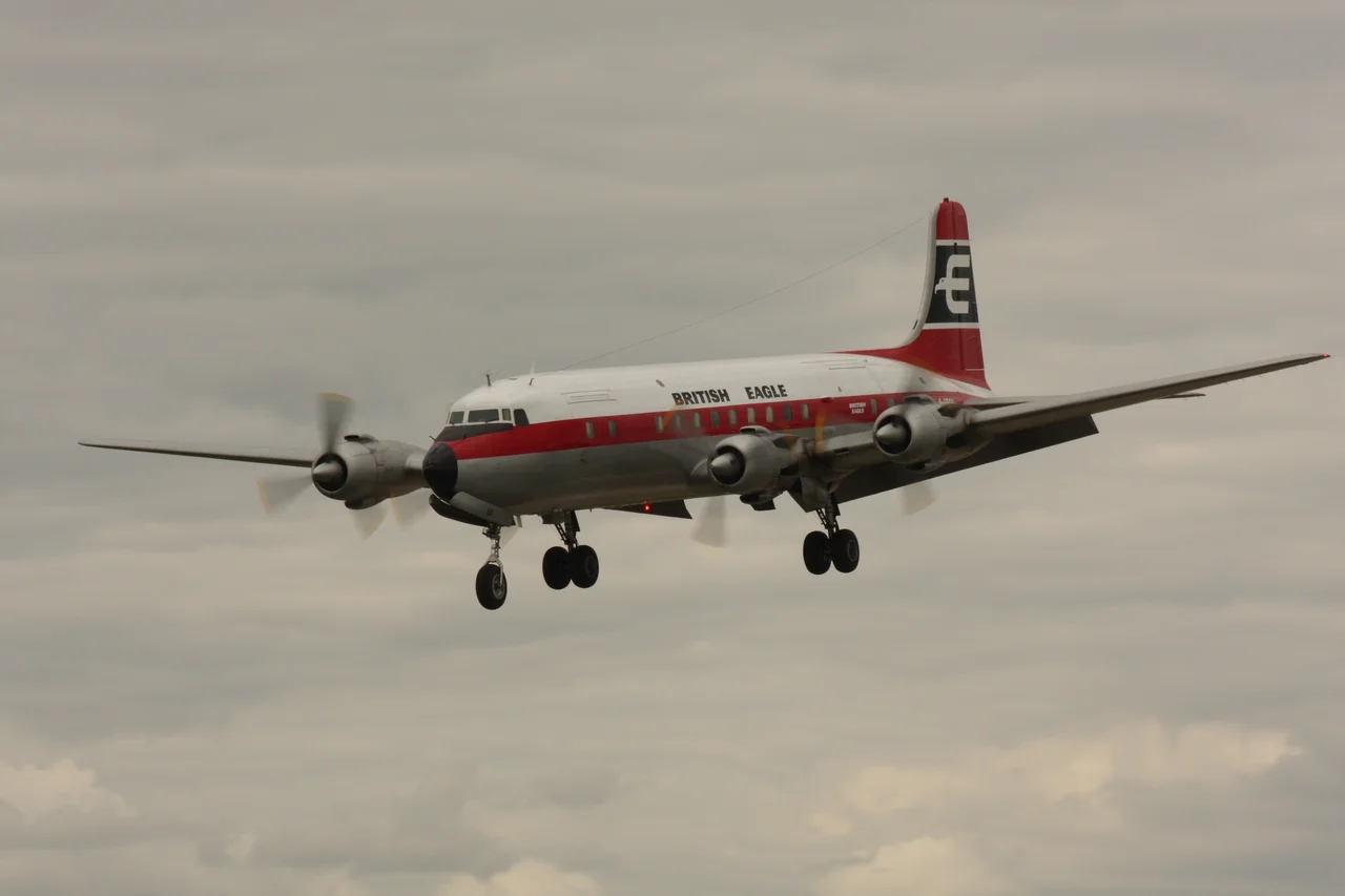
Flight 644 was a routine domestic service, bound from Buenos Aires to Comodoro Rivadavia far down in Patagonia. The passengers were the people who fill any morning flight: families heading home, workers traveling for jobs in the oil south, travelers with appointments and reasons of their own. They boarded an aircraft with a curious history. The four-engined Douglas DC-6 had been built in 1948, and it had first carried the name Presidente Perón before being rechristened General San Martín after the soldier who won Argentina's independence. By July 1961 the politics behind those names had long since shifted, and the airplane was simply the one on the morning's schedule. What matters is not the registration painted on its tail but that every seat held a person with a life waiting at the other end of the runway - sixty-seven of them, the largest number ever lost in a single Argentine air disaster, then or since.
Into the Weather
The trouble was the sky itself. Towering cumulonimbus clouds - thunderheads - had stacked up along the winter route, and the crew radioed air traffic control asking to steer around them. They had climbed to roughly 15,700 feet and turned south. At 8:19 AM, somewhere over the Gorchs region, they reported bad weather and a delay reaching the next waypoint. That was the last anyone heard. Investigators later concluded the airplane had flown into a zone of violent turbulence, where winds estimated near 76 knots - around 140 kilometers per hour - tore at the structure until the right wing failed and separated entirely. Robbed of lift on one side, the DC-6 dropped into a steep dive and struck the pampas at more than 400 kilometers per hour. It was over in seconds, on a clear winter morning for the families waiting in Patagonia, beneath the very clouds the crew had worked so hard to avoid.
What the Sky Hid
In 1961, Argentine airports and aircraft carried no weather radar. A crew could not see the worst of a storm until they were inside it, and the forecast they were given proved dangerously incomplete. The official inquiry found that both the pilot and the company's dispatcher had misjudged the weather and chosen an altitude that put the airplane in harm's way. It is easy, from the safety of the present, to read these as failures. They were also the limits of an era - decisions made with the tools available, on a morning when the tools were not enough to keep sixty-seven people alive.
A Lesson Written in Loss
After the wreckage was gathered from the grass, Argentine authorities recommended that weather radar be installed on every commercial aircraft in the country, alongside improvements to air traffic control. The recommendation came too late for Flight 644, and even afterward the lesson took hold slowly: two more weather-related disasters followed in the years that came. Today the flat country west of Pardo looks as it always has - wheat and grazing land running to the horizon, quiet under the same enormous sky. There is no great monument here. What remains is the memory, and the safer skies that the people of this flight, without ever choosing to, helped bring about.
From the Air
The crash site lies on the Buenos Aires pampas at approximately 36.23°S, 59.52°W, about 12 km west of the town of Pardo and roughly 220 km southwest of Buenos Aires. The terrain is flat agricultural grassland with few landmarks - look for the patchwork of fields and the small grid of Pardo itself. Nearest major airports are Buenos Aires Ezeiza (SAEZ) and Aeroparque Jorge Newbery (SABE) to the northeast; the regional field at Azul lies to the southwest along the old route. This is a region of fast-developing summer thunderstorms; the clouds that doomed Flight 644 still build here on warm afternoons, and clear winter mornings offer the best long-range visibility over the plains.
Nearby Stories
- Azul 34 km away
- Lobos 104 km away
- Chascomús 108 km away
- Los Toldos 143 km away
- Museo Juan Manuel Fangio 160 km away
- Ezeiza Massacre 171 km away
- Coronel Suárez 189 km away
- The Pampas 223 km away