.jpg)
Amazonas (Brazilian state)
In 1541, a Spanish conquistador named Francisco de Orellana paddled down a river he had not meant to descend and reported a battle with women warriors. Whether the encounter happened as he described it, or whether his men fought long-haired male warriors and he embroidered the tale with Greek myth, nobody today can say. What is certain is that Orellana called the river the Rio de las Amazonas, after the fighters of Homeric legend, and the name stuck. Nearly five hundred years later, the state that carries it is the ninth-largest country subdivision in the world, an area of 1.57 million square kilometers that is larger than Chile, Paraguay and Uruguay put together, and still 98 percent forest.
Deep Time, Slow Forest
The Amazon once ran the other way. Fifteen million years ago, before the Andes rose and blocked its course, the proto-river flowed westward, possibly draining into a system that continued across what is now Africa. When the South American Plate collided with the Nazca Plate and the Andes pushed upward, the water backed up into a vast inland sea. Marine creatures adapted: freshwater stingrays of the Amazon today, over twenty species strong, descend most closely from Pacific cousins stranded when the continent shifted. About ten million years ago the water worked eastward through sandstone, the rainforest was born, and when the Ice Ages dried out the tropics, the forest retreated into scattered islands of green. Species diverged on those islands and rejoined when the rains returned. The mind-bending biodiversity of the Amazon is in part a consequence of that long separation and reunion.
The Portuguese Push Upstream
For most of the colonial era, the upper Amazon lay inside the Spanish Viceroyalty of Peru. The Portuguese were supposed to stay on the far side of the Tordesillas line, but a river system this navigable could not hold an imaginary boundary. Beginning with the founding of Belem at the river's mouth in 1616, Portuguese settlers, Jesuit and Carmelite missionaries, and slave-hunting bandeirantes pushed west up the Solimoes. Pedro Teixeira led 70 soldiers and 1,200 Indigenous paddlers in 47 great canoes all the way to Quito and back between 1637 and 1639. Smallpox epidemics in 1661, 1695, 1724 and the 1740s emptied whole river stretches of their Indigenous inhabitants. By the Treaty of Madrid in 1750, Portugal had effectively taken what Spain could not hold. The captaincy of Sao Jose do Rio Negro was formalized in 1755, and in 1850 Amazonas split from Para to become a province of its own.
The Rubber Fortune and Its Cost
The late 19th century brought a commodity that the rest of the world suddenly could not do without. Automobile tires, telephone lines, bicycle tubes and industrial belts all needed latex from the Hevea brasiliensis tree, and Amazonas had Hevea in abundance. Migrants poured in from Brazil's drought-stricken northeast to tap wild trees scattered across the forest. Enslaved and debt-bonded Indigenous seringueiros cut the bark, caught the white sap and carried it out. Untold thousands died of disease and overwork. Meanwhile, Manaus built itself a Belle Epoque city in the middle of the jungle: the famous Amazon Theatre, a new port, electric trams, a Palace of Justice, European luxury shops. The rubber boom collapsed after Brazilian seeds smuggled to British Malaya in 1876 grew into plantations that undercut every Amazonian producer. What remained were the opera house, the empty warehouses and the memory of black gold.
The Free Zone Experiment
In 1957, with the old economy gone and the region depopulating, Brazil's government tried something new. Act 3.173 created the Manaus Free Trade Zone, later expanded under military-government decree in 1967. The idea was to pull industry into the Amazon by waiving import taxes on components assembled there. Televisions, motorcycles, air conditioners and later electronics came to be manufactured in factories surrounded by jungle. The policy was partly a security calculation, an attempt to populate a region the generals feared could be lost to neighbors or rebellion, and partly an attempt to slow deforestation by giving the Amazon a reason to exist besides cattle and logging. It worked unevenly. Manaus grew to 2.1 million people, nearly half the state's population, a modern skyline rising from a river port 1,500 kilometers from the ocean.
Sixty-Two Municipalities, Mostly Water
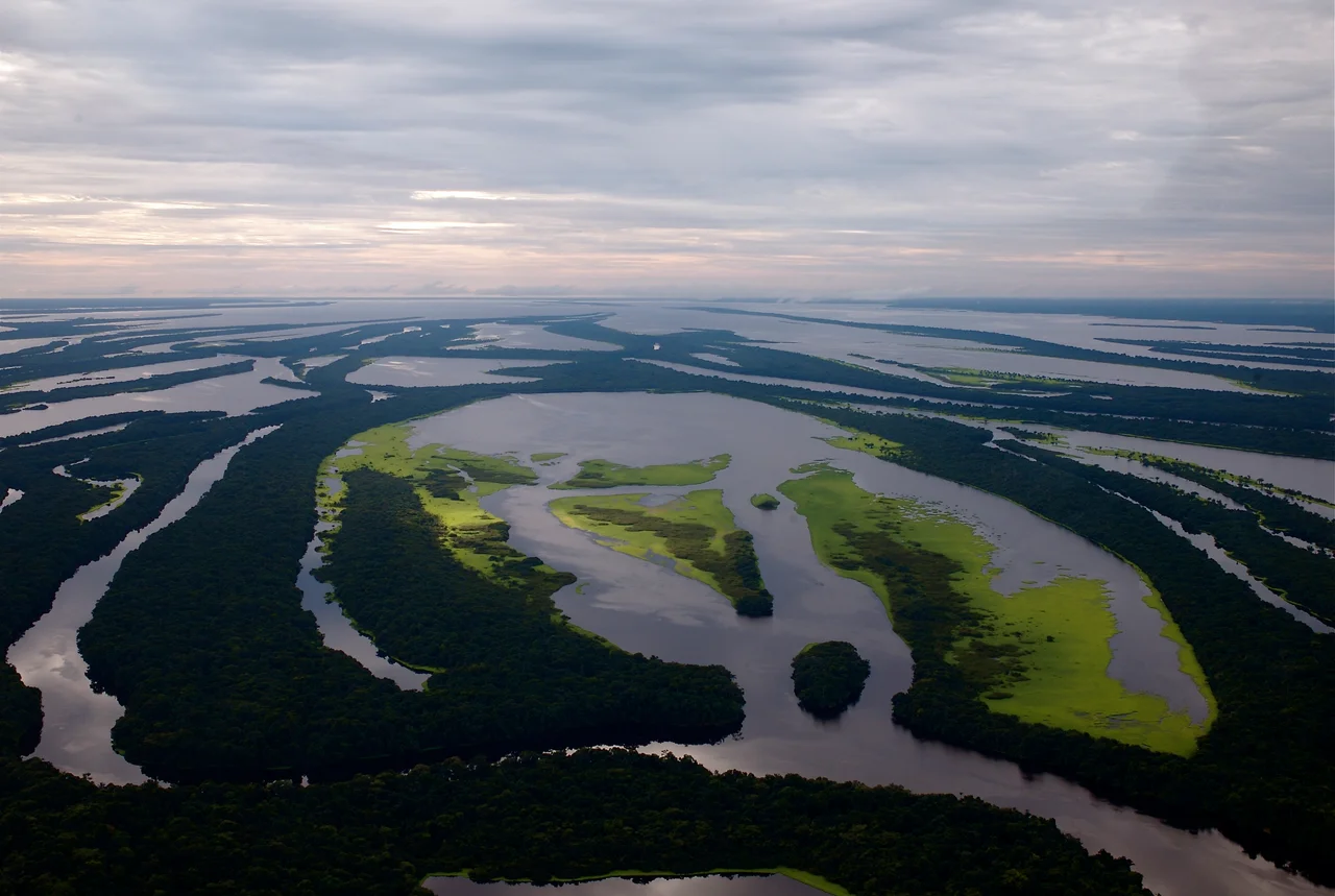
Amazonas divides into 62 municipalities, but most of them do not connect to each other by road. Parintins, Manacapuru, Itacoatiara, Tefe and Coari string along the Amazon in the state's eastern half. The western reach runs to the tri-border at Tabatinga where Brazil, Peru and Colombia meet, territory where Ticuna people live and speak their own language alongside Portuguese and Spanish. The far northwest rises into the Guyana Shield and Pico da Neblina, at 2,995 meters the highest mountain in Brazil, hidden most days under a cap of cloud that gives the peak its name, meaning Mountain of the Mists. Between the rivers lies dense terra firma forest; between the flooded igapo of the black-water Negro and the varzea of the white-water Solimoes lie thousands of square kilometers where the only way in is by boat and the only way out is patience.
From the Air
Located at 3.98S, 64.63W, at the center of Brazil's North Region. Primary hub is Manaus/Eduardo Gomes International (SBEG) on the Rio Negro. Tabatinga International (SBTT) serves the Peru/Colombia tri-border. Pico da Neblina (2,995 m) sits in the far northwest near the Venezuelan border. Recommended viewing altitude 33,000-39,000 feet for best sense of scale. Expect unbroken canopy cut by enormous braided rivers. Convective activity builds strongly on afternoons in the wet season (December through May). The dark Rio Negro and pale Solimoes flowing side by side near Manaus remain distinct for miles.
Nearby Stories
- Tefe 44 km away
- Amazonas (Brazil) 140 km away
- Ipubi Formation 155 km away
- Juruá-Purus Moist Forests 164 km away
- Mamirauá Sustainable Development Reserve 174 km away
- 2019 Amazon rainforest wildfires 199 km away
- Purus Varzea 206 km away
- Jaú National Park 250 km away