
Arkenberge
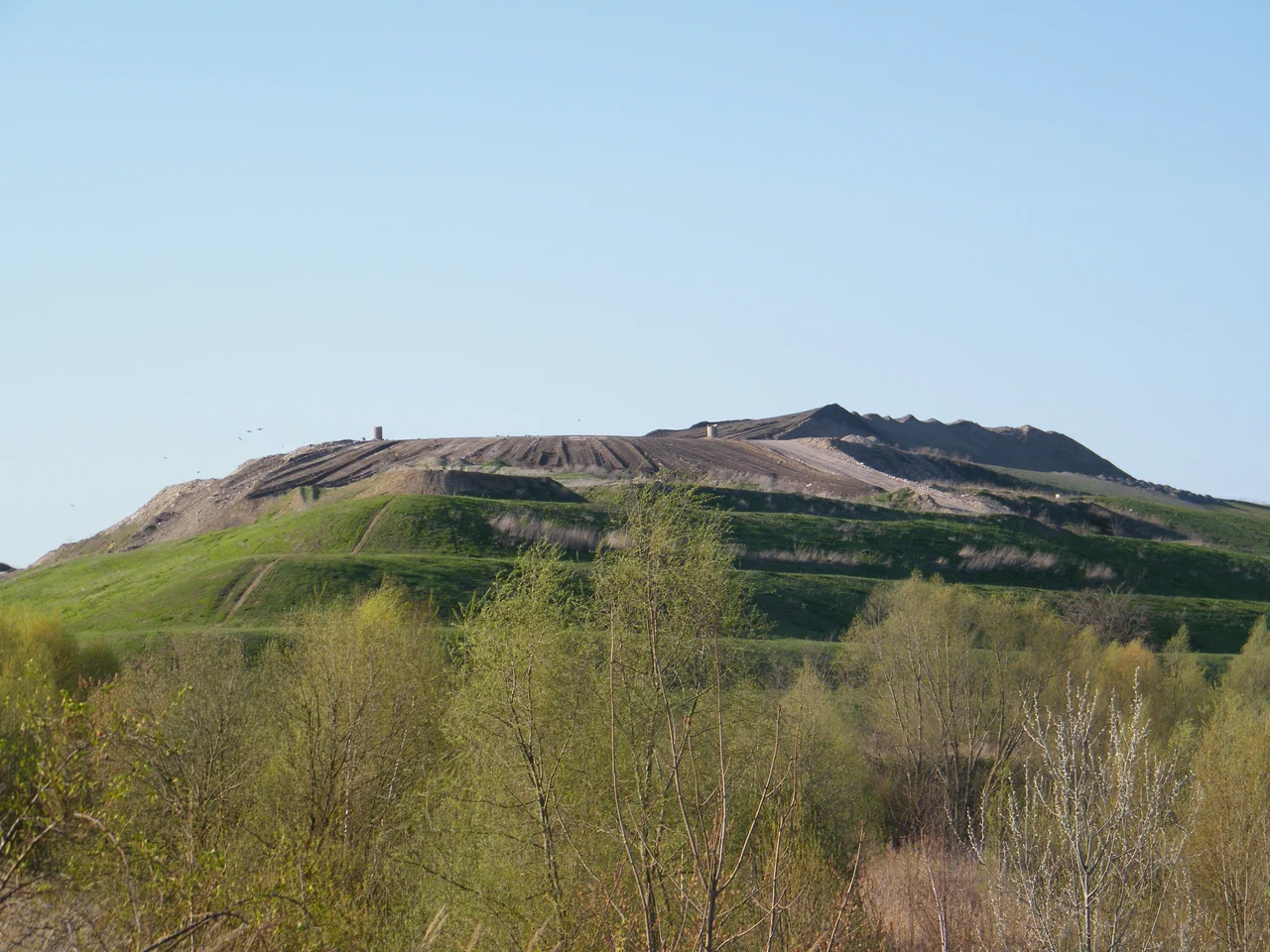
Berlin's summit is made of Berlin. Out past Blankenfelde on the northern edge of Pankow, where the city runs out of streets and into fields, a green mound rises out of flat farmland to 120.7 metres above sea level. Nothing about it is natural. Every metre above about 57 is builders' rubble, tipped there by lorry between 1984 and 1998 and then shaped into a hill on purpose. In January 2015 a survey confirmed what the operators had suspected: the Arkenberge had overtaken the Teufelsberg and become the highest ground in the state of Berlin. A glacial erratic was hauled to the top with an inscription saying so.
The Hill That Was Dug Away
There really were Arkenberge before any of this. The name belonged to a chain of small hills of Pleistocene origin — glacial leftovers, the same ice that flattened the rest of the north German plain. A survey map of 1911 puts the highest of them at 70.3 metres. Over the following decades most of that material went into the backs of lorries and was carted off; the surrounding country lies between 53 and 57 metres, and what survives of the original ridge tops out at 64.8.
In the 1950s the Berlin Outer Ring railway was cut straight through the area, taking another bite. By then a small settlement called Arkenberge had grown up nearby, established in the 1930s and named after hills that were already mostly gone. It is a strange sequence: the place is named for a hill, the hill is removed, and then a much bigger one is built next door out of debris.
Thirty-Six Hectares of Rubble
In 1984 a construction-waste tip was opened on 36 hectares east of the settlement, and for fourteen years it took whatever the building trade threw away. Dumping ended in 1998. From 1999 the operation changed character: more construction waste came in, but now for recycling and for profiling — sculpting the mound into a designed landform, capped and recultivated rather than simply piled.
The plan drawn up for that phase is unusually specific. It called for a hill with two viewing plateaux, separated visually by a saddle so that the summit would read as two peaks rather than one lump. In a landscape as level as the Barnim plateau, a 120-metre artificial hill with two lookouts would give you a horizon that includes most of Berlin. The shaping was carried out. The lookouts have never opened.
Taller Than the Devil's Mountain
The record it took is worth understanding, because the two hills are made of different centuries. The Teufelsberg out in Grunewald reaches 120.1 metres and is built from the ruins of Berlin itself — roughly 26 million cubic metres of wartime debris carted west between 1950 and 1972, poured over an unfinished Nazi military-technical college that the Allies had tried and failed to blow up. It is a hill made from a destroyed city.
The Arkenberge is a hill made from a rebuilt one: offcuts, demolition spoil, the churn of ordinary construction in the 1980s and 1990s. Six-tenths of a metre separates them. Both stand well above Berlin's highest natural ground, the Großer Müggelberg out east above the Müggelsee, which manages only 114.7 metres — a reminder that in this city, geology has been comprehensively outbuilt.
The Park That Never Opened
Plans to turn the Arkenberge and its surroundings into a recreation area firmed up around 2000. In 2015, on the strength of the new survey and the finished landform, it was announced that the hill would open to the public as a park in 2019.
That year came and went. So did the next several. As of spring 2026 the summit is still not open, and the inscribed erratic marking the highest point in Berlin sits on a hilltop the public is not allowed to reach. Berliners who want a view from a rubble hill have to make do with the Teufelsberg, sixty centimetres shorter and on the wrong side of the city. The highest ground in Berlin remains, for now, a fenced rumour on the northern skyline.
From the Air
Located at 52.6399 N, 13.4077 E, on Berlin's far northern edge between Blankenfelde and the Brandenburg boundary, in the borough of Pankow. It is one of the easiest features in northern Berlin to identify from the air: a solitary green-capped mound with a distinctly engineered profile — two flattened plateaux with a saddle between them — rising roughly 65 metres out of otherwise dead-flat farmland at 53-57 metres. The Berlin Outer Ring railway curves past just to the south, and the built edge of the city stops abruptly about 2 km south of the summit. The hexagonal terminal of the former Tegel airport, closed to traffic since 2020, lies 12 km southwest as a fix; the Fernsehturm is 13 km south. Recommended viewing altitude 1,500-2,500 ft AGL, approaching from the north over open country to keep clear of Berlin's inner controlled airspace. Berlin Brandenburg (EDDB) is about 31 km south, Eberswalde-Finow (EDAV) about 29 km northeast, Strausberg (EDAY) about 35 km east-southeast. Low winter sun from the south throws the landform into relief; at midday in summer the grass cap can flatten out and vanish into the fields.
Nearby Stories
- Berlin Brandenburg Airport 3.3 km away
- Caputh 4.1 km away
- Nauen Transmitter Station 6.6 km away
- Carinhall 13 km away
- Neuruppin 14 km away
- Oderbruch 14 km away
- St. Mary's Church, Chojna 25 km away
- Frankfurt (Oder) 34 km away