
Oderbruch
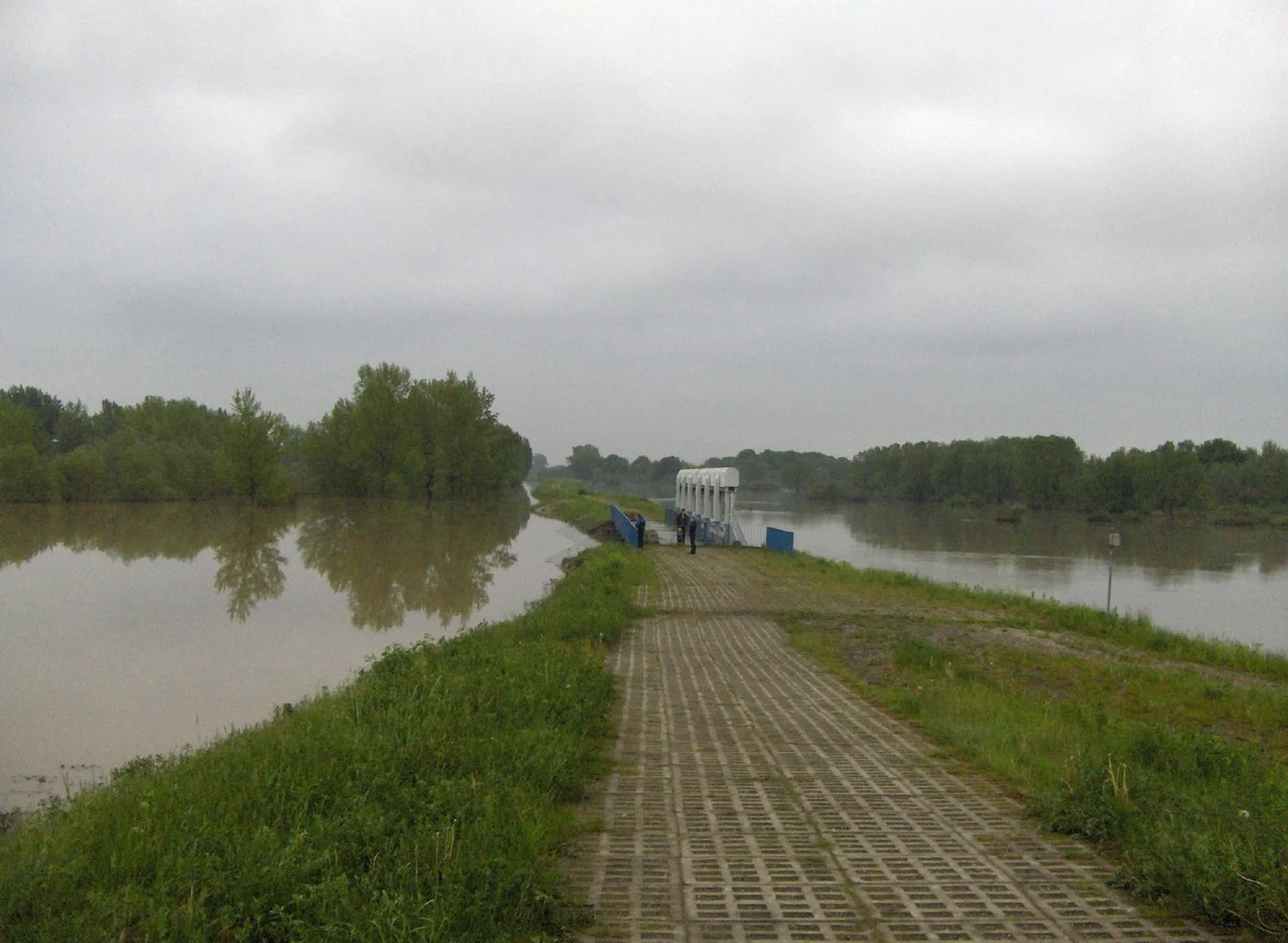
Stand on the dike at Neulietzegöricke and the Oder runs past at roughly eye level, held in its channel by earth that people have been maintaining for two and a half centuries. Behind you the land falls away — sixty kilometres of it, twelve to twenty wide, tilting from fourteen metres above sea level in the southeast down to barely one in the northwest. None of it should be dry. Middle High German had a word for this kind of ground, brouch: marsh, moor, swamp, the same root that gives English its brook. The name Oderbruch is the honest description of the place. Everything else about the landscape is an argument with the water, and the argument has been running since 1747.
A Province Won Without a Battle
On 12 January 1747, an engineer named Simon Leonhard von Haerlem put a proposal in front of Frederick II. Cut the Oder a new bed, dike it, and the marsh it had been wandering through for millennia could be farmed. The plan called for a canal 18.83 kilometres long that would shorten the river's course by roughly 25 kilometres. Work had begun in a small way in 1735 and now ran hard through 1762. On 2 July 1753 the cofferdam at Güstebiese was cut and the Oder went into its new channel. What drained behind it came to some 130,000 morgen — 32,500 hectares — of fertile ground where fishing had been the only reliable living. Frederick spent most of his reign taking territory by force. The phrase attached to this piece of it ever since is a quieter one: I have won a province. In Letschin the locals put up a monument to him for it.
Villages Dug Out of Their Own Ditches
Systematic settlement began in 1753, and the method was as literal as the engineering. Surveyors laid out linear villages — two parallel streets — then dug a drainage ditch down the middle and piled the excavated earth into building plots, so that every house in the Oderbruch stands on the hole that keeps its street dry. Between the two rows went a church, an inn and a schoolhouse. Prussia recruited the colonists mostly from outside its own borders, offering privileges as bait: families came from Hesse-Darmstadt, Mecklenburg, Saxony, Württemberg, Lower Austria and the Swiss canton of Neuchâtel, alongside locals from the Neumark. Neulietzegöricke was the first of them. Its grounds are protected today, its half-timbered houses restored, the original layout still legible in the ground — a village-shaped diagram of how the whole region was made.
The Water Keeps the Receipts
Regulations from 1717, then canals, dikes and dams, gave the Oder a faster and better-behaved passage. The river was not persuaded. Serious floods came in 1785, 1838, 1947, 1981 and 1982, 1997 and 2010. The worst of the twentieth century arrived in the spring of 1947, when ice floes jammed against the flood control channel near Küstrin-Kietz in March and dammed the river within hours. Water topped the dike at two points north of Reitwein and spread across the polder, reaching Bad Freienwalde several kilometres from the riverbank. More than twenty thousand people lost their homes. In the drained country the water table sits about a metre and a half above sea level; two chain pumps built in 1895 near Wriezen were among the machines keeping it there. This is a landscape that only exists while somebody is working.
The Spring the Marsh Came Back
In early 1945 the Red Army crossed the Oder at Kienitz, now part of Letschin, and built a bridgehead of some 300 square kilometres inside the polder. Georgy Zhukov's 1st Belorussian Front assembled around a million soldiers there, with 78,556 Polish troops alongside, against roughly 110,000 men of Theodor Busse's 9th Army dug into the escarpment on the western rim. German engineers deliberately flooded the plain, and the spring thaw finished the job, so the marsh Frederick had drained partly returned — this time as a weapon. The Battle of the Seelow Heights ran from 16 to 19 April. Searchlights meant to blind the defenders were swallowed by dust from the barrage. Estimates of Soviet dead range from five thousand to well over thirty thousand; German losses exceeded twelve thousand. For the people who farmed the Oderbruch, two months of fighting ended in flattened villages and ruined fields, and the ordnance buried in that soil is still corroding. The memorial at Seelow tells the story in German and English.
Beavers, Geese and a European Seal
The Eurasian beaver had been wiped out here. In 1986 forty-six animals were brought in from the Elbe, and the population took hold: a 2008 survey counted 250 in sixty colonies north of Frankfurt (Oder), with the regional total estimated well over five hundred. In an ordinary river valley that is a conservation success story. In a polder it is also a structural question, because beavers gnaw trees, dam ditches, waterlog fields and tunnel into embankments — and the embankments are the only reason the fields exist. The dike association wrote a beaver management plan in 2009 to keep the relationship workable. Elsewhere the wildlife is uncomplicated pleasure: the Kietzer See near Altfriedland anchors a bird sanctuary that takes up to 30,000 migrating birds each autumn, mostly bean geese and greater white-fronted geese. Cyclists ride the resurfaced railbed from Wriezen to Neurüdnitz and the Oder-Neisse route along the dike crest. In April 2022 the Oderbruch cultural landscape received the European Heritage Seal — recognition for a place that is, from end to end, a human artefact.
From the Air
The Oderbruch centres on roughly 52.70°N, 14.25°E, running some 60 km northwest to southeast along the German-Polish border in Märkisch-Oderland, Brandenburg. Fly it low — 1,500 to 3,000 ft AGL — because the whole story is written in the ground pattern: the Oder pinned to the eastern edge inside its dikes, the sinuous Alte Oder and Stille Oder threading the middle as abandoned channels, dead-straight drainage ditches gridding the polder, and the double-street colonist villages strung along them. The Seelow escarpment forms a hard western rim; the wooded Neuenhagener Insel rises out of the flats in the north. The Oder itself is the international boundary, so mind the airspace. Nearest fields: Strausberg (EDAY) about 25 km west-southwest, Berlin Brandenburg (EDDB) about 65 km southwest, Zielona Góra-Babimost (EPZG) about 120 km southeast. Terrain is flat and unobstructed, but ground fog forms readily over the ditch network on calm mornings and can fill the whole basin below the surrounding uplands.
Nearby Stories
- Sonnenburg concentration camp 9.7 km away
- Königs Wusterhausen radio transmitter 12 km away
- Carinhall 12 km away
- ADGB Trade Union School 13 km away
- St. Mary's Church, Chojna 14 km away
- Heros von Borcke 16 km away
- Frankfurt (Oder) 22 km away
- Stalag Luft III 95 km away