Bridges of Edirne
For ninety years before Constantinople fell, Edirne was the capital of the Ottoman Empire. The court lived here, the sultan rode out from here, and the river that nearly encircles the old city had to be bridged again and again, in stone, by every century that mattered. Most of those bridges are still standing. Some still carry traffic. The oldest dates from 1451 - two years before Mehmed II would take Constantinople and shift the empire's center east forever. Walking from one bridge to the next is a way of walking through the early Ottoman moment, before the city it produced eclipsed it.
The River That Made the Plan
The Tundzha River loops around the old town of Edirne in a wide, lazy semicircle, and that geography decided everything. To leave the city in any direction except east, you had to cross water. The Ottomans solved the problem the way Ottomans solved most problems - patiently, in stone, over generations. Beginning in the mid-fifteenth century and continuing through the seventeenth, they laid down a series of arched bridges to the north, west, and south, each pinned to a sultan or a vizier whose name it still carries. The pattern is unmistakable from the air: a string of pale stone arches threading the river loop, with the city tucked inside like something held in cupped hands.
Mehmed's Bridge
The Fatih Bridge went up in 1452, during the reign of Mehmed II - the year before he took Constantinople. It linked the city to the Sultan's Palace on a large island in the river, and although most of the palace was demolished in the nineteenth century, the Adalet Tower still rises from the gardens at the bridge's far end. Three slightly pointed arches span the water, the central one wider than its flanking pair, with narrow openings cut through the pillars to ease floodwater. Triangular stone buttresses on each side divert the current away from the piers. In May, when the Tundzha runs high, those buttresses disappear underwater. By August they reemerge like the foundations of something once submerged.
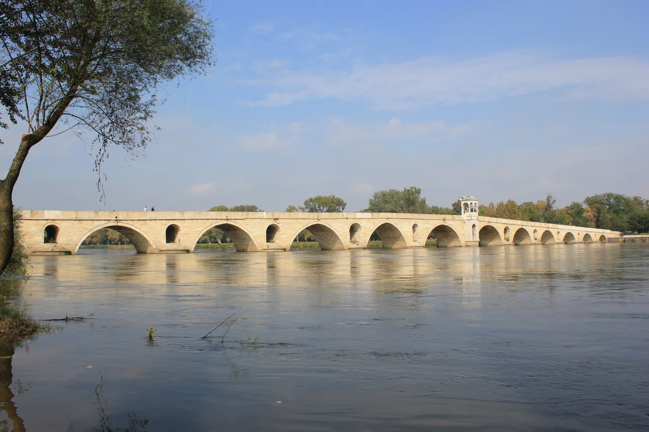
Sinan's Hand
A century after Mehmed, Suleiman the Magnificent's chief architect Mimar Sinan turned his attention to Edirne. The Kanuni Bridge, completed in 1554, continues the line of the Fatih Bridge northward across the river's main branch - 65 metres of vaulted stone over four shallow pointed arches. Where Mehmed's builders had cut openings into the piers, Sinan left them solid, betting on the buttresses alone. He returned in 1567 to design the Yalnizgoz Bridge a short distance downstream, this one part bridge and part dam, with seven small openings flanking a single main arch and a long stone wall meant to hold back the Tundzha when the floods came. Sinan was responsible for some 300 buildings across the empire over a sixty-year career; these two are among the quieter pieces of his legacy, working bridges that still do what he asked them to do.
The Working Crossings
Other bridges accumulated as Edirne required them. The Saracane Bridge, just downstream of Palace Island, opened in 1451 - 120 metres long over ten arches of varying sizes, its low vaulted profile keeping the road close to the water. The Bayezid Bridge, six arches dating from 1488, links the city to the Bayezid II mosque complex on the far bank. The Ekmekcioglu Ahmet Pasha Bridge - usually just called the Tundzha Bridge - was built between 1607 and 1615 with eight stone arches over 135 metres. Two of those arches were destroyed in the Second World War and replaced with temporary steel; in 2007 a comprehensive restoration returned the bridge to its original form. The Meric Bridge, opened in 1842, is the youngest of the lot, but its 263-metre design borrowed openly from the seventeenth-century Tundzha Bridge upstream. Stone copying stone, century to century.
What the Stones Remember
Edirne sits 240 kilometres west of Istanbul, on the main overland route between Europe and Anatolia, near the present-day borders with Greece and Bulgaria. For ninety years it ruled the empire that would shape the next four centuries of this region. Then in 1453 the capital moved to Constantinople, and Edirne settled into a quieter role - a frontier city, a transit town, a place where caravans paused before the long road south. The bridges stayed busy through all of it. They stayed busy through the wars of the early twentieth century, the redrawing of the borders, the changes of the modern republic. The Gazi Mihal Bridge, rebuilt in the nineteenth century atop an earlier Ottoman crossing that itself replaced a Roman bridge, now carries the D100 highway toward the Bulgarian frontier, with a steel-and-concrete span running parallel for the heavier modern traffic. Three layers of bridge, each one trusted to last until the next was needed.
From the Air
The Bridges of Edirne span the Tundzha River loop at approximately 41.69 N, 26.56 E, in northwestern Turkey near the Greek and Bulgarian borders. Tekirdag Corlu Airport (LTBU) lies about 110 km east; the closer Capa Airport (LTBP, military) is just outside Edirne. Recommended viewing altitude 1,500-3,500 m AGL. From above, the river's wide semicircle around the old city is the obvious anchor; the bridges appear as pale stone strokes across the water, with the Selimiye Mosque's pencil-thin minarets giving the city center its unmistakable Ottoman silhouette.
Nearby Stories
- Didymoteicho Fortress 16 km away
- 1928 Chirpan-Plovdiv Earthquakes 64 km away
- Ganos 85 km away
- Istanbul's Rural Outskirts 113 km away
- Great Basilica of Plovdiv 113 km away
- Samothrace temple complex 117 km away
- Buzludzha Monument 124 km away
- Varna Necropolis 149 km away