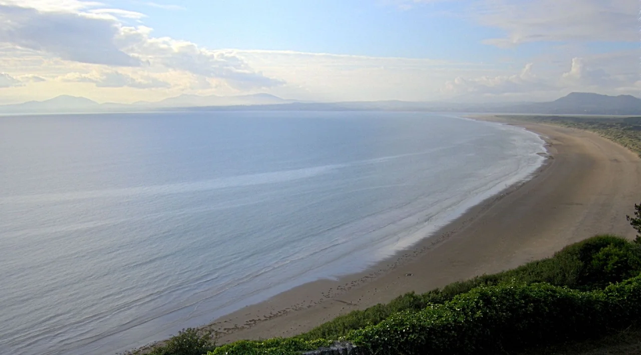

Cardigan Bay
There is a legend that the sea here drowned a kingdom. Cantre'r Gwaelod, the Lowland Hundred - sixteen prosperous townships, a wall against the tide, a watchman who drank one night and forgot to close the floodgates, and the next morning church bells were tolling underwater. The Welsh have told the story for a thousand years. Then in February 2014, winter storms tore the sand off the beach at Borth and exposed something that should not exist: the stumps of an oak and pine forest, preserved in peat for 4,500 years, where the bay now is. The legend turned out to be partly true. There had been a forest. There had been land. The sea did take it. Just not in one night.
The Arc
Cardigan Bay is the largest bay in Wales - a great west-facing arc of the Irish Sea about 65 miles across from Bardsey Island in the north to Strumble Head in the south. The coast it encloses is some of the most varied in Britain: pastel-painted resorts like Aberaeron and New Quay tucked into small harbours, the long sandy sweep of Borth, the steep slate-hard headlands of the Llyn Peninsula, the mountains of Snowdonia rising directly behind the beach at Barmouth. Major rivers thread through this country - the Teifi, Aeron, Ystwyth, Rheidol, Dyfi, Mawddach, Glaslyn - and each one carries the inland weather to the sea. At its turn-of-the-19th-century peak the port of Cardigan, at the mouth of the Teifi, had more than 300 ships registered to it. That was seven times Cardiff's fleet, three times Swansea's. The industrial Welsh coast of the south is what most people picture; this was the seafaring Welsh coast of the west, and for a few decades it was bigger.
The Big Three
Walk the Ceredigion Coast Path on a calm day and watch the water for the Big Three. The harbour porpoise breaks the surface in tight, neat puffs of breath. The grey seal hauls itself onto rocks at the headland and watches you watch it. And the bottlenose dolphin - this is the population the bay is famous for - rolls in pods of three or four or sometimes thirty, the largest such resident pod in the UK, more than 300 animals strong. The Cardigan Bay Special Area of Conservation protects them and the lesser-seen species: minke whales, Risso's dolphins, common dolphins, basking sharks, puffins on the cliffs. Boat trips run out of New Quay every summer. In the late 1990s the bay was invaded by spider crabs - never a British favourite as seafood - until in 2010 the local fishermen started selling them to Raymond Blanc's Michelin-starred kitchens. Cardigan Bay supplies the spider crab to your supper, by way of Oxfordshire.
The Drowned Forest
The bay sits inside a piece of Welsh mythology. The legend of Cantre'r Gwaelod tells of a drowned kingdom under the central and northern bay - towns, fields, a fortified sea wall, a careless prince. For centuries the story was treated as folklore. Then the storms came. In winter 2014 the sand at Borth and Ynyslas was stripped away by gale-driven waves and revealed a buried oak and pine forest dated to 4,500 years before present. The stumps stood upright in the peat, the roots still anchored in the soil they had grown in. There had been land where the bay now is. There had been forest. Sea level rise after the last Ice Age, combined with the laying-down of peat and sand, had swallowed it. The legend was older than anyone had guessed, and rooted in memory of an actual drowning that early Welsh communities must have watched.
The Range
Look at an aviation chart of Cardigan Bay and a large red rectangle dominates it. The MoD Aberporth Range covers some 6,500 square kilometres of sea, from sea level to unlimited height - one of the largest air weapons test ranges in Europe. It was established during the Second World War; today it tests air-launched weapons and unmanned aerial systems, and employs about 200 people directly. Drones flown from the Aberporth airfield range out over the empty bay. Telemetry stations sit on the cliffs of the Llyn Peninsula and along the Ceredigion coast, tracking what flies overhead. This is the modern industrial layer beneath the holiday image - the same waters where dolphin-watching boats run carry the test trajectories of Watchkeeper UAVs and prototype munitions. The bay holds them both. The arc is wide enough.
From the Air
Cardigan Bay is centred near 52.50 degrees north, 4.42 degrees west, opening west into the Irish Sea between Bardsey Island in the north and Strumble Head in the south. From cruise altitude (FL080 and above) the bay's full arc is visible on a clear day - mountains of Snowdonia behind the north shore, the long beaches and small harbour towns of Ceredigion lining the southeast, the Llyn Peninsula curving out into the north. Airports/airfields: Aberporth (EGFA, the MoD-operated airfield on the south shore), Haverfordwest (EGFE) 30 nm south of Strumble Head, Caernarfon (EGCK) on the north shore, Valley (EGOV) on Anglesey to the northwest. CRITICAL: the Aberporth Range Danger Area covers approximately 6,500 km2 of the bay from sea level to unlimited altitude. Always check NOTAMs before transiting Cardigan Bay; the range is active most weekdays.
Nearby Stories
- Battle of Mynydd Hyddgen 6.2 km away
- Llangrannog 7.4 km away
- Penrhyn Du Mines 11 km away
- Cantre'r Gwaelod 20 km away
- Fishguard Lifeboat Station 22 km away
- Battle of Orewin Bridge 28 km away
- Irish Sea Bridge 30 km away
- Ysbyty Ifan 33 km away