Chapada das Mesas National Park
The name translates roughly as "tableland of the tables," which sounds redundant until you actually see the place. Flat-topped sandstone mountains rise out of the southern Maranhão scrub like books stacked on a shelf, and between them the Cerrado - South America's great tropical savanna - still exists in something close to its original state. That is increasingly rare. For decades the agricultural frontier has been chewing northward through Maranhão, turning native grassland into soybean fields at a pace that has alarmed ecologists. Chapada das Mesas National Park exists specifically to draw a line against that advance.
A Line in the Savanna
The park was created by federal decree on 12 December 2005, protecting 159,952 hectares in three municipalities - Riachão, Estreito, and Carolina - at the southern edge of Maranhão. Administration falls under the Chico Mendes Institute for Biodiversity Conservation, the federal agency named for the murdered rubber tapper. The stated aim is simple: preserve untouched Cerrado as a buffer against the spread of farming. The Cerrado is the second-largest biome in South America, often called Brazil's "upside-down forest" because so much of its biomass lives below ground in dense root systems. It is also one of the most biodiverse savannas on Earth, and one of the fastest-disappearing.
Sandstone Tables and Waterfalls
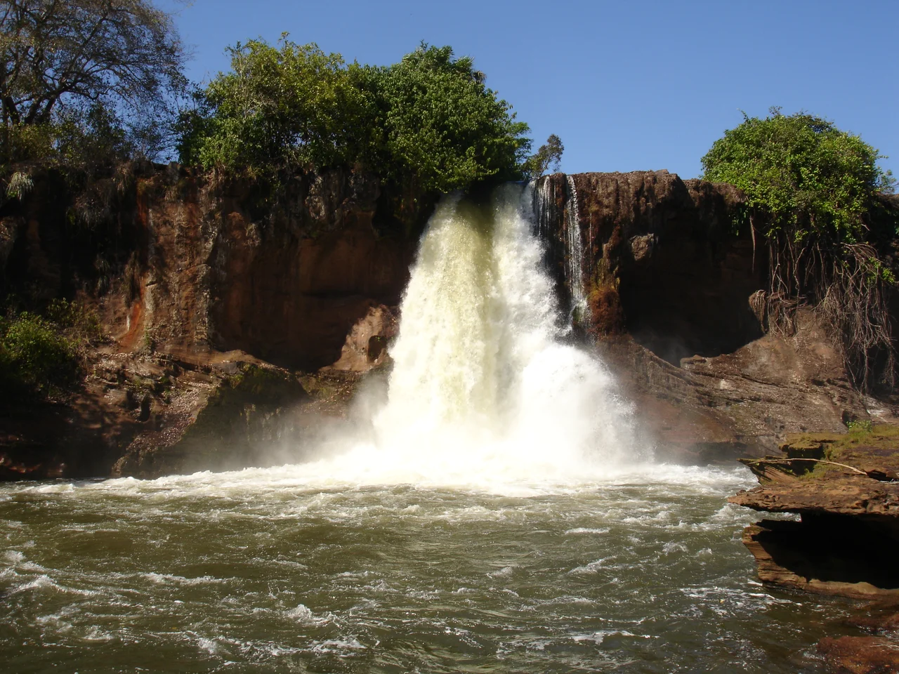
The terrain climbs to 700 meters at its highest point, a modest elevation that nonetheless creates a landscape of dramatic verticality. The mesas - sandstone plateaus scoured by wind and water over millennia - rise abruptly from the surrounding plains, their cliffs streaked with red and ochre. Rock carvings dot some of the exposed faces, left by peoples who used these shelters long before there were borders or decrees. The park contains more than 400 springs, which feed two major rivers: the Farinha in the north and the Itapecuru in the south. Where the water tumbles over sandstone ledges, waterfalls form. The São Romão and Prata falls - both within park boundaries - became the region's signature attractions, though the park itself is not formally open to visitors.
Creatures of the Cerrado
The Cerrado supports a strange, specific cast of large animals, and the park shelters most of them. The giant anteater, Myrmecophaga tridactyla, shuffles across the grasslands tearing open termite mounds with claws adapted for nothing else. Three wild cats share the territory: the ocelot, the cougar, and the smaller oncilla, a spotted feline the size of a housecat that hunts by night. Overhead, the Chaco eagle - Buteogallus coronatus, one of South America's rarer raptors - still circles, though its numbers have thinned across the continent. The bare-faced curassow, a large ground bird, picks its way through the underbrush. These species persist here because the habitat persists. Lose the cerrado, and you lose them along with it.
Climate and the Seasons
Temperatures hover around an average of 26 degrees Celsius year-round, ranging from cool mornings in the fifteens to humid afternoons in the mid-thirties. Annual rainfall averages around 1,400 millimeters, concentrated in a distinct wet season from October through April. The dry season transforms the park. Grass turns golden, streams shrink to thin silver lines between sandstone walls, and the springs that feed the rivers become visibly precious. It is in the dry months that the verticality of the mesas becomes most striking, the rocks bleached bright against dead yellow grass. Then the rains return, and the cerrado greens again almost overnight.
The Buffer That Holds
Most of what draws tourists to the Chapada das Mesas region - the cliffs with rock art, the accessible waterfalls, the small towns with guesthouses - lies outside the park proper, in modified landscapes where ranching and agriculture have long since reshaped the land. The park itself is a reserve, not a destination, and that is deliberate. The soybean fields of the Cerrado have been expanding for decades, driven by global demand and enabled by the region's increasingly long dry season. Every hectare fenced off here is a hectare that does not become monoculture. Whether the line holds depends on political will as much as ecology. For now, the tables still stand, and beneath them, the 400 springs still flow.
From the Air
Located at 7.01°S, 47.15°W in southern Maranhão, Brazil. Best viewed from 6,000-10,000 feet AGL - the flat-topped sandstone mesas are visually distinctive from altitude, rising abruptly from surrounding plains. The nearest substantial airport is Carolina Airport (SWKO). Flying is most rewarding in the dry season (May-September), when the bleached grasses contrast dramatically with the red sandstone cliffs. Average temperature 26°C year-round.
Nearby Stories
- Juscelino Kubitschek de Oliveira Bridge 23 km away
- São Geraldo do Araguaia Environmental Protection Area 83 km away
- Serra dos Martírios/Andorinhas State Park 119 km away
- Parnaíba Basin 132 km away
- Maranhão 153 km away
- Tocantins 249 km away
- Nascentes do Rio Parnaíba National Park 330 km away
- Lajeado State Park 339 km away