São Geraldo do Araguaia Environmental Protection Area
Eight thousand years ago, someone carved figures into the stone on Pedra Escrita and the Ilha dos Martírios - an island in the middle of the fast-running Araguaia River in what is now southeastern Pará. The inscriptions are still there. The river is still fast. And in the dense rainforest lining its west bank, harpy eagles - the largest and arguably most formidable birds of prey in Brazil - still hunt monkeys from the canopy. The São Geraldo do Araguaia Environmental Protection Area wraps around the Serra dos Martírios/Andorinhas State Park in a landscape where ancient humans left their marks, where 20th-century guerrillas fought the military dictatorship, and where the forest itself has mostly been cleared for cattle. What remains is a 29,655-hectare buffer trying to hold the line.
Where the Araguaia Runs Fast
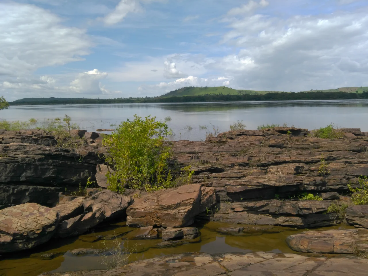
The Araguaia River is one of Brazil's great waterways, flowing for hundreds of kilometers down the border between Tocantins and Pará before joining the Tocantins itself in the north. Through São Geraldo do Araguaia, the river runs fast and rock-filled, the kind of stretch that demands a local boatman rather than a rental. Islands punctuate the channel, and the most famous is the Ilha dos Martírios, the Island of the Martyrs, whose rocks carry prehistoric inscriptions roughly 8,000 years old. On the shore, the Pedra Escrita - the Written Stone - carries more of the same ancient work. During the dry summer months, beaches emerge along the river, including the Remanso dos Botos, a sandy arc where river dolphins called botos can sometimes be seen. This is one of the last stretches of the middle Araguaia where both the river and its associated forest retain something of their original character.
Rock Art from Deep Time
The inscriptions are the human story of this place written before writing existed. Eight thousand years puts them roughly contemporaneous with the earliest known agriculture in the Old World, long before the pyramids, long before any European ship crossed the Atlantic. Who made them is not precisely known - the region has been home to various indigenous peoples over millennia - but the figures scratched into stone suggest someone was speaking across time, leaving a message they hoped would last. They have. The inscriptions on Pedra Escrita and the Ilha dos Martírios are among the oldest known rock art sites in this part of the Amazon basin. They are also deeply fragile. Visitors must arrange boat transport through local operators, and the access that comes with protection also brings the risk of damage. The APA's attractions include not just the inscriptions but caves, trail networks, and a series of scenic waterfalls - Três Quedas, Riacho Fundo, do Spanner, do Honorato, and Sem-Nome.
A Forest Mostly Cleared
The original vegetation here was dense rainforest. The vegetation today is mostly cattle pasture. The APA was created on July 25, 1996, by law 5.983, specifically as a buffer around the Serra dos Martírios/Andorinhas State Park - and specifically because almost all of the surrounding municipality had been deforested. Without the buffer, runoff and fire and cattle would have pushed into the state park itself. The APA occupies the left bank of the Araguaia River opposite the Lago de Santa Isabel Environmental Protection Area on the right bank. It consists largely of private properties used for cattle ranching, made easier by the gentle topography. Three communities live within it: Sucupira, Ilha de Campo, and Santa Cruz dos Martírios, the latter two directly on the Araguaia River. Residents practice artisanal fishing, small-scale agriculture, and livestock raising. Parts of two Federal Settlement Projects - Tira-Catinga I and Boqueirão - fall within the APA.
The Araguaia Guerrilla
This region carries a heavier recent history. During the military regime that governed Brazil from 1964 into the mid-1980s, the rainforests around what is now São Geraldo do Araguaia became the base of the Araguaia Guerrilla, an armed left-wing movement active from the late 1960s to mid 1970s. The Brazilian army eventually hunted down the guerrillas in a series of campaigns that killed many of them and left families still searching decades later for the remains of loved ones. The rock inscriptions and the waterfalls that draw today's visitors sit in a landscape where, within living memory, young Brazilian idealists and soldiers in uniform shot at each other among the trees. Many of those trees are no longer there. The clearing that followed the dictatorship was driven less by politics than by economics - cattle, timber, pasture - but the ghosts remain in the place names and in the grief of families who never received bodies.
Harpy Eagles and What Remains
The APA is home to Harpia harpyja, the harpy eagle, the largest bird of prey in Brazil. It is also the declared main bio-indicator of the protected area, meaning its presence or absence signals the health of the whole ecosystem. Harpies need intact forest with large trees and abundant prey - sloths, monkeys, large rodents. They do not thrive on cattle pasture. That the species still lives here at all is a sign that the buffer zone is doing some of the work it was designed to do, protecting the state park next door and the ancient inscriptions along the river. São Geraldo do Araguaia is not far from Serra Pelada, the scarred hill where tens of thousands of gold miners clawed dirt from the earth with their hands in the 1980s. The whole region has been shaped by extraction of one kind or another. What the APA preserves is a thread of older continuity - ancient rock art, fast river, gentle rainforest - in a landscape where nearly everything else has been rewritten.
From the Air
Located at 6.33°S, 48.47°W along the west bank of the Araguaia River in southeastern Pará, Brazil. APA covers 29,655 hectares. The Serra dos Martírios/Andorinhas State Park lies within the buffer zone. Nearest major airport is Marabá (SBMA) to the north, with Palmas (SBPJ) to the south across state lines in Tocantins. Recommended viewing altitude 8,000-15,000 feet. Visible from altitude: the Araguaia River itself, unmistakable with its rocky channel and island systems; the sharper green of the APA's forest cover contrasting with surrounding cleared pastures; the Ilha dos Martírios and other riverine islands; waterfall systems in the surrounding serras. Dry season (May-September) offers clearest visibility and exposes river beaches.
Nearby Stories
- Juscelino Kubitschek de Oliveira Bridge 40 km away
- Marabá, Pará 73 km away
- Serra Pelada 94 km away
- Chapada das Mesas National Park 113 km away
- Tapirapé-Aquiri National Forest 270 km away
- Tocantins 325 km away
- Ilha do Bananal / Cantão Environmental Protection Area 358 km away
- Santa Inês 372 km away