Lajeado State Park
Eighteen kilometers east of a city that did not exist thirty-five years ago, jaguars still pad through twisted cerrado scrub, and cave paintings older than any Brazilian state stare out from sandstone walls. Lajeado State Park sits on a plateau that drops sharply westward over the Frente de Cuesta escarpment, spilling rainwater down into the Tocantins depression where Palmas, the last capital city planned in twentieth-century Brazil, sprawls in its bow-valley of the Tocantins River. This is unlikely terrain for a city of three hundred thousand people to depend on, but the springs threading through these 9,931 hectares feed the taps of the state capital. Water, here, is political.
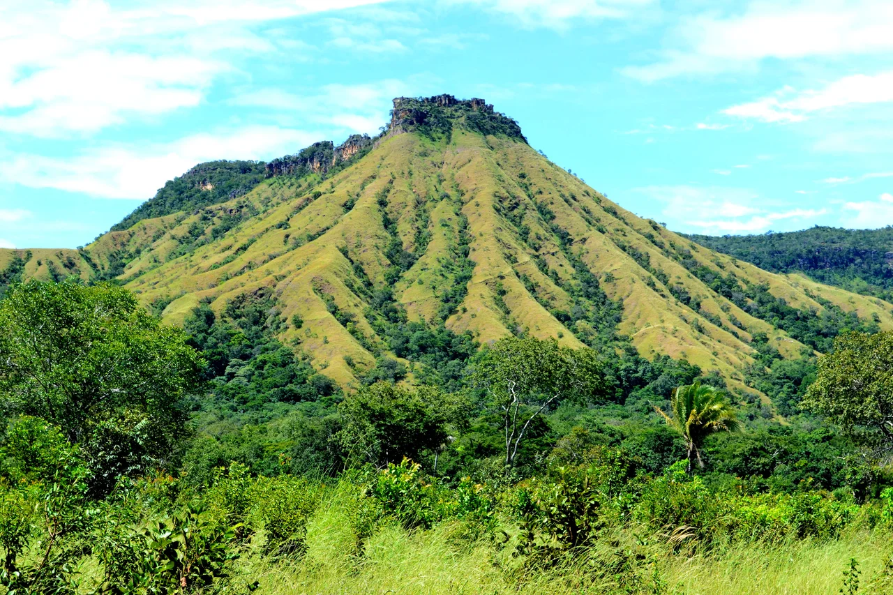
A Plateau Above the Capital
The park straddles two municipalities. Eighty-eight percent belongs to Palmas, twelve percent to the town of Lajeado that gives the place its name. From the air, the geography reads clearly: a flat-topped residual plain rising above the Tocantins depression, bounded on its western edge by the dramatic Frente de Cuesta escarpment that drops sharply toward the river valley below. Springs emerge from fractures in the sandstone, cascading into waterfalls that eventually form the Lajeado sub-basin feeding the Tocantins River. A larger protected zone, the Serra do Lajeado Environmental Protection Area, wraps around the park on all sides, creating a conservation ring that holds back the urban sprawl crawling up the escarpment from Palmas.
Cave Paintings and Cerrado
The cerrado is Brazil's quiet wonder. Often dismissed as scrubland by travelers chasing the Amazon's drama, it is actually one of the most biodiverse savannas on the planet. At Lajeado, 171 plant species from 61 families have been catalogued, dominated by legumes, palms, and the gnarled pau-terra and lixeira trees characteristic of this biome. The vegetation is short, twisted, fire-adapted, its bark often thick as a hand. Walking the park's trails, visitors pass springs, waterfalls, and rock shelters where prehistoric peoples left painted figures on the stone. No one has precisely dated these paintings, but they predate the Portuguese arrival by many centuries, silent witnesses to a time before the plateau had a capital to watch over.
A Young Park for a Young Capital
Lajeado State Park was created by law 1224 on May 11, 2001, barely a decade after Palmas itself rose from former agricultural land. The reasoning was practical and urgent. Palmas needed a permanent water supply, and the springs on the plateau east of the city were exactly that. A state park would protect the watershed, hold back urban sprawl from the escarpment, and preserve the cerrado ecosystem at the same time. A management plan was published on December 31, 2005, though never formally adopted through legislation. The consultative council finally took shape on June 6, 2016. Before the park existed, the land had been used as a fish farm. That farm is closed now, the ponds returning to the dry hills.
What Still Lives Here
A biological survey of the park and surrounding area recorded 41 mammal species, 219 birds, 4 reptiles, and 50 amphibians. The larger mammal list reads like a summary of everything wild in central Brazil: paca, fox, maned wolf, tapir, jaguar. Primates include robust capuchin monkeys, howler monkeys, and black-tufted marmosets, their calls carrying through the gallery forests that line the streams. Among the 219 bird species, three are cerrado endemics: the rufous-winged antshrike, the helmeted manakin with its scarlet crown, and the curl-crested jay. Visitors must give advance notice to enter, and trained guides accompany all hikes. The park also faces pressure from cattle grazing, squatters, hunting, fires, and the urban boundary of Palmas creeping ever closer up the escarpment.
The View from Above
From a cockpit passing overhead at ten degrees south, Lajeado reads as a hinge in the landscape. To the west, the green grid of Palmas fills the valley floor along the Tocantins River, its planned avenues unmistakable from altitude. To the east, the plateau stretches out in cerrado shades of olive and tan, broken by the darker green threads of gallery forests following every watercourse. Between them, the Frente de Cuesta escarpment drops sharply, a geological edge sharpened by erosion over eons. In the wet season, October through March, the waterfalls run strong and the air over the plateau thickens with moisture. In the dry season, May through September, the land bakes under one of the hottest skies in Brazil.
From the Air
Located at 10.10°S, 48.25°W on a cerrado plateau east of Palmas, Tocantins. Elevation of the plateau reaches well above the 195-meter Tocantins valley floor, with the Frente de Cuesta escarpment dropping westward. Recommended viewing altitude 8,000-12,000 feet. Palmas Airport (SBPJ) lies approximately 30 kilometers southwest of the park. The city grid of Palmas is visible in the valley below; the park forms the green plateau immediately east of the capital. Clear weather best in the dry season (May-September).
Nearby Stories
- Tocantins 52 km away
- Ilha do Bananal / Cantão Environmental Protection Area 75 km away
- Jalapão State Park 81 km away
- Cantão State Park 140 km away
- Araguaia National Park 143 km away
- Serra Geral do Tocantins Ecological Station 143 km away
- Chapada das Mesas National Park 324 km away