Serra dos Martírios/Andorinhas State Park
The range was renamed out of embarrassment. For most of its history it was the Serra dos Martirios - the Martyrs Range - but in the 1960s the mountains harbored something the Brazilian military dictatorship preferred not to commemorate: the Guerrilha do Araguaia, an armed left-wing movement that hid among these escarpments until counterinsurgency operations crushed it in the mid-1970s. After the guerrilha ended, officials rebranded the range as Serra das Andorinhas, the Swallows Range, a gentler name for a place that had seen violent things. The old name never fully went away. Today, both are official, stacked together with a slash between them like a wound half-healed.
Eight Thousand Years of Art
The oldest residents of this land left their marks on stone. The park holds more than 80 archaeological sites, 150 cave paintings, and over 5,000 rock engravings - some estimated at 8,300 years old. These pre-Columbian artists worked the escarpments of a landscape where the Amazon rainforest shades into cerrado, leaving a record of a culture that watched the same swallows and the same rivers that watch us back today. Many of the caves are fragile. Fires have scorched them. Graffiti has defaced them. Religious gatherings have worn their surfaces. For decades, proposed dams threatened to flood them entirely - the Santa Isabel hydroelectric project was first studied in 1986, shelved, and then revived in 2000. What has survived has survived almost by accident, in a country still learning how to protect its deepest history.
The House of Stone
Casa de Pedra sits in the northern part of the park, accessible only by a steep climb from the BR-153 highway about five kilometers to the west. Inside a large rock shelter, devotees have built a church to the Trinity. Every year between April and May, the Feast of the Divine Holy Spirit fills the cave for nine or ten days - a tradition with roots in old Portuguese folklore carried into the Amazon by settlers centuries ago. Since 1966, pilgrims have walked up to 30 kilometers to reach the Casa de Pedra, where they see, in the worn rock walls, images related to the divine dove of the Holy Spirit. Dozens of men, women, and children lodge in the caves and shelters for days at a time, praying and singing through the hours. The festival is an act of devotion - and also, inadvertently, a problem for the caves, which were never built for this much human presence.
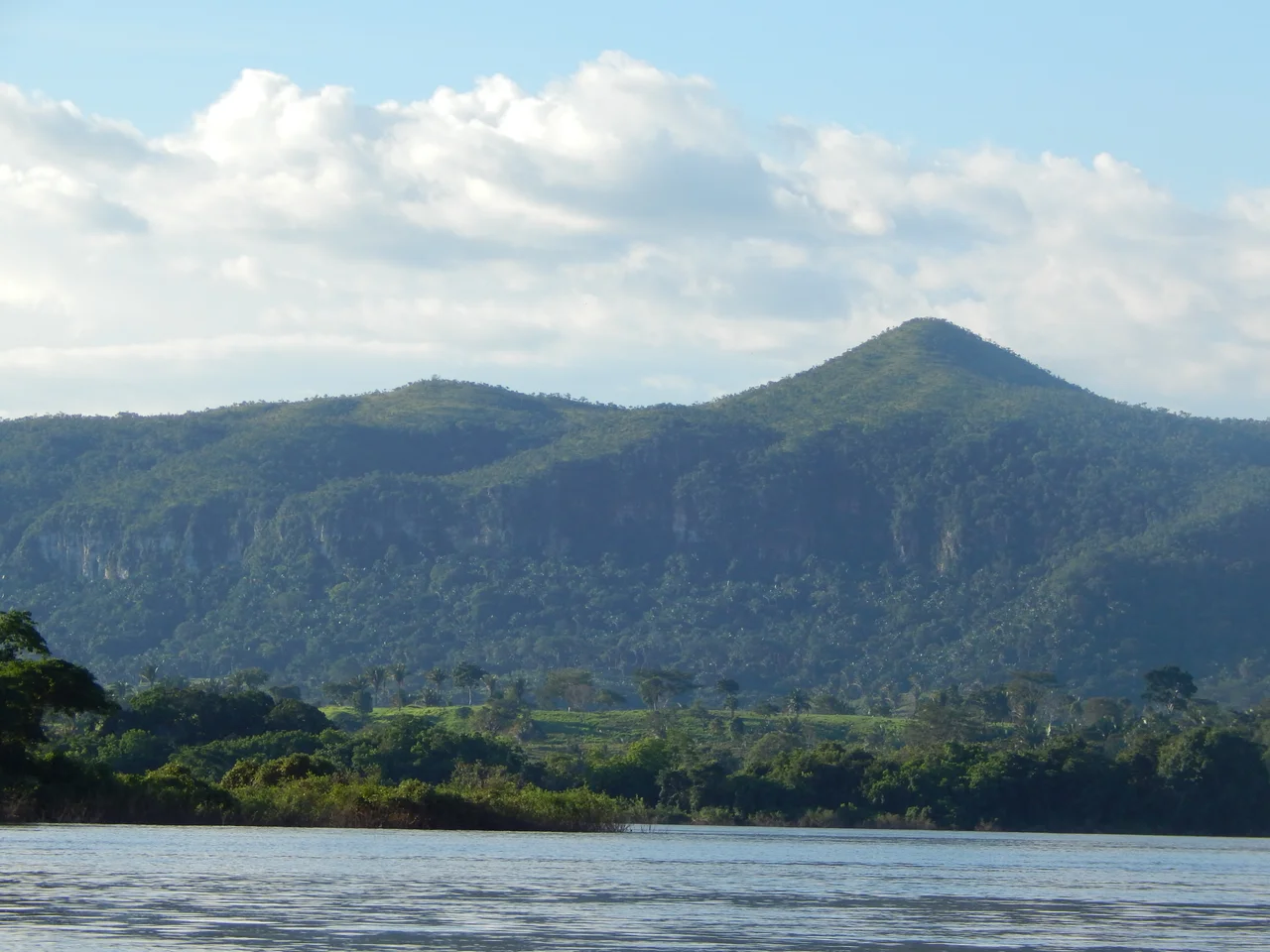
The Escarpment and the River
Serra das Andorinhas contains a steep fault escarpment with drops that plunge 250 meters in places. The Araguaia River, which forms the park's southeastern and eastern border, also divides Para from Tocantins. Its waters run fast and very rocky, demanding experienced pilots for the two-to-three hour boat trips visitors can take along the buffer zone. The park itself covers 24,897 hectares in the municipality of Sao Geraldo do Araguaia and shelters over 500 herbaceous and shrub species, more than 150 tree species, 80 kinds of orchid, and 38 medicinal plants. The harpy eagle hunts here - one of the largest and most threatened raptors in the Americas. Roughly 532 animal species have been documented, some of them in danger of vanishing from Brazil entirely.
Who Lives Here Now
As recently as 2011, 83 families were still practicing subsistence farming inside the park, using slash-and-burn techniques, grazing cattle on the harpy eagle's hunting grounds. Illegal hunting has declined but not disappeared. The park's management balances the interests of these traditional users with the goal of conservation, a negotiation that has not always gone smoothly. Trails range from intermediate to difficult, climbing steep terrain toward viewpoints over the Araguaia and the Quarta Queda waterfall. From a gazebo high above the river, visitors can see the full sweep of the park - the cerrado fading into rainforest, the fault escarpment plunging to the water, the old guerrilla hideouts that became a state park in 1996. The swallows are still here. So are the martyrs, in a sense: the painted rocks, the walking pilgrims, the fighters the forest swallowed, all layered on a single stretch of ground.
From the Air
Serra dos Martirios/Andorinhas State Park is centered at approximately 6.14 S, 48.53 W on the Para/Tocantins border. Terrain features a steep fault escarpment with 250 meter drops along the Araguaia River valley. Recommended viewing altitude 3,000 to 5,000 feet AGL to appreciate the escarpment and river course. The BR-153 highway runs about 5 kilometers west of the park boundary - a useful visual reference. Nearest airfields: Maraba Airport (SBMA) about 180 km northwest and Araguaina (SBAR) to the east. Transition zone between Amazon rainforest and cerrado - expect patchy cloud cover year-round and strong afternoon thunderstorms in wet season (October through April).
Nearby Stories
- Serra Pelada 51 km away
- Marabá, Pará 67 km away
- Juscelino Kubitschek de Oliveira Bridge 82 km away
- Chapada das Mesas National Park 154 km away
- Xingu-Tocantins-Araguaia Moist Forests 218 km away
- Parnaíba Basin 344 km away
- Ilha do Bananal / Cantão Environmental Protection Area 372 km away
- Santa Inês 389 km away