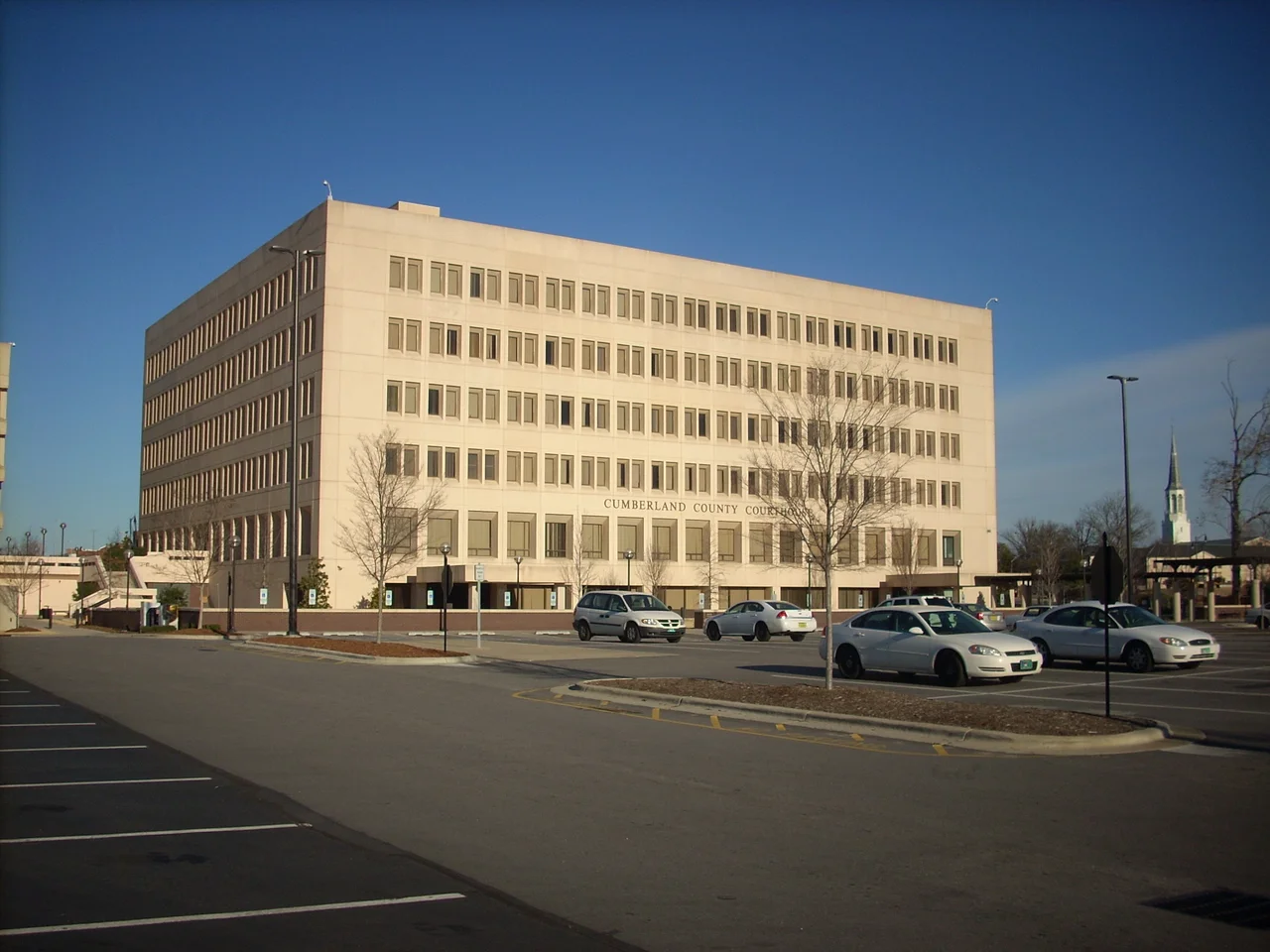

Cumberland County, North Carolina
There is an irony in the name that hides in plain sight. Cumberland County was carved out of Bladen County in 1754 and named for Prince William Augustus, Duke of Cumberland, the British general who broke the Highland Scottish clans at Culloden eight years earlier. The same Highland families he scattered then sailed for the Cape Fear River - and many of them settled here. They named their new town for the Marquis de Lafayette, the French general who helped win American independence from the same British crown the Duke had served. The county is full of these doublings: Confederate, Union, Black, white, military, civilian. Cumberland holds all of them at once.
From Fayette to Cumberland and Back
In July 1784, the General Assembly briefly renamed the county Fayette in honor of Lafayette. Three months later they restored Cumberland. For one strange autumn the place existed under both names - the formal records said Fayette County, the people kept saying Cumberland. The boundaries themselves kept moving. Wake County was carved off in 1771. Moore County in 1784. Harnett in 1855. Hoke in 1911. Each split took farms and families with it, redrawing what Cumberland was. What remained, by the twentieth century, was the area along the Cape Fear River centered on Fayetteville - the county seat then and now, a city with Scottish bones and Lafayette's name.
Bragg and Liberty and Bragg Again
The geography of Cumberland County shifted permanently when the Army established Camp Bragg in 1918, on the sandhills just north of Fayetteville. Renamed Fort Bragg in 1922, it grew into the largest U.S. military installation by population, eventually home to the 82nd Airborne Division, the XVIII Airborne Corps, the 1st Special Forces Operational Detachment-Delta, and the U.S. Army Special Operations Command. In 2023, after years of debate, the installation was redesignated Fort Liberty as part of a national process to rename bases that honored Confederate officers - the original name had commemorated Confederate General Braxton Bragg. In February 2025, federal action restored the name Fort Bragg, this time officially honoring Private First Class Roland L. Bragg, a World War II paratrooper who earned the Silver Star for actions during the Battle of the Bulge. The name on the gate is the same; the man it honors is not. The base employs roughly 50,000 active-duty soldiers and supports many more family members, contractors, retirees - a small city draped across the sandhills with its own schools, shops, and rhythms.
Howard's Gift
Cumberland County is also where, in 1867, seven Black men pooled $136 to buy two lots on Gillespie Street in downtown Fayetteville. Matthew Leary, Andrew Jackson Chesnutt, Robert Simmons, George Grainger, Thomas Lomax, Nelson Carter, and David Bryant - their names belong on any honest map of the place. With General Oliver O. Howard of the Freedmen's Bureau, they established the Howard School. Ten years later, the North Carolina legislature designated it the first state-sponsored institution for the education of African American teachers in the South. Today it is Fayetteville State University, a member of the University of North Carolina system, the HBCU that quietly transformed the county. Its alumni include the first woman command sergeant major of the Army Reserve, MLB players, NFL players, comedians, novelists. The bricks of Chesnutt Library carry the name of Charles W. Chesnutt, son of one of the founders and one of the first major Black novelists in American letters.
Cape Fear, Hay Street, Cross Creek
The Cape Fear River runs along the county's eastern edge, and Fayetteville grew where it meets Cross Creek - a confluence that for generations made the city a riverport for plantations upstream. Downtown still carries that geometry. Hay Street curves toward the river. The 1838 Confederate arsenal, destroyed by Sherman in March 1865, lies in foundations behind the Museum of the Cape Fear. Heritage Square preserves three federal-period houses including the 1797 Sandford House. The first Golden Corral restaurant opened on the edge of town in 1973 - a fact Cumberland County is statutorily proud of, embedded in tourism brochures. The Cape Fear Botanical Garden sits on land that once held cotton fields. The county population reached 334,728 at the 2020 census, with the Fayetteville metropolitan area considerably larger; demographics now split roughly 40% white, 37% Black, 12% Hispanic, with significant Native American, Asian, and multiracial populations. The Lumbee Tribe of North Carolina, state-recognized, has a long presence in adjacent Robeson County and across the broader region.
From the Air
Cumberland County is centered near 35.05°N, 78.83°W in the sandhills of south-central North Carolina. Fayetteville Regional Airport (KFAY) serves civilian commercial traffic. Pope Field (KPOB) handles Air Mobility Command operations at Fort Bragg. Simmons Army Airfield (KFBG) is the Army field on Fort Bragg proper. Restricted airspace covers the Fort Bragg/Pope reservation - check NOTAMs before any operations in the area. The Cape Fear River meanders along the eastern boundary; Fayetteville lies at the confluence of the river and Cross Creek.
Nearby Stories
- Laurinburg, North Carolina 4.7 km away
- Sampson County, North Carolina 9.1 km away
- Rockingham Speedway 18 km away
- Campbell University 19 km away
- The Robesonian Takeover 20 km away
- Johnston County, North Carolina 21 km away
- North Carolina Aviation Museum 53 km away
- Pender County, North Carolina 57 km away