Diepholz
Two rivers meet here. The Hunte slides in from the north, the Lohne from the south, and Diepholz grew up in the wet ground between them — the kind of place medieval lords built when they wanted both water for the moat and reeds tall enough to hide an approaching enemy. For centuries it ran its own affairs as the seat of the Counts of Diepholz, a small independent county tucked between the bigger powers of Osnabrück and Bremen. Today it is the quiet capital of a Lower Saxon district that bears its name, but the old habit of self-government still shows in the careful way the town keeps its own counsel.
The County That Outlasted Its Counts
The Noble Lords of Diepholz first appear in the records as minor local players, then climb steadily through the medieval ranks until, by the late Middle Ages, they hold the title of Count and the right to mint their own coins. Their seat sat on the marshy lowlands between the Hunte and the Lohne, defensible by water if nothing else. The county punched above its weight: one of its sons, Rudolf van Diepholt, rose to become Bishop of Utrecht and Bishop of Osnabrück before his death in 1455 — a Lower Saxon nobleman running the spiritual life of two cathedrals at once. A Swedish princess, Marianne, married into the family and died here sometime after 1285, far from the cold Scandinavian court where she was born. The county itself eventually faded into larger German states, but the town inherited the name and the habit of independence.
The Chemist Who Made Wood Glue Possible
In 1880, Diepholz produced its most quietly consequential citizen: Fritz Klatte, a chemist who would discover polyvinyl acetate — PVA, the white glue that holds together everything from kindergarten craft projects to industrial plywood. Klatte's work also opened the door to polyvinyl chloride, PVC, the plastic that would later wrap the modern world in pipes, records, raincoats, and credit cards. He died in 1934, just as the plastics industry he had helped seed was beginning to transform manufacturing. The man who started it all came from a town of fewer than 18,000 people, where his name is now one of those local facts every schoolchild eventually learns.
Three Villages and a Museum of Old Machines
Diepholz today is really four places stitched together. The historic core sits on the rivers, surrounded by the incorporated villages of Aschen, Sankt Hülfe, and Heede. Aschen, four kilometers north along the federal road, keeps a small local museum — the Heimatmuseum Aschen — where the unglamorous tools of north German farm life are displayed: threshers, butter churns, carpenter's benches, and the household goods of people who lived through the lean years before mechanization made everything easier and cheaper. It is the sort of museum that exists because someone, decades ago, decided this stuff was worth saving. Walking through, you understand why.
A Quiet Religious Geography
Diepholz sits along an invisible line that runs through this corner of Lower Saxony: north of here, the country is largely Protestant; just south, in the Vechta district, it turns sharply Catholic. The town itself leans Evangelical Lutheran — about 47 percent at last count — with a Catholic minority of roughly 19 percent and a growing share of residents who claim no religion at all. It is not the most dramatic religious geography in Germany, but it is real, and it explains why neighboring towns only a short drive apart can feel like they belong to different countries. Diepholz is on the Protestant side, by a small but consistent margin.
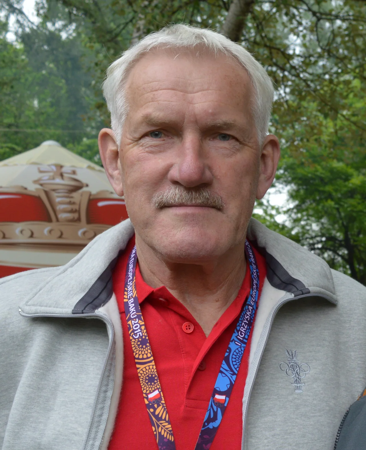
Olympic Bronze and Local Pride
The town's most decorated modern son is Polish handball player Zygfryd Kuchta, born here in 1944 in the chaos of late-war Lower Saxony, who went on to win team bronze with Poland at the 1976 Montreal Olympics. His story is one of those small reminders that the borders drawn by twentieth-century politics did not always match the lives lived underneath them. A child born in wartime Diepholz, raised across the new postwar map, returned in the form of a medal Poland still counts as part of its athletic heritage.
From the Air
Coordinates 52.61 N, 8.37 E, in the flat lowlands of central Lower Saxony. Best viewed from 3,000 to 5,000 feet — the town sits in a wide, shallow basin between Bremen (60 km northeast) and Osnabrück (45 km southwest). Look for the converging rivers Hunte and Lohne and the long ribbon of the B 51 federal road. Nearest major airports: Bremen (EDDW) to the north, Münster/Osnabrück (EDDG) to the southwest. The terrain is uniformly flat — under 50 meters elevation — so visibility is rarely a problem in clear weather.
Nearby Stories
- Wildeshausen Geest 8.1 km away
- Osnabrück (district) 8.6 km away
- Ibbenbüren 12 km away
- Saterland Frisian language 14 km away
- Emsland Railway 29 km away
- Gardelegen Massacre 178 km away
- Ludwigslust Palace 186 km away
- Memleben Abbey 224 km away