Wildeshausen Geest
The Low German word *güst* means dry and infertile. Northern Germans used it for the band of sandy, slightly raised land that the last Ice Age left behind when it dumped its load of crushed rock across the plain - and *geest* is the noun they made from it. The Wildeshausen Geest is one of the wider, drier links in a chain of geest country that stretches from the Ems near Meppen all the way to the Elbe marshes near Stade. To stand on it is to stand on the leftovers of a glacier that ended thousands of years before anyone was here to name it. The Funnelbeaker farmers were. They left so many megalithic tombs in this country that there is now an official Route of Megalithic Culture connecting 33 of them between Osnabrück and Oldenburg.
What a Geest Actually Is
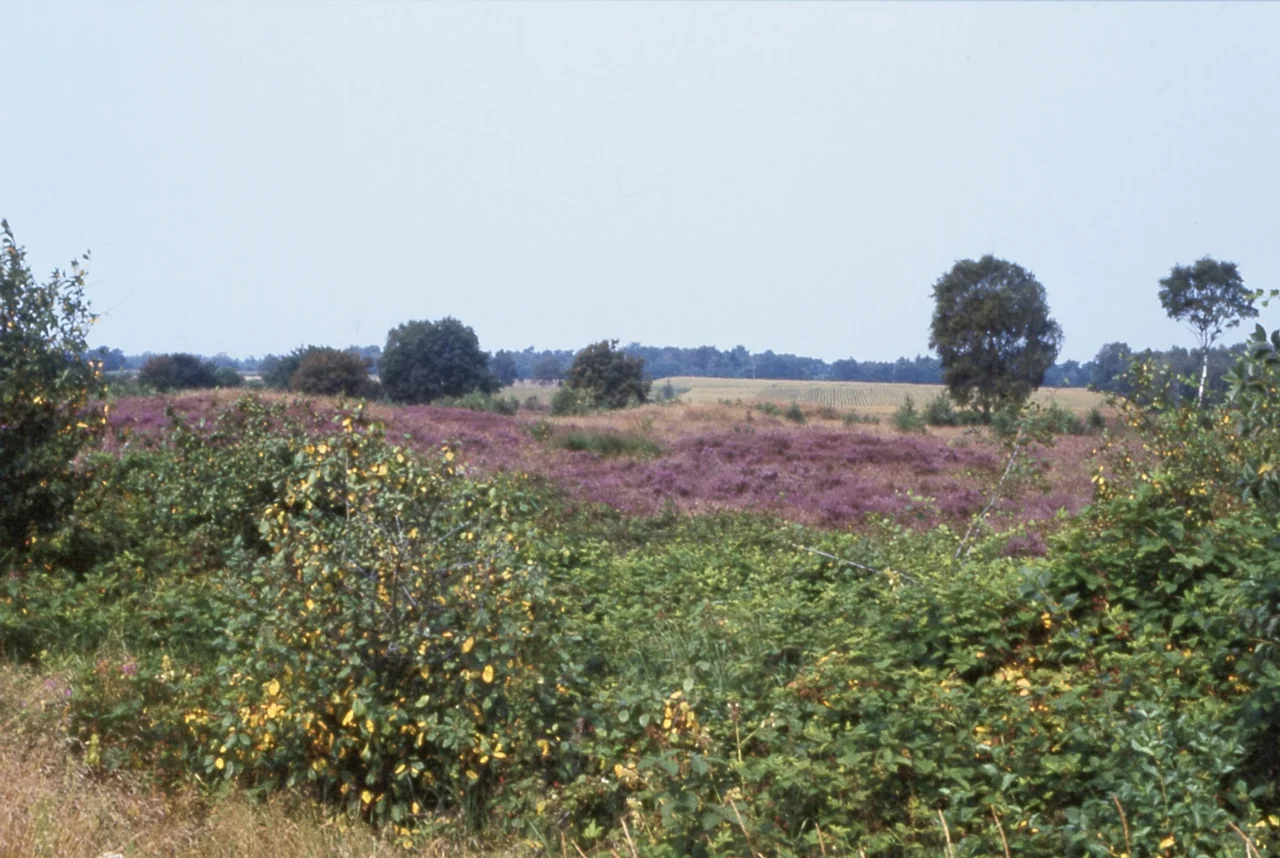
Geest is what happens when an ice sheet retreats and leaves its rubble behind. The Wildeshausen Geest is an *Old Drift* landscape - sandy depositions from earlier glaciations, weathered over hundreds of thousands of years, with peat-filled bogs and wet meadows pooled in the depressions between rises. The plateaux sit at 50 to 60 metres above sea level, reaching 80 metres in the southeast toward Nienburg. The eastern edge is the dramatic one: between Hoya and Syke the geest jumps about 40 metres above the broad Weser Lowlands like a long, wooded coastline above a vanished sea. Marshes lap the geest from the north; a belt of wetland - the Großes Moor, the Sulinger Moor - hems it in from the south, running on to the Wiehen Hills. The geest is the dry island in between.
Rivers That Made Themselves
Most of the larger waterbodies in the geest flow south to north. The Hunte arrives from the Wiehen Hills and runs across the whole nature park; the Delme, the Klosterbach and the Hache all rise within the geest itself, carving out small green valleys that give the landscape its rolling, broken character. On the northern edge, between Ganderkesee and the marshes, the rivers bend east and find the Weser. Small streams on the eastern rim gather into lowland rivers like the Süstedter Bach. None of this is dramatic on a continental scale - the elevations are modest, the rivers are slow, the bogs are quiet - but the cumulative effect is a country of clearings and woods, fields divided by hedgerows, and brook valleys deep enough to feel sheltered.
The Stones in the Trees
What makes the Wildeshausen Geest unforgettable is what the Neolithic left lying around. The Funnelbeaker culture, the first farmers of the North European Plain (3500 to 2800 BC), built hundreds of *Großsteingräber* - 'big stone tombs' - across this landscape, dragging glacial boulders into long galleries and chambered passages. The Visbeker Braut and the Visbeker Bräutigam, just south of the park, are among the largest in Germany. Smaller sites like Kleinenkneter Steine, Pestruper Burial Ground near Wildeshausen and the Heidenopfertisch are scattered through the woods at the end of unsigned paths. The Pestruper field is the only preserved urn-field of its scale in Europe - about 500 grass-covered mounds raised one by one around 600 BC. The Route of Megalithic Culture links 33 of these sites; you can ride or drive it in a day, and still feel like you have only scratched the surface.
The Park You Live In
The Wildeshausen Geest Nature Park is not a wilderness. The woodland mosaic is heaviest in the Wardenburg-Twistringen-Syke triangle that contains the towns of Wildeshausen and Harpstedt; everywhere else the geest is a working landscape of farms, mixed and coniferous forests, hedge-lined meadows. People live here, ride here, cycle the long-distance routes along the Hunte, fish in the brooks, gather at small-town festivals in Pentecost week. The protected status is less about keeping anyone out and more about keeping the character in - the rolling river valleys, the brook-fed watermills, the heath, the stones in the trees. It is the kind of nature park you can drive through almost without realising. The trick is to stop the car and walk a few hundred metres into the woods.
From the Air
The Wildeshausen Geest is centred at roughly 52.92 degrees north, 8.38 degrees east, stretching across the Oldenburg, Diepholz and Vechta districts of Lower Saxony. The geest plateau sits at 50 to 60 metres above sea level (up to 80 metres in the southeast) and rises about 40 metres above the Weser Lowlands along its striking eastern edge between Hoya and Syke. From cruising altitude the park appears as a mosaic of woods, fields and grassland, threaded by the dark green river valleys of the Hunte, Delme, Klosterbach and Hache. Bremen (EDDW) is the closest large airport, about 25 km northeast of Wildeshausen town. Münster-Osnabrück (EDDG) lies about 80 km southwest. Small fields include Flugplatz Oldenburg-Hatten (EDWH) on the park's northern edge.
Nearby Stories
- Vechta 1.9 km away
- Saterland Frisian language 4.1 km away
- Vossbarg 14 km away
- Varel 17 km away
- Emsland Railway 30 km away
- Gardelegen Massacre 179 km away
- Ludwigslust Palace 180 km away
- Wöbbelin Concentration Camp 185 km away