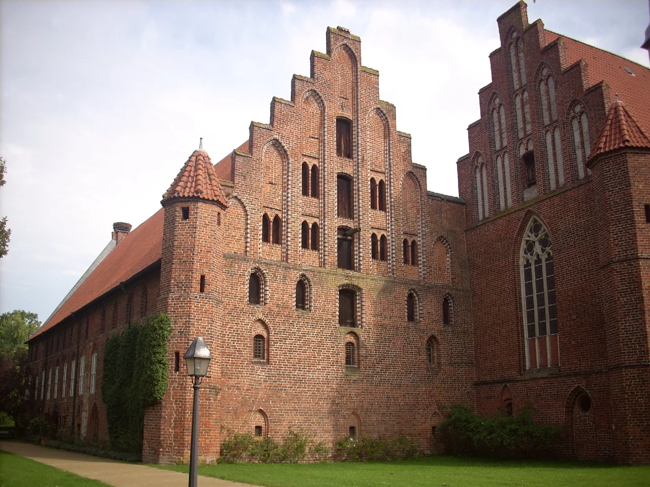

Ebstorf Abbey
Somebody at Ebstorf drew the world as a body. Christ's head rose above the upper edge, his hands reached out at either side, his feet rested at the bottom, and everything the thirteenth century believed about seas, cities, beasts and history was crowded into the space between them, with Jerusalem at the centre. The thing measured roughly 3.6 metres on a side — thirty sheets of sheepskin parchment sewn together — and it was the largest map of the world medieval Europe is known to have made. It burned in 1943.
A Count's Investment
The house was founded around 1160 as the Priory of Saint Maurice, for Premonstratensian canons regular, by Volrad von Bodwede, Count of Dannenberg and a nephew of Henry the Lion. Piety was not the only motive. A monastery anchored a claim, drew traffic and generated revenue, and Volrad founded this one partly to consolidate his influence across the region.
It first appears in the written record in 1197. Ebstorf belongs to the six houses known as the Lüneklöster, the monasteries of Lüne, all of which came through the Reformation as Lutheran convents rather than closing — an unusual outcome, and the reason the buildings and their contents were never dispersed.
Fire, Brick, and Pilgrims
A fire in the thirteenth century changed the character of the place. The house was handed to the Benedictine nuns of Walsrode Abbey, who established a daughter house here, and Ebstorf became a Marienwallfahrtsort — a site of Marian pilgrimage, with the crowds and offerings that implies.
What rose after the fire is what stands today. The fourteenth-century abbey buildings are North German Brick Gothic: dark red brick laid in patterns, high gables, arcaded cloisters, the whole vocabulary of a region with excellent clay and no building stone. The church survives with its raised nuns' gallery intact, the elevated choir from which the community sang while the laity stood below. The Propstei dates from the fifteenth century. In that same century the nuns were brought under the reforming programme of the newly established Bursfelde Congregation, which required a considerably stricter life than the one they had been keeping.
The Map That Was Also an Encyclopedia
The Ebstorf Map was made between about 1234 and 1240, attributed — tentatively, and still argued over — to Gervase of Ebstorf, who may or may not have been the same man as Gervase of Tilbury. Like most medieval mappae mundi it puts east at the top, which is why the head of Christ occupies the direction of the rising sun and of Eden.
It was never a chart for finding your way. It was an encyclopedia laid flat: descriptions of animals, an account of the creation of the world, definitions of terms, and pagan and biblical history packed in among the coastlines. The map was rediscovered at the abbey in 1843 and taken to Hanover, and in 1943 an Allied bombing raid on that city destroyed it. What survives is a set of black-and-white photographs taken in 1891 and a handful of colour facsimiles produced before the war. A faithful copy hangs at Ebstorf, and it is what most visitors come to see.
Reformation and a Very Long Administration
In 1529 Ernest the Confessor, the Welf duke ruling from Celle, converted the monastery to a Lutheran convent. Conversion on paper and conversion in practice were different matters; the transformation was not complete until 1565.
Since 1818 the house has been administered by the Monastic Chamber of Hanover, an institution created by the Kingdom of Hanover's Prince-Regent — later King George IV of the United Kingdom — to manage and preserve the estates of Lutheran convents on their behalf. Lower Saxony inherited the responsibility from the vanished kingdom and holds it still. Lutheran nuns live at Ebstorf today under a Lutheran abbess, new postulants are received into the community, and the sisters keep the daily hours together and attend Mass at the Ebstorf Evangelical Lutheran Church. Women have lived a religious life on this site, more or less without interruption, since the thirteenth century.
What Is Still in the Rooms
The interiors reward slowness. Medieval stained glass fills the windows of the Nonnenchor, the nuns' choir. Statues of the Virgin stand in the cloisters, ranging in date from the thirteenth century to the fifteenth, so that three hundred years of changing taste in the same subject sit within a few paces of one another. There is a figure of Saint Maurice, the Theban soldier-saint the house was originally dedicated to. There is a baptismal font from 1310 and a pulpit built in 1615, the second a product of the Lutheran centuries and the first of the Catholic ones. Medieval chests and cupboards survive throughout.
Ebstorf has kept nearly everything — its brick, its glass, its font, its Virgins, its hours of prayer. The one thing it could not keep is the thing it is famous for.
From the Air
Ebstorf Abbey sits at 53.0306°N, 10.4122°E on the southern Lüneburg Heath, about 12 km west-northwest of Uelzen. From 2,000-3,000 ft the abbey shows as a compact block of red-tiled roofs with a church tower on the edge of the village, ringed by arable land with pine plantation and open heath beyond. The heath itself is the visual event here: the heather flowers in August and turns whole tracts of open ground purple, most striking in low morning light. Nearest airfields are Faßberg (ETHS) 20 km southwest, Celle (ETHC) 50 km southwest, Hamburg (EDDH) 75 km northwest and Hannover (EDDV) 80 km southwest. Terrain is flat to gently rolling with no significant obstacles; low stratus and ground fog are common on autumn mornings over the heath.
Nearby Stories
- Scharnebeck Twin Ship Lift 8.5 km away
- Stones Fan Museum 18 km away
- Sieben Steinhäuser 22 km away
- Celle 23 km away
- Herrenhausen Gardens 39 km away
- Ludwigslust Palace 40 km away
- Gardelegen Massacre 42 km away
- Stalag X-B 51 km away