Else (Werre)
Rivers are supposed to start at a spring or a snowmelt or a marshy seep. The Else does not. It begins at a bifurcation - one of the rare points on Earth where a river splits and both branches survive, flowing to different seas. Near Gesmold, just outside the town of Melle in Lower Saxony, the river Hase loses about a third of its water to a channel that turns east instead of northwest. That channel is the Else. The Hase keeps going to the Ems and ultimately the North Sea. The Else flows east through the Ravensberg Hills into the Werre, into the Weser, and into a completely different watershed.
The Water Wars
A river bifurcation is geologically odd. Most channels merge; few divide and stay divided. The Else-Hase bifurcation may have begun as a natural phenomenon, or it may have been engineered, or it may simply have been maintained by human hands once it appeared - the historical record is genuinely unclear. What is clear is that medieval and early-modern communities downstream were acutely aware of the value of that water. Historical disputes over the bifurcation could redirect the entire flow either toward the Ems or toward the Werre. With a few hours of digging at the right point, a town could double its water supply and starve a rival. The Hase loses a third of its mass at the divide today - a number that human management has helped to fix in place.
The Course Through Two States
After the bifurcation in Melle, the Else flows roughly 35 kilometers east, crossing the state line from Lower Saxony into North Rhine-Westphalia at river kilometer 19.2. It passes through Rödinghausen and Bünde, slips under the A30 autobahn three times - at Gesmold, at Bruchmühlen, and at Bünde - and is crossed by the Else Valley Bridge at Kirchlengern before discharging into the Werre near the town's eastern edge. The Werre, meeting it, swings almost 90 degrees east to align with the Else's direction, as if acknowledging the tributary's stubborn westward-to-eastward intent. Weirs control the lower reaches; four of them in a short stretch between Bünde and the mouth keep the velocity in check.
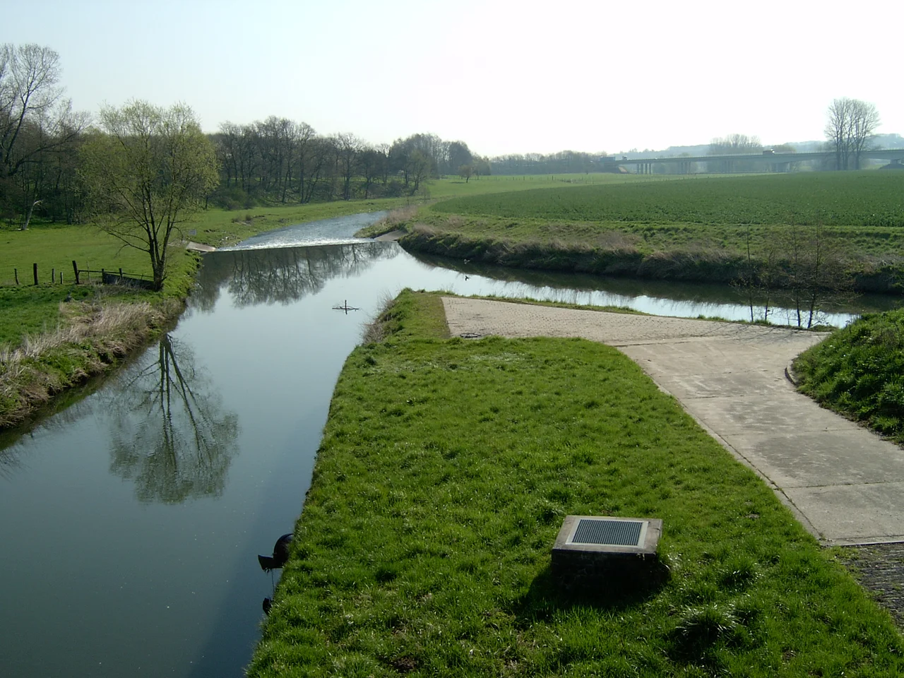
Else Meadows and a Kingfisher's Bank
Between Löhne and Osnabrück, where the railway line parallels the river, two adjacent nature reserves share the name Elseaue - 'Else water meadows' - covering 117 hectares of near-natural floodplain. They were designated in 1994 and 1995, threading a thin protected ribbon through the otherwise intensively farmed Ravensberg Land. On the floodplain, you can still trace the remnants of former river courses - the abandoned bends and meanders the Else has cut through over centuries. The steep banks, up to three meters tall, are a haven for the common kingfisher, that improbable little blue flash of a bird that needs vertical earth to nest in. Most riverbanks are too gentle for them. The Else still cuts hard enough in places to give them what they need.
Cycling the Bifurcation
The Else-Werre cycle path follows the river from the bifurcation at Melle east through the towns along its banks, across the Werre at Kirchlengern, and on into the Weser - a route that retraces, in reverse, the path the water itself takes. Bünde has a canoe association and good fishing thanks to consistently decent water quality. Stand at the bifurcation today and you can watch the moment of decision: the Hase coming through from the south, and one out of every three drops of it veering east, joining a river that has no source and no mountain, only a sibling and a fork. From this small Westphalian split, water has been routed to the North Sea via Holland for the Hase's portion, and via the Weser past Bremen for the Else's - same rain, different harbors.
From the Air
52.20°N, 8.26°E (mid-course). The Else flows roughly 35 km east from the bifurcation near Melle to its mouth at Kirchlengern, paralleling the southern flank of the Wiehen Hills. From altitude, trace the river as a sinuous line between the forested Teutoburg ridge to the south and the Wiehen ridge to the north, with the A30 autobahn crossing it three times. Nearest airport: Münster Osnabrück International (FMO/EDDG), about 40 km west of the bifurcation.
Nearby Stories
- Münster Osnabrück Airport 3.8 km away
- Hunteburg 6.1 km away
- Liesborn Abbey 16 km away
- Nordkirchen Castle 19 km away
- Siege of Lingen (1597) 32 km away
- Gardelegen Massacre 179 km away
- Memleben Abbey 198 km away
- Ludwigslust Palace 226 km away