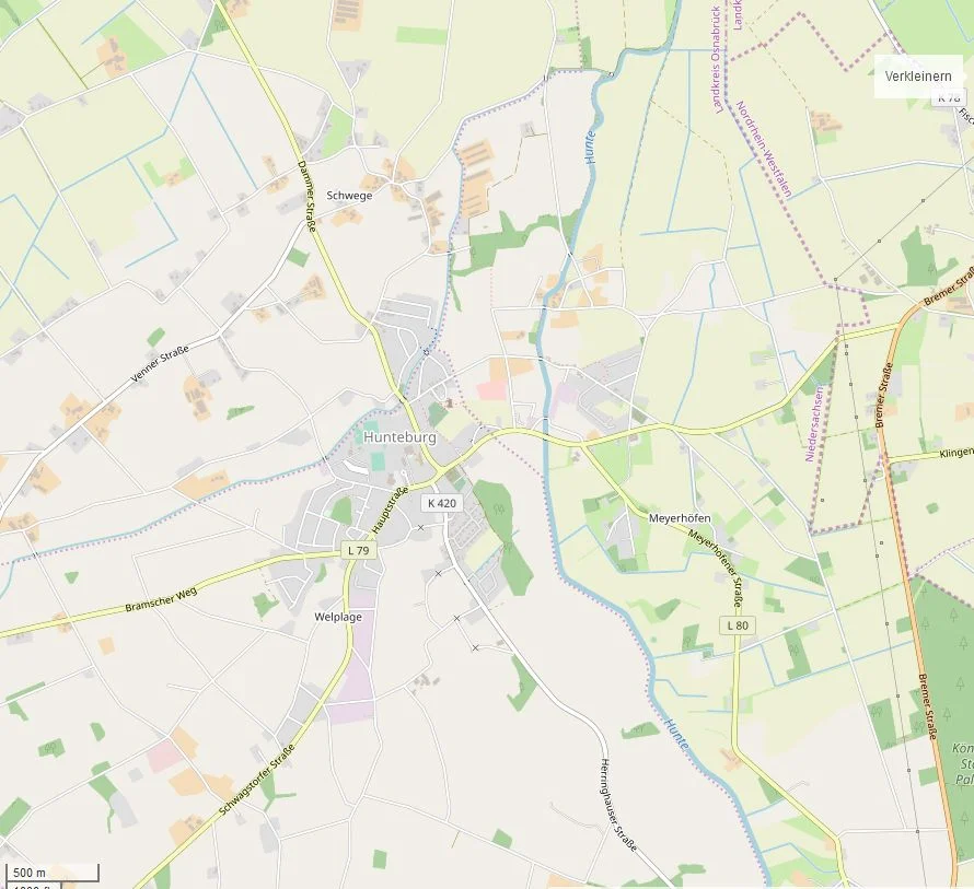
Hunteburg
There is a small stone arch bridge in Hunteburg that has been carrying foot traffic since 1424. It was built when the village around it was a small ring of houses huddled near a bishop's border-fort, when peat had not yet been cut commercially out of the bogs to the south, and when the river Hunte flowed past on its way to the Dümmer without anyone giving it a second thought. The fort is long gone. The bishop is long dead. The Holy Roman Empire that paid for both has been broken apart and replaced several times over. The bridge is still there.
A Border-Castle on the Hunte
Hunteburg appears in writing in 1324, when the knight Friedrich von Schwege is recorded as supplying suitable land for the new fortification - Hunteburg, the castle on the Hunte. The Bishop of Osnabrück at the time, Gottfried Graf von Arnsberg, needed it. Between 1250 and 1370, the bishops were ringing the edge of their territory with a chain of small Pinnenburgen, or pin castles, to mark and defend the boundary of the Bishopric. Hunteburg was one. Very little is known about its physical form: a stone keep, a wooden palisade, and a moat fed from the Hunte by a system of channels. By 1378 an administrative Amt - an office or jurisdictional district - had been established here, covering what are now the neighbouring communities of Bohmte and Ostercappeln. Around 1402, Bishop Friedrich von Horn founded a chapel served by a priest from Ostercappeln, and in 1492 Hunteburg got its own parish.
Two Faiths, One Church
The Reformation reached Hunteburg unevenly. By the time of the Thirty Years War, the village's congregation was mixed Catholic and Lutheran, and Pastor Kling Hammer was reportedly holding separate services for both denominations in the same church. In 1633, Swedish troops set fire to the building. The settlement that followed the Peace of Westphalia produced a curious arrangement: under the Capitulatio perpetua Osnabrugensis of 1650, the Bishopric of Osnabrück alternated Catholic and Lutheran prince-bishops, and ordinary people were guaranteed the free exercise of religion. The new Hunteburg church, built in 1688, became Catholic but was made available for shared use; in practice the Lutherans tended to go to services in Dielingen or Venne instead. Two centuries later, in 1815, the local Lutherans finally founded their own parish and built the St. Matthew Church. After that, Hunteburg had a parish of each denomination, a feature of so many Westphalian and Lower Saxon villages whose religious history runs along these confessional seams.
Five Countries in Twelve Years
The early nineteenth century shuffled Hunteburg through almost every state in northern Europe. In 1803 the Bishopric of Osnabrück was secularised and reorganised as a principality. In 1806 the village became part of the Kingdom of Prussia. In 1807 it shifted to the new Kingdom of Westphalia, the Napoleonic puppet state run by Jérôme Bonaparte. In 1811 the French Empire absorbed it directly. In 1815, when the Congress of Vienna redrew the map, it was attached to the newly created Kingdom of Hanover. The Office Hunteburg was merged with the Office Wittlage, then briefly separated again between 1852 and 1859, then permanently combined. In 1866 Prussia annexed Hanover - and with it Hunteburg - in the wake of the Austro-Prussian War. None of these transitions seems to have rattled the village much. The bridge from 1424 was still standing through all of it.
Peat, Power, and the Last Train
Industrial peat extraction came to Hunteburg in the early twentieth century. In 1909 a joint-stock company called Hakumag - the Hannoversche Kolonisations- und Moorverwertungs AG - built a power station in the Schwegermoor with a generating capacity of 2.6 megawatts. The plan was ambitious to the point of fancy: cooked peat would yield ammonium sulphate as a nitrogen fertiliser, and the methane released by the process would run the generators. The works opened in 1911. Two years later, the volume of dry peat the bogs could supply turned out to be insufficient and the power station was shut down. Hakumag carried on selling white and black peat. In the 1920s and 1930s, seasonal workers came from the Netherlands and Slovakia to cut it. During the Second World War, the company used forced labourers and Polish and Russian prisoners of war - men whose names mostly went unrecorded, who worked in the wet open bog, and whose fate after 1945 is difficult to trace. The railway that reached the village in 1914 carried its last passenger train in 1971 and its last freight in 2004. The municipality of Hunteburg itself was dissolved in 1972, when Schwege, Welplage, and Meyerhöfen were merged into the larger community of Bohmte. Today about four thousand people live here. The bridge is still in use.
From the Air
Hunteburg sits at 52.44 degrees N, 8.27 degrees E in southern Lower Saxony, on the River Hunte just south of the Dümmer lake and north of the Wiehengebirge ridge. From altitude it appears as a small village surrounded by agricultural land, with the broad pale sheet of the Dümmer immediately to the north and the dark wooded line of the Wiehengebirge to the south. The Hunte makes a clear thread running from the hills through the village and out into the lake. Nearest airport is Münster Osnabrück International (EDDG), about 40 km southwest. Best viewing altitude 3,000-5,000 feet; the combined landmarks of lake, hills, and river make this corner of the North German Plain easy to orient over.
Nearby Stories
- Else (Werre) 0.6 km away
- Münster Osnabrück Airport 8.7 km away
- Visbek 12 km away
- Ibbenbüren 22 km away
- Börger 24 km away
- Gardelegen Massacre 178 km away
- Ludwigslust Palace 192 km away
- Memleben Abbey 214 km away