
Externsteine
In 1934 the new German government sent a labour brigade into the Teutoburg Forest with an assignment: find the shrine. Wilhelm Teudt, an amateur prehistorian who had spent a decade calling the Externsteine the "Germanic Stonehenge," was put in charge. They dug through two seasons. When the finds were finally re-analysed in the 1990s, they proved to be stone tools of the Mesolithic Ahrensburg culture and ceramics and metal no older than the Carolingian period, with the Bronze and Iron Ages conspicuously absent - nothing whatever from the centuries in which ancient Germans were supposed to have worshipped here. The rocks had kept none of the past that was wanted from them. They have kept a great deal of other past instead.
Thirteen Pillars in a Forest of None
The Externsteine are a natural sandstone outcrop on the northeastern slope of the Teutoburger Wald, in country that is otherwise almost entirely without exposed rock. The formation runs for several hundred metres, beginning inside the woods with masses half-buried in soil and ending in thirteen tall, largely free-standing pillars, numbered I to XIII from northwest to southeast. The first five are the imposing ones. Rock I, the largest, is the Grottenfels, named for the chambers cut into it. Rock II, the Turmfels, rises 37.5 metres above the ground. Rock III is the Treppenfels - the stair rock. Rock IV carries a loose boulder on top, now fixed in place, which gave it the name Wackelsteinfelsen. The Hermannsweg, a long-distance walking trail, threads straight through. The reserve covers roughly 27 acres and has been recognised as a national geotope since 2006.
What the Rock Actually Holds
Carved into the flank of the stone is a relief of the Descent from the Cross, 4.8 metres high and 3.7 metres wide, the oldest work of its kind known north of the Alps. It was long taken for Carolingian, ninth-century; since the 1950s scholarly consensus has placed it in the twelfth, and on stylistic grounds historians now date it to about 1160-1170. Around it are chambers hollowed out of the rock, an arcosolium, and an upper altar mentioned in a document of 1385. Thermoluminescence testing puts the last large fires in the main chambers in the fourteenth or fifteenth century, and one in the Kuppelgrotte as early as the tenth. Hermits are named here in 1385 and again in 1469. The most persuasive reading of the whole ensemble is that it was built as a stand-in Holy Sepulchre for pilgrims who could never reach Jerusalem. Nobody knows who commissioned it, or why so elaborate an undertaking left no paper trail.
How the Myth Was Made
In 1564 someone told the theologian Hermann Hamelmann that the rocks had once been a pagan sanctuary, and the idea stuck. Three centuries later a local amateur historian, Gotthilf August Benjamin Schierenberg, appears to have been the first to identify that vague "pagan idol" with the Irminsul, the Saxon pillar Charlemagne is said to have destroyed. Teudt went further from the mid-1920s, arguing the site had been a central Saxon shrine and an ancient solar observatory. When the Nazis came to power they handed him the place. The tramway and hotels were pulled down, a "sacred grove" was laid out nearby, and the SS put Serbian prisoners of war to work on the scheme - men held as captives and set to labour in the manufacture of a past. No archaeological evidence supports use of the site between the end of the Upper Palaeolithic and the Carolingian period. The theory never had evidence. It had enthusiasm, and then it had a government.
The Rocks Were Named for Being Rocks
The oldest recorded forms of the name, both from 1093, are Agistersten and Eggesterenstein. Hamelmann Latinised it as rupes picarum, rock of the magpies, connecting it to the Westphalian eckster; other scholars have reached for the giant Ecke of the medieval Eckenlied, or for the river Exter. More recent linguistic work favours something duller and far likelier. Germanic ag means sharp, edged, pointy; Middle Low German egge described a long rocky ridge, the element surviving today in the nearby Eggegebirge. The stones, in other words, were probably named for the shape they are. The Latinised spelling with an x turns up first in the sixteenth century and became standard only in the late nineteenth.
Half a Million People a Year
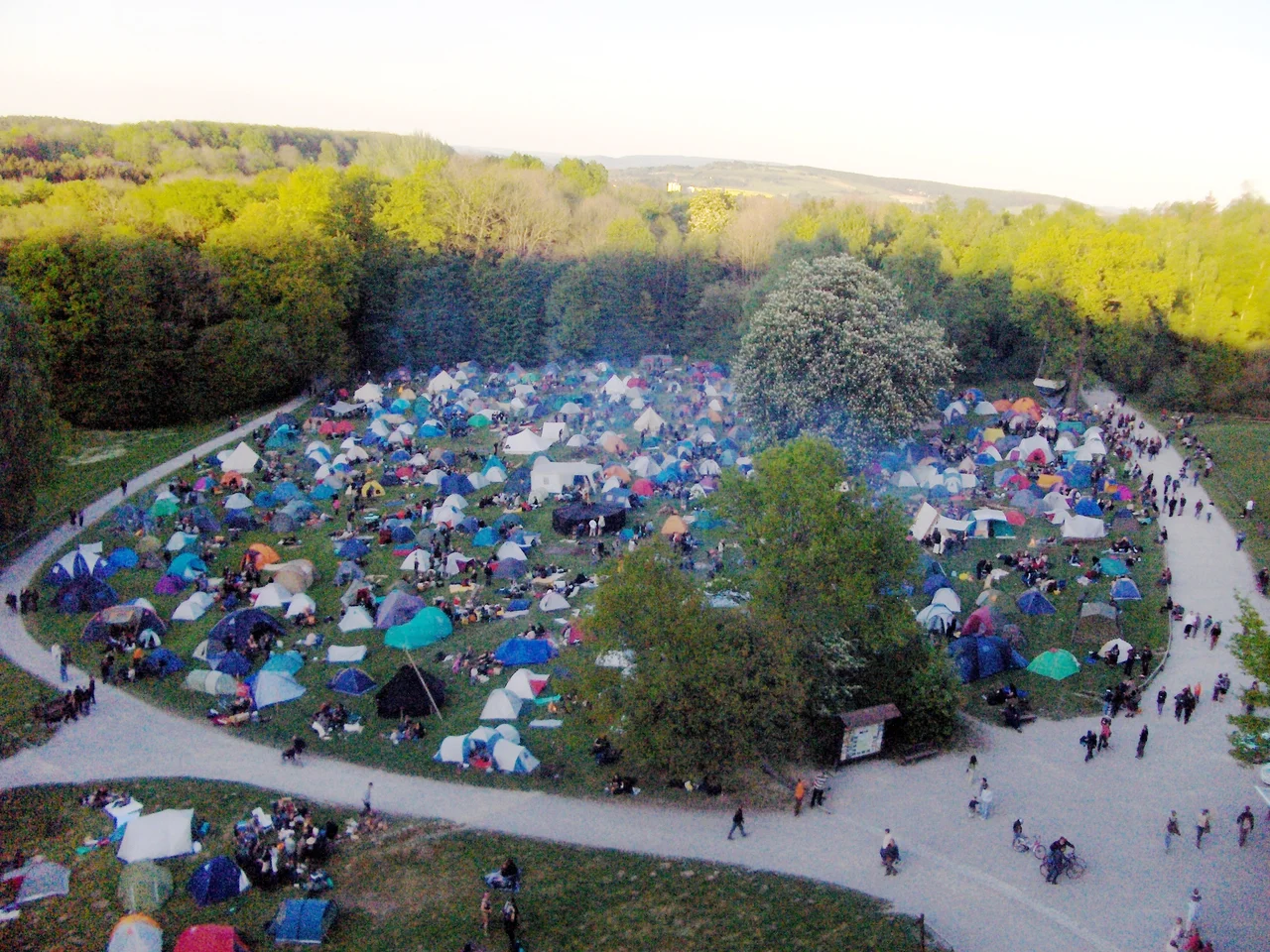
Between half a million and a million people visit annually, which makes the Externsteine one of the most frequented nature reserves in Westphalia. Gatherings at the summer solstice and on Walpurgis Night have been a fixture since the 1980s, and by the late 2000s the crowds were topping 3,500 at a time. In 2010 the Lippe authorities banned camping, alcohol and open fires and closed the car park. A spokesman was careful about it: the measure was aimed not at "esotericists, druids and dowsers" but at large-scale binge drinking. The site still draws neo-pagans and nationalists, both trading on a reputation manufactured in the nineteenth and twentieth centuries. It also draws people who simply want to climb the steps cut into the stair rock and stand at the top, looking out across a forest that has no other rock in it.
From the Air
The Externsteine stand at 51.869N, 8.918E in the Lippe district of North Rhine-Westphalia, on the northeastern flank of the Teutoburg Forest near Horn-Bad Meinberg. From the air at 1,500-3,000 ft the formation reads as a short, bright line of pale rock breaking out of continuous dark woodland, with the Wiembecke pond immediately west - the only exposed stone for miles, which makes it far easier to spot than its size suggests. The colossal Hermannsdenkmal monument on its wooded hilltop a short distance northwest is the best coarse reference for finding it. Paderborn Lippstadt (EDLP) is the nearest airport to the southwest; Hanover (EDDV) lies northeast and Münster/Osnabrück (EDDG) west. Terrain is modest forested ridge country. Morning valley fog and low cloud on the ridge are common in autumn; the rocks are most legible in low afternoon light, which throws the pillars into relief.
Nearby Stories
- Meller Möbelfabrik 6.6 km away
- RAF Gütersloh 9.3 km away
- Intercity Experimental 9.5 km away
- Sababurg 16 km away
- GEO600 22 km away
- Fagus Factory 22 km away
- Niederhagen concentration camp 22 km away
- Warsteiner 29 km away