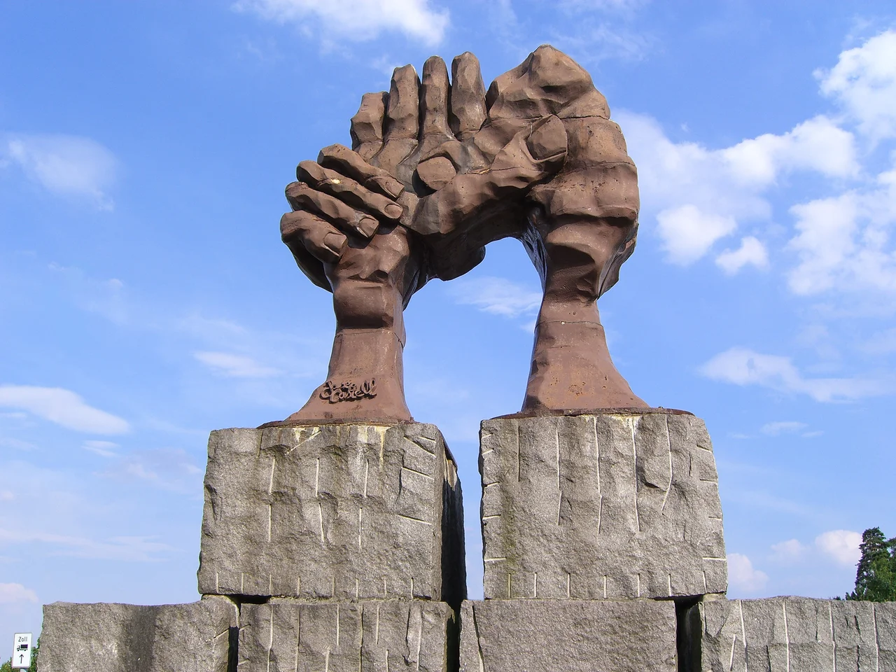

Helmstedt–Marienborn border crossing
At midnight on 30 June 1990 the barriers at Marienborn went up and were not lowered again. It was forty-five years to the day since the first checkpoint had opened on that stretch of road — 1 July 1945, a handful of wooden huts straddling the line between the British and Soviet occupation zones. What stood there at the end was a thirty-five-hectare complex on a hill, staffed by up to a thousand people, built for the sole purpose of examining everyone who used the shortest road between West Germany and West Berlin.
Alpha
The Western Allies worked through the phonetic alphabet. The autobahn crossing at Helmstedt was Checkpoint Alpha; where the transit road entered West Berlin at Dreilinden it was Bravo; the crossing into East Berlin itself was Charlie, the one everybody has heard of. Alpha was the busiest of the three by a wide margin.
The vocabulary was itself a political position. The East Germans called their side a Grenzübergangsstelle — a border-crossing place, the language of a state managing its frontier. The Allies said "checkpoint," which implied a control post on a line inside one country, because they did not recognise the German Democratic Republic as a country at all. That legal argument shifted in 1973 when the GDR was admitted to the United Nations. The word never changed.
The Shortest Road
Geography did the rest. From Helmstedt to Berlin was 167 kilometres, shorter than any alternative, so almost all transit traffic to and from West Berlin funnelled through here, along with most road travel into East Germany and Poland. The crossing cut the Bundesautobahn 2 between the Helmstedt-Ost and Ostingersleben junctions — an ordinary motorway that simply stopped being ordinary for a few hundred metres.
At first it was Royal Military Police on one side and Soviet occupation troops on the other, in temporary buildings right on the zonal line. During the Berlin Blockade, from June 1948 to May 1949, the Soviet checkpoint was closed altogether. From 1950 the East German border police, and later the GDR Border Troops, ran the eastern controls, while the Soviet Army kept the job of escorting Allied military convoys to and from Berlin. As the Cold War hardened, both sides built.
Thirty-Five Hectares on a Hill
Between 1972 and 1974 the GDR abandoned the old arrangement and put up something new: a vast control complex on a hillside field near Marienborn, deliberately sited about 1.5 kilometres east of the actual border. Placing it inland meant that anyone who reached the barriers was already deep inside East German territory, with nothing behind them.
Up to a thousand passport control officers, customs officials and border police worked the site. The buildings were linked underground by a tunnel system through which units could be moved quickly and unseen. Everything about the layout — the separated entry and exit lanes, the raised control tower, the inspection bays — was designed to slow a vehicle down, isolate it, and look at it from every angle. The West German buildings a short distance away were, by comparison, almost apologetic in scale.
Ten Million Cars
Between 1984 and 1989 alone, roughly ten million cars and five million lorries were processed here. For West Germans it meant hours: the wait was so predictable that the federal government built extensive car parks and rest areas along the approach to Helmstedt purely to absorb it. You queued, you handed over documents, you were looked at, your car was looked at, and eventually you were waved on — or you were not.
That is the ordinary experience, and it is worth holding onto, because the extraordinary ones happened here too. This was a place where families visiting relatives could be turned back without explanation, where possessions were confiscated, and where forcing a vehicle through the barriers could be fatal. Fred Woitke was killed here in 1973 driving a lorry at the barriers with two colleagues; a second attempt in 1983, with a tanker, was smashed to a stop by the same defences before it could break through. The barriers were built to make sure it usually ended that way.
A Listed Building
The controls loosened during the autumn and winter of 1989, and after that the whole apparatus became instantly, absurdly redundant. It was formally dismantled at midnight on 30 June 1990. By October the former GDR buildings had been placed under heritage protection, though the old departures area was later demolished when the autobahn was widened to six lanes, and a motel and service area now occupy part of what was once the control complex.
The rest opened on 13 August 1996 as the Gedenkstätte Deutsche Teilung Marienborn — the Memorial to the German Division — on seven and a half hectares run by the state of Saxony-Anhalt. The date was not accidental: 13 August was the anniversary of the day the Berlin Wall went up in 1961. You reach it from the motorway services and you can only see it on foot, which is exactly right. Walking through the empty lanes where you would once have queued, past control booths with nobody in them, is a very different experience from driving past at 130 kilometres an hour on the road alongside — which is what almost everybody now does, without slowing down at all.
From the Air
The memorial and former control complex lie at 52.2155°N, 11.0810°E, immediately north of the A2 autobahn near Marienborn in Saxony-Anhalt, at the edge of the Lappwald and about 3 km east of Helmstedt in Lower Saxony. From 2,000–4,000 ft the layout is startlingly clear from above: a long rectangular apron of concrete lanes and canopies set at an angle to the motorway, with the raised control tower still standing and the modern service area built into one end. Trace the A2 east from Helmstedt and you cannot miss it. The former border line itself often still reads as a narrow strip of differing vegetation running north–south across the fields, roughly 1.5 km west of the site. Braunschweig-Wolfsburg (EDVE) is about 40 km west, Magdeburg-Cochstedt (EDBC) roughly 45 km south-southeast, Hannover (EDDV) around 100 km west. Terrain is gentle and open; low winter sun brings out the old border strip better than any other light.
Nearby Stories
- Brunswick Lion 3.7 km away
- Rothensee boat lift 9.3 km away
- Ströbeck 15 km away
- Goslar 16 km away
- Eschede train disaster 30 km away
- Stones Fan Museum 46 km away
- Bauhaus Dessau 48 km away
- Holy Blood of Wilsnack 50 km away