
Hutton-le-Hole
The sheep do the mowing at Hutton-le-Hole. They wander across the village green whenever they like, cropping the grass to a careful uneven length, stepping aside for the wooden bridges that cross the beck. The stream splits the green in two, criss-crossed by footpaths, criss-crossed by sheep. A Victorian writer once described this village as ill-planned and untidy, overcrowded with the homes of weavers and labourers, manure piled everywhere and the beck used as a common sewer. Conde Nast Traveler now lists it among the twenty most beautiful villages in the UK and Ireland. Both descriptions are about the same place. The sheep have not noticed the change in reputation.
Hoton in the Domesday Book
The village appears in the Domesday Book of 1086 as Hoton. It has been spelled Hege-Hoton, Hoton under Heg, and Hewton over the centuries; the modern Hutton-le-Hole - meaning roughly the place of the burial ground near the hollow - did not settle in until the 19th century. Near the end of the 13th century the manor was granted to St Mary's Abbey in York. By the 1600s the village had become a Quaker community: weavers and small farmers who built a Meeting House in 1698 and buried their dead in a small ground beside it. The Quaker evangelist John Richardson died here in 1753 at the age of 87 and was buried at the nearby Kirkbymoorside Friends Meeting House, which still stands as a Grade II listed building. The Hutton-le-Hole Meeting House was converted into a residence in 1859, though Quaker burials continued at the site until 1868.
The Folk Museum
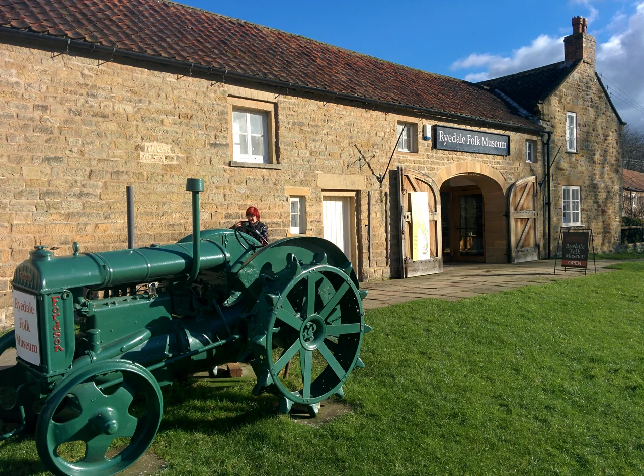
The Ryedale Folk Museum at the southern end of the village is the kind of thing Britain does well: thirteen rescued historic buildings collected and reconstructed in one field. An Iron Age round house. An Elizabethan manor. Thatched cottages. Period shops and workshops, including the photographic studio of William Hayes, believed to be the oldest daylight photographic studio in England - built in Monkgate, York, in 1902 and moved here in 1991. Until 1997 the field hosted something even stranger: the world championship in Nine Men's Morris, an ancient board game played on a grid of three concentric squares connected by lines. Champions came from across the world to push wooden counters around the boards at a folk museum in the North York Moors. The championships have moved on, but the museum continues, with crafts and workshops in season.
Twenty-Nine Grade Twos
Hutton-le-Hole carries twenty-nine Grade II-listed buildings - most of them 18th-century stone cottages with red pantiled roofs in the Yorkshire idiom. There is a 1935 K6 telephone box, the classic Giles Gilbert Scott design painted Post Office red, still in service. There is a sundial from 1833. St Chad's Church, built in 1934 on the site of an earlier Zion Chapel, holds Anglican services as part of the Lastingham Benefice. The first schoolhouse opened in 1845 and was replaced in 1875 - that building is now a holiday let, like a number of others around the village. A Grade II* listing protects a cluster of stone-and-pantile houses that look exactly as they did in the 1800s, except now the inhabitants are weekend visitors rather than Quaker weavers.
Walking to Lastingham
The walk that the National Park Authority recommends is two miles long and ends at the ancient church of St Mary in Lastingham, where a Saxon crypt has stood since 1078 above the bones of Saint Cedd. You leave Hutton-le-Hole past the Folk Museum, cross fields stitched with drystone walls, and arrive at one of the oldest continuously functioning churches in northern England. The Tabular Hills Walk passes through both places. Hutton Beck, which makes the village what it is, joins Catter Beck and then the River Seven a few miles south, and from there flows into the River Rye. The car park at the north end of the village - large, pay-and-display - fills up early in summer. The sheep ignore the cars completely, as is their right under several centuries of common grazing.
From the Air
Located at 54.30 N, 0.92 W on the southern edge of the North York Moors National Park, 4 km north of Kirkbymoorside and the A170 road. The village sits in a small valley with Hutton Beck running south through the centre. Pickering lies 11 km southeast. Nearest civil airport is Teesside International (EGNV), 50 km northwest. Best viewed at 1,500 to 2,500 feet AGL; the village green divided by the beck, the Ryedale Folk Museum at the south end, and the surrounding pattern of drystone walls climbing onto the moor are the recognisable features.
Nearby Stories
- 1892 Thirsk Rail Crash 4.3 km away
- Filey Brigg 5.6 km away
- Yorkshire Air Museum 7.2 km away
- Staithes 8.9 km away
- Darlington 10 km away
- Harewood House 11 km away
- Burton Constable Hall 20 km away
- Breagh Gas Field 56 km away