Inca-Caranqui
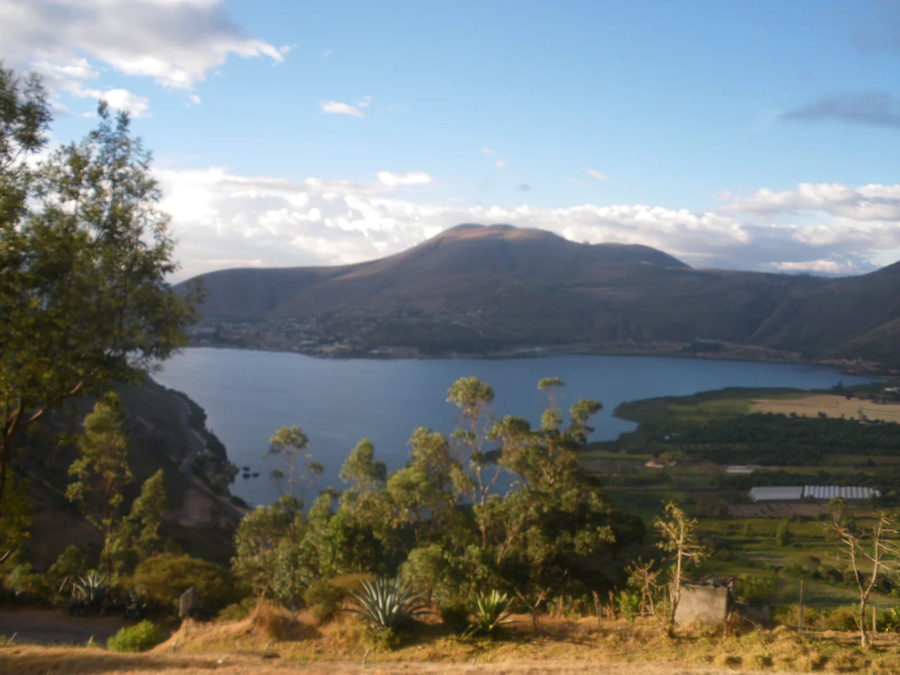
The lake was named for what happened there. Yaguarcocha means Blood Lake in Kichwa, and the men who gave it that name were not speaking metaphorically. Around 1500 CE, after more than a decade of war, the Inca emperor Huayna Capac finally defeated the Caranqui chiefdoms of northern Ecuador. In retribution for their resistance, he ordered the massacre of the male population on the lake's shores. The Spanish chronicler Miguel Cabello de Balboa, writing decades later, said the water ran red. Today Yaguarcocha sits on the southern edge of the city of Ibarra, ringed by a motor-racing circuit and a small airport. In the village of Caranqui a few kilometers away, a vacant lot holds the stone pool where the Incas performed their rituals after the killing was done.
The Country of the Mounds
Before the Incas arrived, the Ecuadorian sierra between the Guayllabamba and Mira rivers held between 100,000 and 150,000 people organized into small chiefdoms. Caranqui, Cayambe, Otavalo, Cochasqui. The names survive in modern towns scattered around the inter-montane basin of the Imbabura Volcano, a landscape that stretches 160 kilometers north of Quito toward the Colombian border. The defining feature of this region is the tolas: flat-topped earthen mounds, sometimes two hundred meters on a side and fifteen meters high, built between 1200 and 1500 CE. Hundreds of them still rise above the maize fields at altitudes between 2,200 and 3,000 meters. Archaeologists have found elite residences, ceremonial platforms, and burials inside them. The Caranqui people spoke Barbacoan, a language no one remembers anymore. They lost it sometime in the seventeenth or eighteenth century and now speak Kichwa, the Ecuadorian dialect of Quechua their conquerors brought north.
Huayna Capac's Campaign
The Incas came from the austere high Andes of southern Peru. When they descended into Ecuador, they found lush, lower country, and they wanted it. Topa Inca Yupanqui began the northern conquest sometime after 1471 and hit a wall of local resistance. His son Huayna Capac, ruling from roughly 1493 to 1525, finished what his father started. He set up command at Tumebamba, near modern Cuenca, and built a ring of hilltop fortresses called pukaras at Pambamarca to crush the Cayambes. Then he encircled Caranqui with more pukaras and ground his way forward. The campaign may have taken more than a decade. Spanish chroniclers say the future emperor Atahualpa fought in the final battle, which places the decisive Inca victory somewhere between the 1490s and 1520. Other chroniclers claim Atahualpa was actually born in Caranqui around 1500 CE. A statue and a museum in the village carry his name regardless of which account is right.
The Garrison Town
After the conquest, Caranqui became a major Inca garrison. In 1544, the Spanish chronicler Pedro Cieza de Leon visited the ruins and described what had stood there: a Temple of the Sun, a central plaza with a large water pool, barracks for Inca troops, and an acllawasi housing 200 aclla, the sequestered women of the Incas. Scholars still argue about who built it all. Huayna Capac may have started the complex in the first years of the sixteenth century. His son Atahualpa may have expanded it in the 1520s. One theory holds that Atahualpa used Caranqui for his royal investiture and wedding around 1525, after the death of his father. Within a decade, the Spanish would arrive and the whole Inca world would tip into collapse. Caranqui had been the northernmost place the Incas ever fully incorporated into their empire. It was also, by accident of timing, among the last places they finished building.
The Pool That Survived
Most of the old Inca center is gone, buried under the urban sprawl of Ibarra. Two stone walls with doors and niches still stand near the center of the village. The remarkable find came in 2008. The town of Caranqui purchased a vacant lot, and archaeologists began digging. They uncovered a semi-subterranean pool of finely cut stone, ten meters by sixteen, its walls rising about a meter. Canals and water spouts and drains let the pool be filled and emptied. Pools like this appear at other Inca sites associated with Huayna Capac, notably Quispiguanca in the Sacred Valley of Peru. But the Caranqui pool is unusually large, suggesting it was used ritually by many people at once, perhaps for the kind of royal investiture that might have happened here. An Inca great hall, a kallanka, and another central plaza are thought to have stood just to the west. Excavation continues, slowly, on land the town bought itself.
Karanki Now
In the twenty-first century, the name is more commonly spelled Karanki. The people who descend from the empire's northern frontier now speak Kichwa and Spanish, farm the same high valleys their ancestors shaped, and live alongside the mounds their great-great-grandparents built. Ibarra spreads out in the valley below, a white city of colonial churches and markets. Yaguarcocha is a weekend destination now, not a battleground. Tourists walk the old race track around its shore. A few hundred meters from the Inca pool sits the Museum of Atahualpa, honoring an emperor who may have been born here, or who may have massacred here, or who may have done both. History in this valley is thick and not entirely settled. Huayna Capac's descendants lost this land to Spain within thirty years of finishing their conquest. The Caranqui lost it before them, and then they lost it again.
From the Air
Located at 0.32 degrees North, 78.12 degrees West, in the Imbabura province of northern Ecuador. The archaeological site sits at roughly 2,300 meters elevation on the southern outskirts of Ibarra, with Yaguarcocha lake 3 km north. Imbabura Volcano (4,621 m) dominates the northern horizon. The Pan-American Highway passes just east. Nearest airports: Mariscal Sucre International (SEQM) in Quito, about 100 km south; the small Atahualpa airfield (SEIB) at Ibarra. Recommended viewing altitude: FL120 to FL180 for the full inter-montane basin with its tolas scattered across the maize fields; descend toward 3,000 meters for Yaguarcocha and the archaeological zone. Clear visibility is best in the June-to-September dry season.
Nearby Stories
- Mindo 6.7 km away
- Hacienda Guachala 7.3 km away
- San Miguel (Ecuador) 31 km away
- Sanctuary of Las Lajas 33 km away
- Sumaco Napo-Galeras National Park 46 km away
- Northwestern Andean Montane Forests 46 km away
- Quinindé Canton 82 km away
- Ecuadorian Amazon 148 km away