
Kirkcudbrightshire
Every other Scottish county was run by a sheriff. Not this one. In 1369, when Archibald the Grim - Earl of Douglas and one of the most ruthless men in fourteenth-century Scotland - was given the part of Galloway east of the River Cree, he installed a steward instead of a sheriff to administer it. The arrangement stuck for six hundred years. The locals took to calling Kirkcudbrightshire 'the Stewartry' and Wigtownshire next door 'the Shire,' and well into the twentieth century that was simply how you said where you were from. The county was abolished as an administrative unit in 1975. The name survives in land registration, in lieutenancy, and in the way Gallovidians still talk.
Novantae and Romans
The first people of this corner of southwest Scotland were the Novantae, a Celtic tribe west of the River Nith who long held onto their independence. After Agricola's invasion in 79 AD, the area was nominally part of Roman Britannia, but the evidence for any sustained Roman presence is thin - a single marching camp at Shawhead, in Kirkpatrick Irongray, is about all that remains. When the Romans left, the Novantae vanished from the record. By the sixth century the area was part of the Brythonic kingdom of Strathclyde; by the ninth century it had been absorbed by the kingdom of Northumbria. A silver hoard buried near Talnotrie around 875-900 was either a Northumbrian metalworker's stash or a Viking raider's - the historians have been arguing for over a century.
The Lordship of Galloway
Through the eleventh, twelfth and thirteenth centuries, Galloway was a sub-kingdom: the local chiefs became lieges of the Scottish king after Malcolm Canmore killed Macbeth in 1057, but they kept a real measure of autonomy. The Lordship of Galloway was its own thing. Only with the death of Alan of Galloway in 1234 did the area come fully under the Scottish crown. In 1308 Edward Bruce - brother of Robert - cleared the district of the English. Then in 1369 Archibald the Grim got the eastern half, and the Stewartry was born. Shortly after 1369 he built Threave Castle on an island in the River Dee, the most important fortress in Galloway. In 1455, when the power of the Black Douglases finally broke, Threave was besieged by James II's forces and converted into a royal keep.
Smugglers and Free Traders
After the Acts of Union in 1707, commercial prosperity returned slowly - but the cleanest economic indicator was the explosion of smuggling. The Galloway coast, with its endless inlets, its tidal flats, and its remoteness from any organised customs presence, was perfect 'free trading' country. Tea, brandy, tobacco, lace - the contraband came in by night, was inland by dawn, and on its way to Glasgow or Edinburgh by the end of the week. The Jacobite risings of 1715 and 1745 stirred almost no sympathy here; the locals had a more lucrative loyalty to the smuggling trade. In the 1760s, Major William Caulfeild pushed a military road through from Bridge of Sark near Gretna to Portpatrick, finally giving the crown a way to move troops at speed.
Hills, Burns and Granite
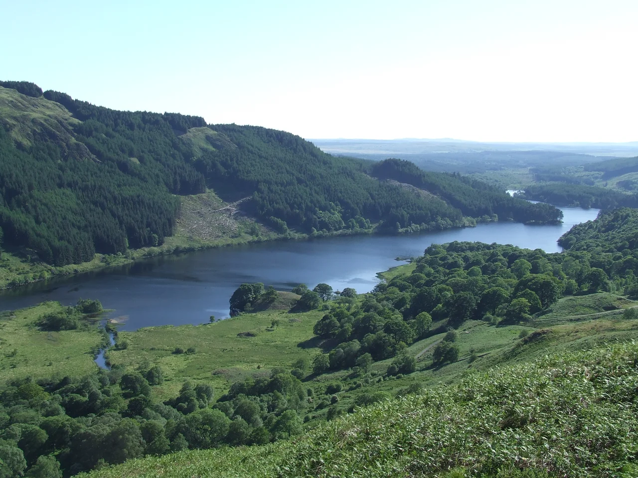
Kirkcudbrightshire is bounded by the Solway Firth to the south, Ayrshire to the north, Wigtownshire west and Dumfriesshire east. Its highest point is Merrick at 843 metres. Three principal rivers drain the county - the Cree, rising in Loch Moan and reaching the sea near Creetown after about 30 miles; the Dee or Black Water of Dee, dark with peat, rising in Loch Dee and entering the sea below Kirkcudbright after nearly 36 miles; and the Urr, rising in Loch Urr and falling into the sea south of Dalbeattie after 27. The bones of the landscape are granite plutons intruded into older Silurian and Ordovician shales - the Criffel pluton around Dalbeattie, another between the Cairnsmore of Fleet and Loch Ken. Granite from Kirkmabreck quarries built docks in Liverpool and beyond from 1830 onward.
The People Who Came From Here
For such a thinly populated county, the Stewartry has produced an unlikely number of consequential people. James Clerk Maxwell - the nineteenth-century physicist whose equations describe electromagnetism and whose work made the modern world possible - was born in Edinburgh but raised at Glenlair in Kirkcudbrightshire. John Paul Jones, Scots-born commander of the early United States Navy, came from Kirkbean. David Coulthard, the Formula One driver, is from Twynholm. Devorguilla of Galloway - mother of John Balliol, king of Scotland, and founder with her husband of Balliol College, Oxford - was a Galwegian noblewoman of the thirteenth century. John Welsh of Irongray was a leader of the Covenanters. Edinburgh architect James Newlands, born in 1813 and later Liverpool's first Borough Engineer, designed and built the world's first integrated sewerage system there in 1848 - and his earliest surviving design is the Johnston School in Kirkcudbright town.
From the Air
Kirkcudbrightshire stretches across the southwestern corner of Scotland, centred roughly on 54.84°N, 4.05°W. Its coastline along the Solway Firth runs about 50 miles between the rivers Nith and Cree; its highest point, Merrick (843m), rises in the northwest. Best appreciated from 5,000-10,000 feet, where the dark uplands of the Galloway Forest, the granite Cairnsmores, and the broad tidal flats of the Solway all read clearly. Carlisle Lake District (EGNC) sits 35nm east of the central county; Prestwick (EGPK) 45nm north; the Isle of Man (EGNS) 40nm south. The Dundrennan Range south-east of Kirkcudbright is active military airspace - check NOTAMs.
Nearby Stories
- Port William, Dumfries and Galloway 1 km away
- Alauna (Maryport) 4.1 km away
- Calder Abbey 6.3 km away
- Kenmure Castle 7.8 km away
- Lochmaben Castle 12 km away
- Bishopscourt, Isle of Man 21 km away
- Point of Ayre Lighthouse 23 km away
- Ballantrae Lifeboat Station 29 km away