.jpg)
Kromlau Azalea and Rhododendron Park
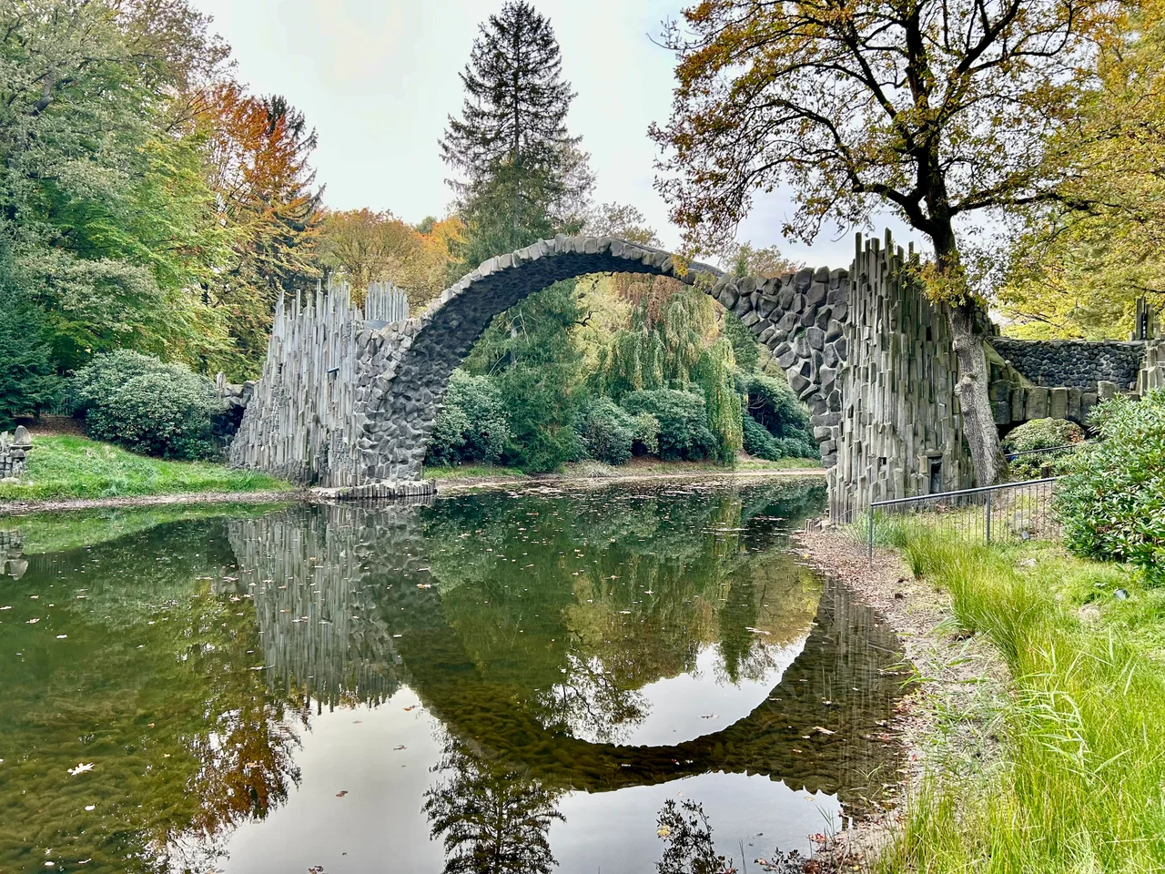
The bridge is only half of what you came to see. The other half is underneath it, in the water. The Rakotzbrücke arches over the small Rakotzsee in far eastern Saxony at an angle calculated so that on a still, clear day the reflection completes the curve into an unbroken stone circle, and it does this from wherever you stand on the shore. That was the brief. When Friedrich Herrmann Rötschke commissioned the bridge in 1860, he was not solving a crossing problem; there is barely anything on the far side worth crossing to. He was building a piece of geometry that only exists when the pond is calm. Germans call it the Teufelsbrücke, the Devil's Bridge, on the reasonable assumption that no ordinary mason would attempt it.
The Man Who Planted a Landscape
Friedrich Herrmann Rötschke, who lived from 1805 to 1893 and is described in the records as the knight of the local town, laid out roughly eighty hectares of parkland in the nineteenth century, reportedly over the grounds of a former feudal estate. What he made was a landscaped park rather than a formal garden: winding water, planted islands, sightlines that reveal things gradually. The azaleas and rhododendrons that give the park its name came later to dominate it, and they set the calendar. Late spring turns the understorey into banks of pink, magenta and white beneath old pines and oaks. The park holds more than the famous arch, too, including the Kavalierhaus, a smaller bridge in an Asian idiom crossing to the island pond, and a Hercules figure standing among the shrubs.
Basalt That Was Shipped In
Nothing about the Rakotzbrücke's material is local accident. The columns are artificially formed basalt, selected and brought in from distant quarries, then set to imitate the natural hexagonal jointing that basalt develops when a lava flow cools slowly. Thin rock spires rise from the water at either end of the span, arranged so they read as an outcrop the bridge happens to have been built onto rather than as ornament shipped in by cart. The stonework mixes that imported basalt with rougher local fieldstone. Seen from a few metres away in flat light, the whole assembly looks like something the ground did on its own. That was the intention, and it is the reason photographs of the bridge circulate so widely without any explanation attached: nothing in the picture announces that it was designed.
Why You Cannot Walk Across It
You will not be crossing. The bridge was renovated in 2018 and 2019, and crossing has remained forbidden throughout, both for the safety of visitors and for the survival of the structure itself. A thin nineteenth-century arch of stacked basalt columns was never meant to carry a queue of people, and the surface that reads so beautifully from the bank is uneven and steep underfoot. The restriction is not a hardship. The circle only works from the shore anyway; standing on the bridge is the one position from which you cannot see the thing the bridge was built to do. After the Second World War the park was nationalized, and it has stayed free to enter ever since, with only a small charge for parking.
A Sorbian Address
The park sits in the village of Kromlau, in the municipality of Gablenz, in Upper Lusatia at the far eastern edge of Saxony close to the Polish border. Those are the German names. In Upper Sorbian, the language of the Slavic minority indigenous to this region, the village is Kromola and the municipality is Jabłońc, and the park is the Acalejowy a Rododendronowy Park Kromola. Gablenz lies inside the officially recognized Sorbian settlement area, where road signs carry both names by law. The municipal coat of arms puts the point plainly: it shows the Rakotz Bridge alongside apples, jabłučina or jabłoń in Sorbian, a pun on the village name that only works in the older language.
Waiting for the Water
The circle is conditional. It needs windless air, a pond unruffled by rain or ducks, and light coming from an angle that does not scatter off the surface. Photographers arrive early for exactly this reason, and plenty of visitors see only a handsome stone arch over dark water and wonder what the fuss is about. Come back an hour later and the pond has gone glassy and the illusion snaps shut, the reflected half of the arch fitting the real one so exactly that the join disappears. It is a trick of engineering, patience and weather working together, staged in a quiet park in a corner of Germany that most maps treat as an afterthought.
From the Air
Kromlau lies at 51.54 N, 14.64 E, in Landkreis Görlitz at the eastern edge of Saxony, about 4 nm from the Polish border on the Neisse. The park sits in flat, heavily forested lowland: at 2,000 to 4,000 feet the landmarks are the wooded plain of the Muskau Heath, the arc of the Muskau Fold with its old mining ponds, and the Bad Muskau landscape park on the Neisse about 3 nm east. The Rakotzsee itself is tiny and will not be picked out from the air; navigate to the village of Gablenz. The large Boxberg power station and the Bärwalder See lie roughly 8 nm southwest and are visible for a long way. Nearest airports are Rothenburg/Görlitz (EDBR) about 16 nm southeast and Cottbus-Drewitz (EDCD) about 21 nm north; Zielona Góra (EPZG) in Poland lies about 40 nm northeast.
Nearby Stories
- 2001 American Memorial 12 km away
- Stalag Luft III 13 km away
- Spreewald 14 km away
- Villa Wolf 14 km away
- Bautzen II 20 km away
- Moritzburg Castle 32 km away
- Czocha Castle 36 km away
- Gorzów Wielkopolski 98 km away