
Lusatia
Ask for the capital of Lusatia and you will get four answers, all of them defensible. Bautzen, if you mean Upper Lusatia, which has looked to it for centuries. Luckau or Lübben, if you mean Lower Lusatia, whose administrators sat there. Cottbus, if you mean the biggest city, though Cottbus was a Brandenburg exclave from 1445 and therefore not properly Lusatian at all. Or Żary, which has been advanced as the capital of Polish Lusatia since 1945, when a chunk of the region ended up on the far side of a new international border. The reason there is no single answer is simple: Lusatia has never once been a single administrative unit. It is a place that exists because the people in it say so, which is exactly the kind of place that tends to outlast the states that keep carving it up.
Swamp, in the Original
The name is Slavic and unglamorous. Łužicy means swamps, or water-hole; Germanised it becomes Lausitz, Latinised, Lusatia. The region runs from the Bóbr and Kwisa rivers in the east to the Pulsnitz and the Black Elster in the west, drained by the Spree and the Lusatian Neisse, and closed off in the south by the Lusatian Mountains along the Czech border. It splits neatly in two. Upper Lusatia is the hilly southern half, with fertile soil, old towns and the timber-framed Umgebindehäuser that combine Franconian carpentry with Slavic log building. Lower Lusatia is flat, sandy, wooded and boggy, part of the North European Plain. Between them lies the Grenzwall, a morainic ridge that once carried forest thick enough to be a genuine military obstacle, and the boundary between the two Lusatias still runs roughly along the Black Elster at Senftenberg.
Ten Owners in Nine Hundred Years
Slavs began moving into this country in the seventh century, among them the Milceni, whose descendants are still here. After that, ownership becomes a list. Meissen took it, Poland held it from 1002 to 1031, Meissen again, then Bohemia from 1075. In 1319 it was split between Bohemia and the Piast duchy of Jawor, and from 1368 the Bohemian Crown had all of it. In 1346 six Upper Lusatian towns formed the Lusatian League to deal with robber barons, and found themselves dragged into the Hussite Wars. Matthias Corvinus of Hungary took the region in 1469; it returned to Bohemia in 1490 and passed to the Habsburgs in 1526. The Peace of Prague handed most of it to Saxony in 1635. Then the Congress of Vienna, punishing Saxony for backing Napoleon, cut it in half in 1815 - and Prussia, refusing a Lusatian province, filed the pieces under Brandenburg and Silesia.
The Language on the Second Line
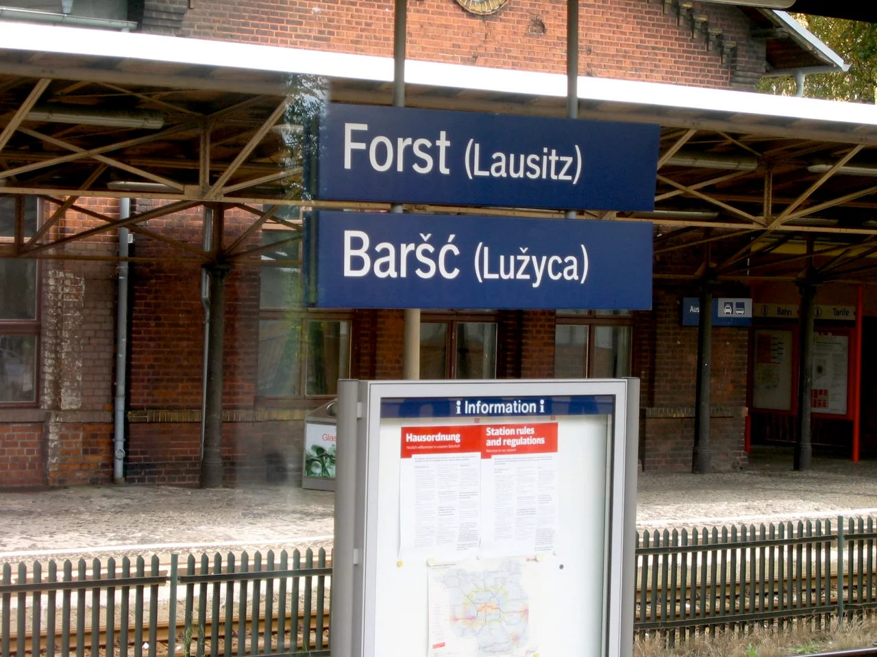
More than 80,000 Sorbs live in Lusatia, one of Germany's four recognised indigenous minorities, and the road signs carry their names below the German ones. The 1900 census counted 93,032 across the region: 55.8 per cent of the district of Cottbus, 37.8 per cent of Hoyerswerda, 17.7 per cent of Bautzen. The nineteenth century had been good to them - a literary revival, the founding of Maćica Serbska and later the Domowina - but the twentieth was not. Between the wars the German government systematically renamed places to erase their Slavic origins. Under the Nazis every Sorbian organisation was banned, the newspapers closed, the language forbidden, and activists arrested, exiled or sent to the camps. In 1945 a Lusatian National Committee in Prague petitioned the Allied powers roughly ten times for a free Lusatian state, or union with Czechoslovakia or Poland. Nothing came of it. The Domowina had not asked to leave Germany.
Brown Gold
What shaped Lower Lusatia more than any dynasty was the lignite beneath it. Open-cast mining ran through the second half of the nineteenth century and the whole of the twentieth, and it worked at a scale that treats villages as overburden: dozens of settlements were simply removed, some of them Sorbian, to reach the coal or to clear ground for plants like Schwarze Pumpe. Whole churches were dismantled and carted off. The pits are exhausted now, and the holes they left run well below the natural water table, so they are being filled - deliberately, from surface rivers, into a linked chain that has become the largest artificial lake district in Europe. It is an unusual sort of restitution: the landscape is not being put back, because it cannot be. Something else is being put there instead.
Where the Line Fell
The war ended here in the spring of 1945, and it ended badly. At Horka on 26 April German troops attacked a marked field-hospital column of the 9th Polish Armoured Division and killed some 300 men, most of them wounded soldiers and the medical staff caring for them. Then Potsdam drew the Oder-Neisse line, and the eastern slice of Lusatia became Polish; the Germans and Sorbs living there were expelled during 1945 and 1946. What is left is a region in four administrative pieces - Saxony, Brandenburg, and the Polish voivodeships of Lower Silesia and Lubusz - and two pairs of towns cut down the middle by a river, Görlitz with Zgorzelec and Guben with Gubin. Muskau Park, itself split by the border and maintained by both countries, is a World Heritage Site; Herrnhut joined the list in 2024. The Spreewald and the Upper Lusatian heath and pond landscape are biosphere reserves.
From the Air
Lusatia has no legal boundary, but its heart is around 51.55 N, 14.73 E, at Bad Muskau on the Lusatian Neisse, and the region runs roughly 150 km north-south from the Spreewald to the Czech border and about 100 km east-west. Terrain divides sharply: the northern half is flat, 60 to 150 metres, all pine plantation, drainage ditches and mining scars; the southern half rises steadily through 200 to 400 metres to the Lusatian Mountains, with the isolated basalt cones near Görlitz and Bautzen standing out of the farmland. Best surveyed between 3,000 and 6,000 feet AGL. The clearest navigational features are the Lusatian Neisse running north along the Polish border, the Spree threading north-west toward the Spreewald, the raw geometric lakes of the Lausitzer Seenland in the middle, and the cooling plumes of the remaining lignite power stations, visible for tens of miles. Dresden (EDDC) lies about 44 nm south-west of Bad Muskau and Berlin Brandenburg (EDDB) about 67 nm north-west; Görlitz (EDBX) and the gliding field at Klix (EDCI) serve the Upper Lusatian side. Note that the Neisse is an international border along its whole length here.
Nearby Stories
- 2001 American Memorial 12 km away
- Stalag Luft III 13 km away
- Spreewald 14 km away
- Villa Wolf 14 km away
- Bautzen II 20 km away
- Moritzburg Castle 32 km away
- Czocha Castle 36 km away
- Gorzów Wielkopolski 98 km away