
Methana
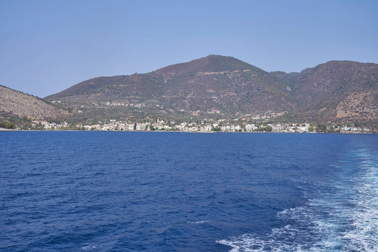
The Athenian general Nicias knew exactly what he was doing when he built a wall across the Methana isthmus in 425 BCE. By sealing off the peninsula from the mainland with a single structure, he turned it into an island-fortress — a Peloponnesian thorn lodged in the side of Sparta's allies. The wall is gone, but Methana is still what it always was: a place apart. The volcanic peninsula juts into the Saronic Gulf like a clenched fist, its dark dacite and andesite hills rising steeply from the water, its thermal springs steaming from the ground, its deep history compressed into a landscape that still smells faintly of sulphur on a warm afternoon.
Where the Peloponnese Breathes Fire
Methana is entirely volcanic in origin — a fact that shapes every aspect of the landscape. The peninsula's hills are not eroded limestone like much of the surrounding Peloponnese; they are solidified lava domes and cinder cones, dark and craggy, with thin soils and rocky outcrops. The highest point, Helona Mountain, reaches 740 metres. Over 30 volcanic eruption centres are distributed across the peninsula's 50 square kilometres. The major tectonic fault cuts the town of Methana from west to east, and the area remains prone to earthquakes. Thermal springs and mofettes — volcanic gas exhalations — seep from the ground near the water's edge. The last confirmed land eruption was the dome near Kameni Chora, which ancient writers placed in the third century BCE. A submarine eruption north of Kameni Chora was recorded in 1700. Geologists who have mapped the peninsula systematically since 1991 consider it capable of future volcanic activity.
Older Than Its Name
The name Methana appears in an Egyptian document most scholars did not expect: the Aegean List from the Mortuary Temple of Amenhotep III, dating to the fourteenth century BCE, includes what appears to be an early record of the settlement. The earliest known physical settlement on the peninsula, near the village of Vathy, dates to between 1500 and 1300 BCE — the height of Mycenaean civilisation. Artefacts from that period, excavated by archaeologist Helene Konstolakis-Jiannopoulou in 1990, are now in the museums of Poros and Piraeus. In Geometric times, around 800–700 BCE, sanctuaries were built near Kounoupitsa village. Two ancient acropoleis — Palaiokastro near Vathy, and Akropolis Oga near Kypseli — guard the peninsula's terrain. Methana appears in Thucydides, in Ovid, Strabo, and Pausanias. The fact that so many canonical ancient writers mention it suggests the place was never an obscure backwater; it was a recognised node in the Greek world, even before its Ptolemaic chapter began.
Arsinoe and the Ptolemies
In the Hellenistic period, Methana entered a new phase. After Athens lost the Lamian War against Macedon in 322 BCE, Ptolemaic Egypt extended its influence across the Aegean, and Methana became one of its strategic bases. The Ptolemies renamed it Arsinoe — after one of the Ptolemaic queens — and built a fort on the islet of Nisaki guarding the main harbour. When Pausanias visited in the second century CE, the town's agora still bore the traces of this cosmopolitan past: a temple of Isis (the Egyptian goddess), statues of Hermes and Heracles. The Phoenicians, too, had established a base here — the article notes it under the name Arsinoe. In Athenian general Nicias's time, the peninsula had been an Athenian military asset; later it was Ptolemaic; later still, medieval. Arvanites settled here in the fourteenth century during a period of demographic dilution, and their presence shaped the communities that survive today.
The Sulphur Baths
Methana's thermal springs have drawn visitors for centuries, and the town remains a modest spa destination. The hot springs — geologically linked to the same volcanic system that built the peninsula — emerge along the shoreline and in the town itself, sulphur-scented and mineral-rich. Pausanias noted them after describing the Kameni Chora eruption: the landscape rearranged itself, and water followed the new heat. The modern town (population 892 in the 2011 census, 1,352 in the 2021 census for the municipal unit) is built at the water's edge, with the ferry connecting it to Poros and ultimately to Piraeus. Half the entire peninsula's population lives in Methana town. The surrounding countryside is mountainous and bushy, with pastures around the town and a mountain ridge in the west about three kilometres long. From the upper slopes of Helona, the full Saronic panorama opens: Aegina, Salamis, the mountains of Attica, and the pine-green hills of Poros across the narrow channel.
From the Air
Methana sits at approximately 37.58°N, 23.39°E on the volcanic peninsula extending into the Saronic Gulf, about 50 km southwest of Athens. The peninsula is easy to identify from altitude by its darker volcanic rock contrasted with the limestone of the surrounding Peloponnese. The narrow isthmus connecting it to the mainland is barely a kilometre wide at its narrowest point — exactly where Nicias built his wall in 425 BCE. The closest major airport is LGAV (Athens International Eleftherios Venizelos), approximately 65 km to the northeast. Poros is visible to the east across a narrow strait. At moderate altitude on a clear day, the full Saronic Gulf is visible, with Aegina to the north and the mountains of the Argolid behind.
Nearby Stories
- Agios Vasileios, Corinthia 4.4 km away
- Nafplio 6.1 km away
- Agios Georgios (island) 6.3 km away
- Tsakonia 8.6 km away
- Saronic Gulf Islands 11 km away
- Brauron 17 km away
- Spetses 21 km away
- SS Heraklion 49 km away