Moalboal
The sardines move as a single organism. Tens of thousands of them, compressed into a shimmering, undulating column just off the coast of Panagsama Beach, rotating in a slow vortex that divers call a sardine tornado. This spectacle, visible year-round in the waters off Moalboal, has turned a quiet fishing peninsula on Cebu's southwestern coast into one of the Philippines' most celebrated dive destinations. But Moalboal was remarkable long before the first wetsuit arrived. Its name may derive from the Cebuano word for a bubbling spring, bukal-bukal, and its founding legend involves a fugitive from Bohol who could make objects levitate.
The Legend of Laguno
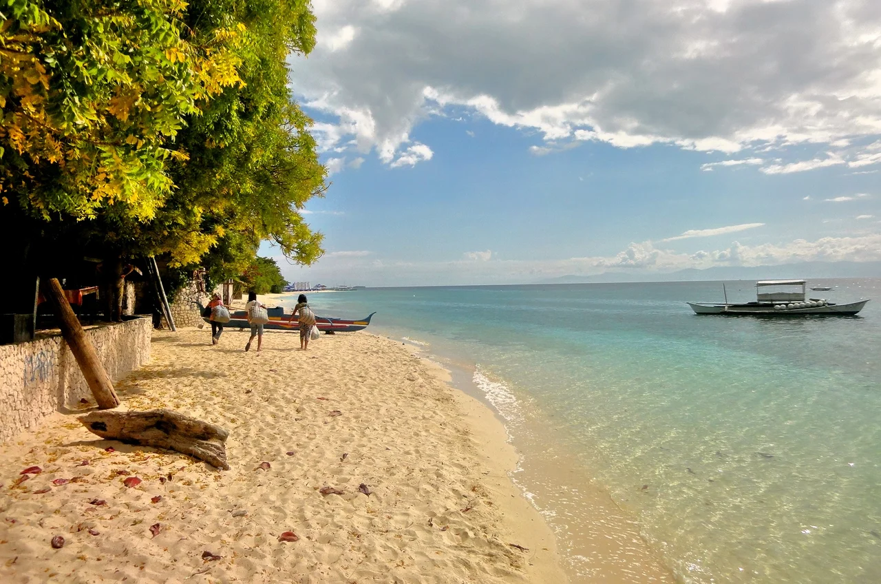
Before the Spanish arrived, before parishes and municipalities existed, local tradition holds that a man named Laurente Sabanal came to this peninsula from the island of Bohol. Known as Laguno or Llaguno, he had killed a guardia civil who had abused him and fled across the water to found a new settlement. The people who followed him believed he possessed supernatural abilities, including the power to make objects float in the air. When Moro raiders attacked from the south in their vintas, Laguno reportedly used these abilities to terrify them into retreating. When he died, his body was buried on the sandy shore where he had made his stand. A log was placed on his grave as a marker of respect. Today, the street along that shore still carries his name.
Burned to Bare Walls
Moalboal's history is punctuated by erasure. The parish of San Juan Nepomuceno was officially established on February 6, 1852, after decrees from both the Spanish governor and the local bishop gave their combined approval, a requirement under the unified church and state of colonial rule. The town became an independent municipality in 1917 under the Americans. Then came the Japanese occupation, and with it, the Battle of Tomonoy on August 13, 1944, when Filipino guerrillas ambushed Japanese forces in the hills above town. The Japanese retaliated by burning Moalboal to the ground. No ancestral houses survive. The only 18th-century structure still standing is the San Juan Nepomuceno Parish Church, and even that retains only its belfry tower and exterior walls from the original construction. Everything else was rebuilt from ash.
The Cathedral Below
Three kilometers off the coast lies Pescador Island, a rocky outcrop that conceals one of the most famous dive sites in the Philippines. Beneath its surface, an underwater cave known as the Cathedral opens into a cavernous space where shafts of light pierce the blue. The reefs along the west coast of the Copton peninsula drop off steeply, plunging more than 40 meters in places, their walls decorated with black coral, sea fans, and sponges. Green sea turtles graze on the shallows. Whale sharks pass through seasonally. Thresher sharks patrol the deeper water. In 2024, Conde Nast Traveler named Panagsama Beach one of the best beaches in Southeast Asia, the only Philippine beach on the list. Further north on the peninsula, White Beach stretches two kilometers along Saavedra, a quieter expanse that once drew only locals but now attracts visitors from around the world.
Peninsula Life
Moalboal occupies a peninsula on Cebu's southwestern shoulder, bordered by the Tanon Strait to the west, with Negros Island visible on clear days across the water. The municipality is divided between its coastal barangays, where fishing has been the primary livelihood for generations, and its mountainous interior, where communities in places like Agbalanga, Bala, and Busay survive by farming. With a population of around 37,000, the town straddles two economies. Downtown Poblacion serves as the civic and commercial center, with two shopping malls and the municipal hall. The tourist zones cluster around the beaches of Basdiot, Tuble, and Saavedra, where dive schools, restaurants, and resorts line the shore. Pedicabs and trisikads navigate the streets, while habal-habal motorcycle taxis handle the steeper routes into the hills.
Coral Festival
Every May 15 and 16, Moalboal celebrates the Kagasangan Festival, named from the Cebuano word gasang, meaning coral. Dancers in costumes depicting the sea's flora and fauna parade through the streets in honor of San Juan Nepomuceno, the town's patron saint. The festival is both a celebration of marine abundance and a reminder of what that abundance requires: the reefs that make Moalboal famous are also the reefs its people depend on. Tongo Point and Tuble, both designated marine sanctuaries, protect stretches of reef where hard and soft corals grow along steep drop-offs. The town that was once burned to nothing has rebuilt itself around the living coral at its doorstep, and the festival each year is an acknowledgment that the relationship between community and reef runs deeper than tourism.
From the Air
Coordinates: 9.95N, 123.40E, on the southwestern peninsula of Cebu Island. Moalboal is clearly visible from altitude as a narrow peninsula jutting into the Tanon Strait, with Negros Island across the water to the west. Pescador Island appears as a small rocky dot approximately 3 km offshore. Nearest major airport: RPVM (Mactan-Cebu International Airport) approximately 105 km north. The town is accessible via the coastal road running south from Cebu City. White Beach and Panagsama Beach are visible along the western shore of the peninsula.
Nearby Stories
- Republic of Negros 9.2 km away
- Boljoon Church 11 km away
- Pamplona Massacre 29 km away
- Cebu 37 km away
- Daku Balay 54 km away
- November 2023 Mindanao Earthquake 466 km away
- Sinkyo Maru 522 km away
- Sinking of MV Sewol 2680 km away