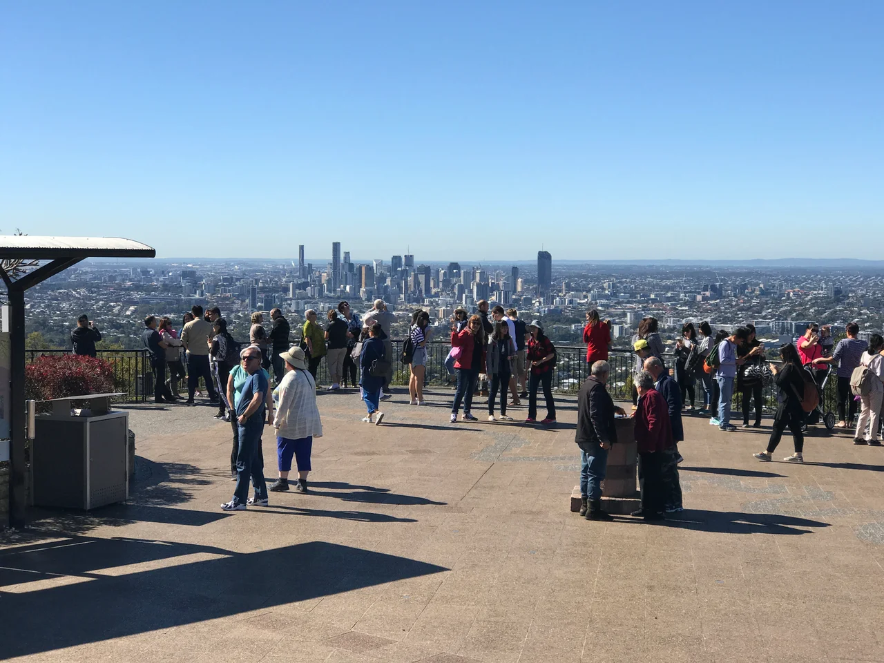

Mount Coot-tha Lookout
The name carries a sweetness that the postcard view tends to bury. Long before it became Mount Coot-tha, the Turrbal people knew this hill as Ku-ta, the place of wild honey, where stingless native bees nested in the trees and people climbed to gather it. It was a place of the honey-bee dreaming. Today, 226 metres up, a brass star is set into the terrazzo floor of an octagonal viewing platform, and visitors stand where the honey-gatherers once stood and look out over a city that did not exist when the hill earned its name. Brisbane unrolls below, the river threading through it, the towers of the centre catching the morning light, the ranges fading blue to the west.
The Place of Honey
Mount Coot-tha is the high point of the Taylor Range, the wall of green hills that forms Brisbane's western backdrop. To the Turrbal people, traditional custodians of this country, it was Ku-ta, named for the wild honey of stingless bees that lived in its trees, a destination worth the climb. Linguists still debate whether the Turrbal spoke their own language or a dialect of the wider Yuggera tongue, but the meaning of the place is not in doubt. In 1880, the European name was settled as Mount Coot-tha after a clerk of the parliament consulted a member of the Turrbal people, an anglicised echo of Ku-ta. The honey is the older truth beneath the tourist lookout, and it deserves to be remembered first.
The Best View in Brisbane
Europeans first recorded climbing the summit in 1828, and they reached the same conclusion the Turrbal had: there is no better place to take in the surrounding country. As Brisbane grew, so did the habit of coming up here, and the lookout's popularity tracked the rise of leisure time and, later, the motor car, which turned a day-trip up the hill into something an ordinary family could do on a weekend. The view runs from south to northeast, taking in the whole sweep of the city, the river's loops, and the distant coast on a clear day. The Queensland Heritage Register, which listed the site in January 1995, recognised it as the best vantage point over the area since that first recorded ascent.
Kiosk and Lookout
Two structures crown the hill, each from a different era of civic ambition. The kiosk to the north grew from an open-sided shelter built around 1918, a single-storey timber building on a stone base with a terracotta-tiled gable roof, finials, chimney pots, and a tall ventilator riding the ridge. It has been added to over the decades but kept its character, a legible record of a building evolving to meet a century of visitors. The lookout itself is younger, a 1950s work in the functionalist style: a broad radiating platform on a porphyry stone retaining wall, with the raised octagonal viewing deck at its southern end. That brass star in the terrazzo floor, under a concrete canopy on steel posts, points the way across the landscape below.
Towers, Gardens, and the City Below
The hill does more than hold a view. On a ridge near the summit stand the television transmission towers that broadcast to Brisbane, their masts a landmark from across the city. At the mountain's base spread the Brisbane Botanic Gardens, 56 hectares of subtropical planting that count among Queensland's finest. Sir Samuel Griffith Drive loops around the slopes, carrying the steady stream of visitors up to the lookout's car park, a short walk from the deck. The buildings here, both kiosk and lookout, stand as good examples of the work of the Brisbane City Council's architects, civic structures built to give the public the best of a hill the Turrbal valued long before any of it was raised.
From the Air
Mount Coot-tha Lookout sits atop the Taylor Range about 6 kilometres west of central Brisbane, at 226 metres above sea level, at 27.485 degrees south, 152.959 degrees east. The cluster of tall television transmission towers near the summit is the single most reliable landmark from the air, visible for many kilometres. The Brisbane CBD towers and the looping Brisbane River lie to the east. Archerfield Airport (ICAO YBAF) is roughly 9 kilometres to the southeast, and Brisbane Airport (YBBN) about 16 kilometres to the northeast. As terrain rising sharply above the surrounding suburbs, the mount warrants caution at low level; maintain safe clearance above the towers. Best appreciated from 2,000 to 4,000 feet in clear morning air, when the whole city and the coast beyond open up to the east.
Nearby Stories
- Redcliffe Peninsula 2.7 km away
- Tamborine National Park 12 km away
- Cressbrook Homestead 27 km away
- Main Range National Park 31 km away
- 2010-2011 Queensland Floods 38 km away
- Cape Byron 96 km away
- Cape Byron Light 126 km away
- HMS Porpoise (1799) 588 km away