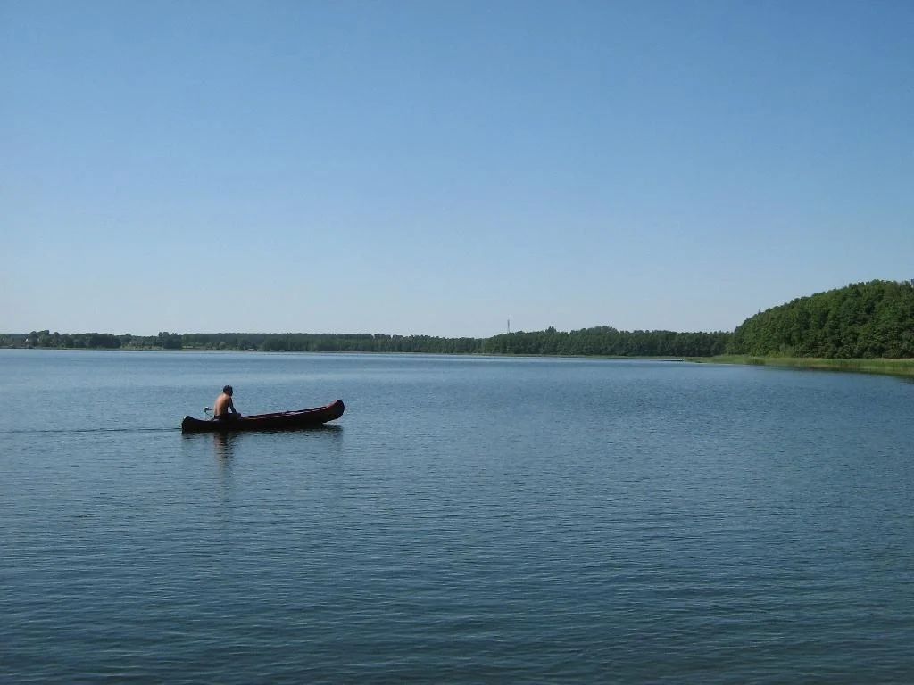

Müritz National Park
East Germany had two days left when Muritz National Park came into existence. The park was declared on 1 October 1990; the state that declared it was dissolved on the 3rd. In its final weeks the outgoing government pushed through a programme of national parks and reserves across a collapsing country, work driven largely by Michael Succow, a biologist appointed deputy environment minister a few months earlier who understood exactly how briefly the window would stay open. Muritz was the largest of them, and it still is: 322 square kilometres of moraine, sandur and standing water, the biggest terrestrial national park in Germany, protected by a signature from a government that no longer exists.
Two Parks with a Town Between Them
The park is not one continuous shape but two, split by the town of Neustrelitz. The western and much larger section runs from the eastern shore of Lake Muritz inland; the smaller Serrahn section lies east of the town. Both sit on ground the last ice age left behind - terminal moraine ridges, flat outwash plains of sand, and the shallow basins between them that filled with water and never drained. Roughly seventy-two per cent of the park is forest and thirteen per cent is lake, with 108 lakes larger than a hectare and an uncountable litter of smaller pools, ditches and runs. What is left over is bog and meadow. Lake Muritz itself, 117 square kilometres and the largest lake lying entirely within Germany, borders the park but is mostly outside it; only the eastern shore is protected.
Where the Havel Starts
Somewhere in the Muritz section, in ground too wet to walk across easily, the Havel begins. It is a modest start for a river that will collect the Spree, run through Potsdam and Brandenburg an der Havel, and reach the Elbe more than three hundred kilometres later. The source sits near the watershed dividing water that ends in the Baltic from water that ends in the North Sea, a line invisible on the ground and decisive on the map. This is the quiet pleasure of the Muritz landscape: nothing here is dramatic, and almost everything is consequential. Waren, on the north shore of the lake, keeps the Muritzeum, where visitors get their bearings before going in.
The Beeches That Went on the World List
In 2011 the beech forests of the Serrahn section were added to the UNESCO World Heritage list, joining ancient beech stands in Slovakia and Ukraine as part of a single transnational site. The reasoning has less to do with beauty than with evidence. When the glaciers withdrew, beech spread back across Europe and became the dominant tree of the continent's temperate lowlands, and the few forests that escaped centuries of clearing and replanting record how that happened. Serrahn is one of them. Walking under those trees is not like walking through a planted wood: the canopy closes overhead, the ground is bare and open, and the light that arrives has been filtered through several storeys of leaves.
A Hundred Pairs of Cranes
The park's inventory runs to 54 mammal species and 214 birds. Red deer move through the forest in numbers large enough to shape it. White-tailed eagles nest by the water and ospreys fish it, dropping feet-first from a hover. More than a hundred pairs of cranes breed here, and in autumn their calls carry for kilometres across the shallows as migrating flocks gather on the lakes to roost. The wetter margins hold bitterns, black storks, redshanks and greenshanks, birds that have vanished from most of the drained and straightened lowlands around them. Nothing about this abundance is accidental - it exists because a large enough piece of ground was left alone at the right moment.
Tank Tracks and Juniper
The landscape carries its uses openly. About 3,500 hectares of what is now national park served the Soviet forces as a tank training area during the Cold War, ground churned by armour and closed to everyone else, which is one reason it survived unbuilt. Elsewhere the open stands of common juniper - dark, upright, scattered across sandy clearings - are the fossil of an older practice: they spread on land grazed by cattle, because cattle eat almost everything else. Take away the herds and the junipers will eventually be shaded out by the returning forest. A national park has to decide what it is preserving, and here the answer includes a few centuries of human habit as well as the ice.
From the Air
Muritz National Park is centred near 53.436 N, 12.837 E in southern Mecklenburg-Vorpommern, roughly midway between Berlin and Rostock. From 3,000-5,000 ft AGL the two sections separate clearly on either side of Neustrelitz, dark unbroken forest scattered with lakes of every size, with the broad pale sheet of Lake Muritz on the western edge as the anchoring landmark. The town of Waren sits on the lake's north shore. Rechlin-Larz (EDAX) is about 15 km southwest, Neubrandenburg (EDBN) about 35 km northeast, Parchim (EDOP) about 70 km west, and Berlin Brandenburg (EDDB) about 120 km south. As over any German national park, fly high, avoid low passes over nesting areas in spring and early summer, and check current charts and NOTAMs for noise-abatement and nature-protection advisories. Autumn mornings bring dense valley fog over the lake basins that burns off late.
Nearby Stories
- Feldberg Lake District Nature Park 5.2 km away
- Neuruppin 18 km away
- Carinhall 20 km away
- Holy Blood of Wilsnack 28 km away
- Wöbbelin Concentration Camp 54 km away
- Historical Technical Museum, Peenemünde 64 km away
- Lilleø 154 km away
- Copenhagen City Hall 230 km away