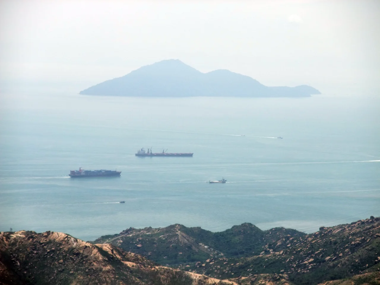

Nei Lingding Island
In May 1513, a Portuguese explorer named Jorge Álvares reached an island near the Chinese coast and called it Tamão. Western scholars believe, though recent Chinese scholarship disputes it, that Tamão was the island now called Nei Lingding — the main landmass sitting in the mouth of the Pearl River, 6 kilometres off the mainland coast. If the identification holds, then this small island was the site of the first European contact with China via the sea route around the Cape of Good Hope. Five centuries of complicated history followed from that single landfall.
The Outer Anchorage
For centuries before the Portuguese arrived, the Pearl River had been one of the world's major trade corridors, connecting the interior of southern China to the sea routes of Southeast Asia and beyond. Nei Lingding sat at its mouth like a gatehouse. By 1814, European ships traveling to Canton — the city now called Guangzhou — were required to stop at the island, have their cargo inspected and measured by Chinese customs officials, and pay duties before proceeding upriver.
The island was a chokepoint by design. The Qing court controlled access to Canton through the Canton System, which restricted foreign trade to a single port and a small number of authorized merchants. Lintin Island, as Nei Lingding was then romanized, was the last formal checkpoint before that system began. Ships that couldn't or wouldn't comply with the requirements — and increasingly, ships that preferred to operate outside the system entirely — found other uses for the island's anchorage.
The Hulks of Lintin
In 1821, the Chinese government prohibited the importation of opium into its ports. The prohibition created a problem for British and American merchants who had built profitable businesses supplying opium grown in British India to Chinese buyers. Their solution was elegant in its cynicism: anchor old boats — hulks — just offshore at Lintin, outside the formal port system, and use them as floating warehouses.
Smaller, faster boats would carry the opium from the hulks into the river network, where it could be distributed to buyers in Guangzhou and beyond. When the American diplomat Edmund Roberts visited the island in 1832, he counted seven to eight ships engaged in this trade, including American vessels. The island was also a seasonal shelter during monsoon storms; ships sometimes stayed for six months at a time. Lintin had become a hub in one of the most profitable and most destructive drug-smuggling operations in history — a trade that would eventually trigger two Opium Wars and reshape the political geography of the entire Pearl River Delta.
Jurisdiction Passed and Passed Again
The administrative history of Nei Lingding Island reflects the complexity of the Pearl River estuary's modern geography. Though the island sits closer to the eastern shore — the side belonging to Hong Kong and Shenzhen — it was, until 2009, administered as part of Zhuhai, whose main center sits on the western bank. That anomaly ended when jurisdiction was handed over to Shenzhen in 2009.
The transfer made geographic sense but required bureaucratic effort: a small island with a complicated history, sitting in water between major cities, reassigned between two Special Economic Zones. The Portuguese had fortified it briefly in the sixteenth century before the Chinese expelled them. The British had used it as a drug depot in the nineteenth century. Now it belongs administratively to a city — Shenzhen — that barely existed before 1980.
Macaques, Pangolins, and Mangrove
The final chapter of Nei Lingding's modern history is ecological rather than commercial. Part of the island has been designated the Neilingding Island and Futian Nature Reserve, covering 7.8 square kilometres — 4.5 square kilometres of land and 3 square kilometres of mangrove forest. The reserve was established to protect a population of some 300 rhesus macaques, along with other animals including pangolins and pythons.
Macaques and pangolins: one species famously adaptable, the other among the world's most trafficked mammals, now sheltering on the same island that once sheltered opium hulks. The mangrove forest along the island's shores filters tidal water and provides nursery habitat for fish species that feed the fishing communities of the surrounding estuary. Nei Lingding has been many things to many people across five centuries. What it is now — a wildlife refuge in the mouth of one of the world's busiest waterways — may be its most improbable identity yet.
From the Air
Nei Lingding Island is located at approximately 22.4128°N, 113.8036°E, positioned in the center of the Pearl River estuary between Hong Kong (to the east), Shenzhen (northeast), and Zhuhai/Macau (to the west). From the air, it appears as a distinct forested landmass surrounded by water, roughly rectangular in shape. The Hong Kong-Zhuhai-Macau Bridge crosses the estuary to the south. Hong Kong International Airport (VHHH) is approximately 20 km to the east-southeast; Shenzhen Bao'an International Airport (ZGSZ) is approximately 30 km to the north. At 3,000–6,000 feet, the island's separation from both shores and its mangrove-fringed coastline are clearly visible. The estuary's heavy shipping traffic — container vessels, ferries, and fishing boats — provides navigational context for understanding why this island served as an anchorage for centuries.
Nearby Stories
- Sai Kung District 3.7 km away
- Second Battle of Chuenpi 12 km away
- Birds' Paradise 16 km away
- Hac Sa Beach 17 km away
- Yamen, Guangdong 20 km away
- Hong Kong 12 38 km away
- West Lake (Huizhou) 49 km away
- Jiangmen Underground Neutrino Observatory 72 km away