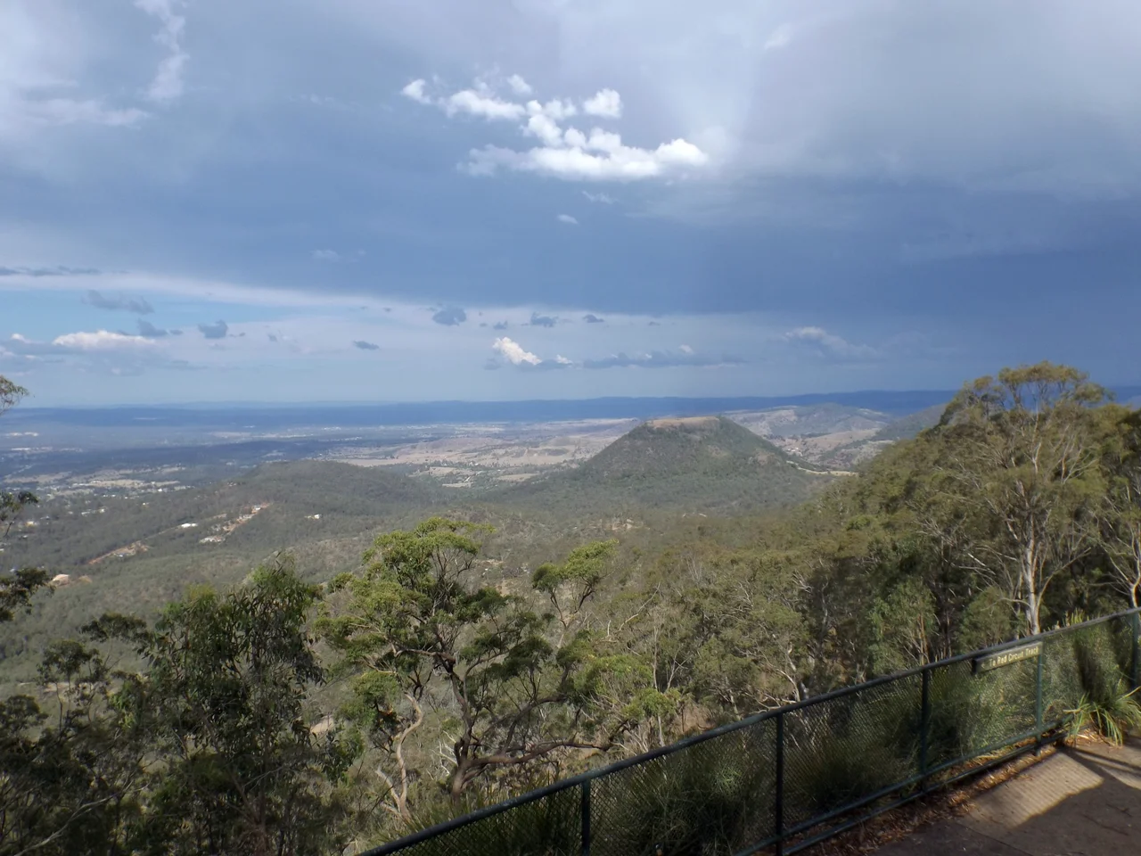

Picnic Point, Toowoomba
The city simply runs out of ground. One moment you are driving through the leafy streets of Rangeville, past hoop pines and clipped hedges, and the next the land falls away beneath your feet and the whole eastern world opens up: the Lockyer Valley spread out a kilometre below, the blunt volcanic plug of Tabletop Mountain rising from the plain, the Main Range fading into blue haze. Picnic Point is the moment Toowoomba ends and the view begins. For more than a century, people have driven to this exact spot on the rim of the Great Dividing Range just to stand at the edge and look.
The Man Who Chose the View
Some places are discovered. This one was deliberately selected. William Henry Groom, Toowoomba's most relentless civic champion, picked this bluff in consultation with the Commissioner of Crown Lands as a site "of great beauty, easy of access," commanding "splendid views of the deep gorges of the Main Range and the hills below it." He wanted it set aside as the recreational resort of the people, a place for a day's outing, and the town agreed. The reserve grew to roughly 65 hectares strung along the crest of the escarpment, perched near 700 metres above sea level. The genius of the choice is that nothing about the approach gives it away. From the valley floor below, the bush-clad cliff looks untouched; the parkland and its crowds are invisible until the very last turn of Tourist Road.
Cliff Edge and Camera
Walk to the stone cairn near the kiosk and you are standing where countless visitors have framed the same photograph. The cairn carries a brass direction plate, almost certainly the one Kodak donated in 1930, and behind it sits Tabletop Mountain, the flat-topped hill of volcanic origin that anchors every Picnic Point picture ever taken. The view sweeps a full 180 degrees, north to south along the escarpment and the foothills, reaching toward the World Heritage forests of the Scenic Rim. Below the lookout, stone-walled paths thread down the cliff face, past a waterfall built into an old quarry, past lawns where couples still marry in a small rotunda. The mushroom-shaped water tower, oddly beloved, marks the skyline. So does a 46-metre flagpole, raised in 2009 for Queensland's 150th birthday and visible, on a clear day, from the highway far out on the plain.
Tobruk Drive and the Quiet Bush
Not all of Picnic Point is manicured. Behind the kiosk, Tobruk Memorial Drive runs east along a dipping ridge through open eucalypt forest that was still being grazed into the early 1960s. The name remembers the 1941 siege where Australian troops held the Libyan port against Rommel, and the road's opening coincided with a shift in how Australians saw their own bush, no longer as scrub to be cleared but as something worth keeping. Volunteers from the Toowoomba West Lions Club spent years tending this end of the park; a gully is being coaxed back to rainforest with community-planted seedlings. Tracks with names like the Pardalote Walk and the Fantail Circuit meander out to Bob Dodd's Lookout, and a bridle trail eventually offers the determined walker a route down toward Tabletop Mountain itself.
A Place People Defend
When the Queensland Heritage Register listed Picnic Point in 2008, it cited the obvious, the exceptional sweeping views, but also something harder to measure: the way this place lives in the affection of its community. The story of love padlocks proves the point. Couples began clipping engraved padlocks to the railings, a romantic gesture imported from Paris, and the town promptly argued about it, some calling it heartfelt, others a safety risk or simple vandalism. It is the kind of small, passionate dispute that only happens over a place people genuinely care about. A hundred and forty years after Groom chose this bluff, Picnic Point is still doing exactly what he intended, gathering the people of Toowoomba at the edge of their world to look out at the view.
From the Air
Picnic Point sits at 27.58°S, 151.99°E on the eastern escarpment of the Great Dividing Range, near 700 metres elevation. From the air, the dramatic cliff line where the Toowoomba plateau drops to the Lockyer Valley is the defining feature, with the flat-topped volcanic cone of Tabletop Mountain (about 596 m) standing just east of the escarpment as a clear landmark. The tall flagpole and mushroom-shaped water tower mark the lookout itself. Brisbane West Wellcamp Airport (YBWW) lies roughly 15 km west; Toowoomba City Aerodrome (YTWB) is just north. Brisbane (YBBN) is about 110 km east. Best viewing is morning, when low sun rakes across the valley and the range stands out in clear relief; afternoon valley haze can soften the long views east.
Nearby Stories
- North Ipswich Railway Workshops 20 km away
- Main Range National Park 22 km away
- Cressbrook Homestead 41 km away
- Woodford Folk Festival 41 km away
- Jimbour Homestead 43 km away
- Tamborine National Park 60 km away
- Warialda 217 km away
- Inverell 254 km away