.jpg)
Pilgrim's Rest
Alec Patterson pushed a wheelbarrow most of the way here. When a donkey kicked him somewhere north of Cape Town, he swapped the animal for a barrow and kept walking, more than a thousand kilometres, until he reached a creek in the eastern Transvaal in 1873. He was a secretive man, and when he found gold glinting in his prospector's pan, he said nothing to anyone. The secret did not keep. By September of that year the valley was a proclaimed gold field, and a tin-roofed town had begun to spread along the stream that still carries the diggers' name: Pilgrim's Creek.
Wheelbarrow and the Rush
On 22 September 1873, Pilgrim's Rest was officially proclaimed a gold field, and the slow trickle of prospectors became a flood. Within weeks more than two hundred diggers had staked out the banks of the creek. Inside a year, some fifteen hundred men worked four thousand claims, panning the alluvial gravel for the loose grains and nuggets that the river had been sorting for millennia. The names of that first generation survive in local memory: Alec "Wheelbarrow" Patterson, who started it; William Trafford, who registered an early claim; Tom McLachlan, remembered as one of the greatest of the South African prospectors. They built fast and cheap, in timber and corrugated iron, because no one expected the gold, or the town, to last.
The Town That Stayed
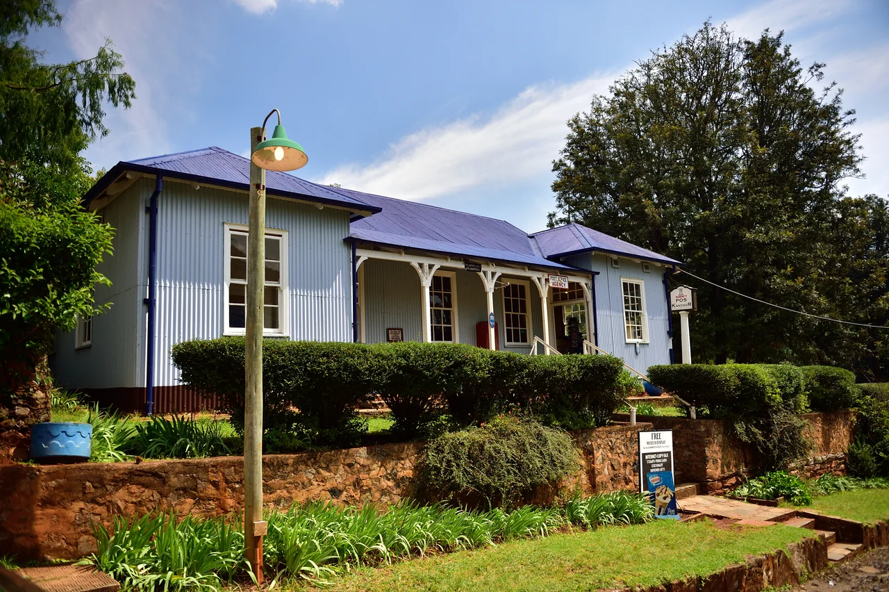
The easy alluvial gold thinned, as it always does, and deep-reef mining took over, run for decades by the Transvaal Gold Mining Estates. When the company finally wound down operations in the 1970s, Pilgrim's Rest faced the fate of most mining settlements: abandonment, then collapse into the veld. Instead, the whole village was bought up and frozen in time. In 1986 it was declared a national monument, and the corrugated-iron cottages, the printing works, the diggers' museum and the wood-and-iron Royal Hotel were preserved rather than demolished. Walk the single main street today and you are walking through the 1880s, the buildings still standing where their first owners nailed them together.
Uptown, Downtown
For all its rough beginnings, Pilgrim's Rest grew into a real town, and it split, as gold towns do, along lines of money. "Downtown" held the working heart: the diggers, the trading stores, the printing works that produced the local paper. "Uptown" gathered the managers and the gentility around the Royal Hotel, a wood-and-iron establishment that has been serving travellers, in one form or another, since the rush years. Between them ran a single main road, and along it the whole apparatus of a Victorian frontier settlement assembled itself in corrugated iron, a material cheap enough to throw up in a hurry and, as it turned out, durable enough to last a century and a half. The town even claims a footnote in engineering history: the surrounding mines drew on early hydroelectric power, generated from the rivers tumbling off the escarpment.
Living Museum on the Escarpment
Pilgrim's Rest sits on the Panorama Route, the scenic ribbon that runs along the Drakensberg escarpment in the Kruger lowveld region of Mpumalanga. The town is small enough to cross on foot in minutes, which is part of its charm. Visitors still pan for gold in the creek, hands cold in the running water, watching for the same telltale colour that stopped Patterson in his tracks, and the village hosts gold-panning contests that keep the old skill alive. The surrounding country is laced with waterfalls and high viewpoints, and the Blyde River Canyon lies just to the north. It is a place that has turned its own ending into its purpose: a town that refused to become a ruin, and became a memory you can step inside instead.
From the Air
Pilgrim's Rest lies at 24.88°S, 30.75°E, tucked into a wooded valley on the Drakensberg escarpment in eastern Mpumalanga, South Africa, at roughly 1,200 m elevation. The town threads along a single creek-side street between forested ridges; the dramatic Blyde River Canyon and Three Rondavels sit about 25 km to the north, and Graskop and Sabie lie nearby to the south. The nearest sizeable airport is Kruger Mpumalanga International (ICAO FAKN), roughly 70 km to the southeast near Mbombela (Nelspruit); Hoedspruit (FAHS) lies to the northeast. Best viewed from low altitude in clear morning light, before the afternoon highveld cloud builds over the escarpment.
Nearby Stories
- Blyde River Canyon Nature Reserve 13 km away
- Sabi Sand Game Reserve 27 km away
- Sudwala Caves 27 km away
- Battle of Bergendal 68 km away
- Kruger National Park 71 km away
- Bushveld Igneous Complex 105 km away
- 2010 FIFA World Cup 109 km away
- 1986 Mozambican Tu-134 Crash 109 km away