Piracicaba River (Minas Gerais)
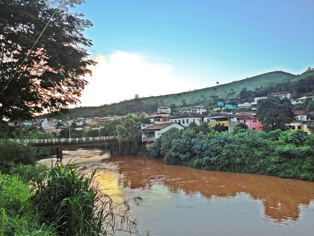
The name comes from Tupi-Guarani and points at a problem. Piracicaba: the place where the fish stop. Small rapids and cataracts break the river's flow, especially around Antônio Dias, and fish trying to swim upstream crowd against them. The word captures what the people who lived here first noticed. Three centuries later, different obstacles have taken over. The river's fish face a different kind of interruption now.
Born on Sol Peak
The Piracicaba starts high, at 1,680 meters on the Caraça mountain range, in the São Bartolomeu district of Ouro Preto. Sol Peak rises to 2,068 meters nearby, an outlier of the Espinhaço range that punctures the Iron Quadrangle like a geological accident. From these headwaters the river runs 241 kilometers eastward through 21 municipalities and drops more than a kilometer in elevation before emptying into the Doce River between Ipatinga and Timóteo. Its main tributaries carry the names of the landscapes they drain: Prata, Peixe, Maquiné, Santa Bárbara, plus the Turvo stream. The basin covers 5,465 square kilometers of iron-rich mountain country, some of the most mineralogically valuable terrain on the continent.
The Gold Rush Arrives
In the late 17th century, bandeirantes from São Paulo followed the river inland, hunting the gold rumored to lie in its headwaters. They found it. The discoveries around Ouro Preto launched one of the great mining booms of the colonial Americas and pulled settlement into the valley, first at Ouro Preto and Mariana, then at Catas Altas, Santa Bárbara, Nova Era, and Antônio Dias. Mining was Brazil's dominant industry in the 18th century. It also left the first scars: churned banks, muddy water, forests cleared for firewood and timber. The rivers of the region absorbed the work of every shovel and sluice that came after.
Displacement and Conflict
The land between the mouths of the Piracicaba and the Manhuaçu was home to the Aimoré people, who resisted Portuguese intrusion into the Doce valley for more than two centuries. The royal crown banned settlement here during much of that time, partly to prevent gold smuggling and partly because the Aimoré held the territory. When settlement was formally authorized in 1755, the resistance gave way to violence. Colonial authorities launched punitive expeditions, including one in the 1760s led by Governor Luís Diogo Lobo da Silva with 150 armed men, who navigated the Piracicaba and Doce as far as the site now called Conselheiro Pena. The Aimoré were pushed off their land and displaced, many killed outright, a pattern repeated across the river basins of Minas Gerais.
The Steel Valley
The 20th century brought a different kind of extraction. The Vitória-Minas Railway ran along the river's course, and the combination of rail, water, and timber attracted the steelmakers. Acesita opened in Timóteo in 1944; Usiminas followed in Ipatinga in 1956. To power them, the Sá Carvalho Hydroelectric Power Station opened on the Piracicaba at Antônio Dias in 1951, the largest in Minas Gerais at the time. Around these industrial anchors grew João Monlevade and the cluster of cities now known as the Vale do Aço, the Steel Valley. Eucalyptus plantations spread across hillsides once covered in Atlantic Forest, feeding the charcoal furnaces. Urban and industrial effluents poured into the river, and siltation thickened the current into something closer to paint than water.
A River in Recovery
The Piracicaba is one of the most degraded tributaries of the Doce, but it is not abandoned. Erosion is classified as strong or very strong across 66 percent of the basin, and headwater sediment loads run 100 to 200 tonnes per square kilometer per year. Yet the effort to reverse this is visible. Usiminas began replanting riparian forest at the river mouth in the 1990s. The Piracicaba River Basin Committee was established in February 2000. Wastewater treatment plants have come online in some cities. Fishing is regulated by a state law passed in 2002 that requires licenses, registered boats, and a closed season called the piracema from November through February, when fish migrate upstream to spawn. The name the Tupi gave this place still makes sense. The fish still stop here, and people still try, with more or less success, to let them keep going.
From the Air
Coordinates 19.49°S, 42.51°W at the river mouth on the Doce near Ipatinga. Recommended viewing altitude 5,000-8,000 ft AGL to trace the river corridor through the Steel Valley. The river runs from the Caraça range in Ouro Preto east to Ipatinga-Timóteo, 241 km. Nearest airport: Usiminas Airport (SBIP, IPN) at Ipatinga. Belo Horizonte's Confins (SBCF) is 180 km southwest. Industrial haze can reduce visibility over the Vale do Aço area.
Nearby Stories
- Feliciano Miguel Abdala Private Natural Heritage Reserve 4.7 km away
- Santo Antônio do Rio Abaixo 44 km away
- Vila Império 51 km away
- Mutum, Minas Gerais 59 km away
- Santa Bárbara, Minas Gerais 63 km away
- Pico do Itambé State Park 98 km away
- Robert Quayle (1814 ship) 101 km away
- Poté 151 km away