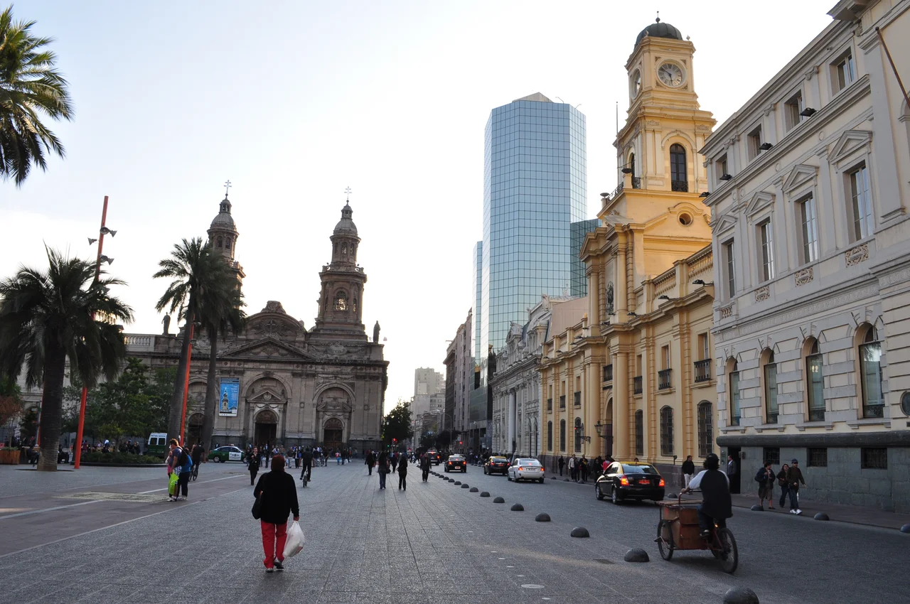

Plaza de Armas (Santiago)
When Pedro de Valdivia paced out Santiago's central square in 1541, he believed he was founding a city on empty ground. He was wrong by several centuries. Beneath the Plaza de Armas, archaeologists have found evidence of an Inca settlement that stood here long before the Spanish arrived, a northern outpost of the empire built on irrigation and mineral wealth. Valdivia's new capital was raised, quite literally, on top of an older one. The square that became the symbolic center of Chile sits over a buried city most Chileans never learned was there.
A City Drawn on a Chessboard
The plan was deliberate and geometric. Valdivia's surveyor, Pedro de Gamboa, laid out Santiago on a chequerboard grid, streets crossing at right angles like squares on a chessboard, with one block left open at the center. Around that open square the colony would arrange its instruments of power: the church, the court, the governor's residence. The Spanish called it the Plaza de Armas, the place of arms, where the city's defenders could muster. Colonial life pressed in around it. Markets known as recovas sprouted at its edges as goods flowed through, and in its middle stood a gallows, a blunt reminder that royal power could end a life as easily as it could grant a permit.
Freedom Carved in Marble
At the heart of the square today stands a monument to the Freedom of Latin America, a figure breaking chains, sculpted from Carrara marble by Francesco Orselino. It replaced an older bronze fountain from 1671, which now lives at La Moneda Palace. The allegory is pointed, but it sits among more complicated company. The square also holds an equestrian statue of Valdivia himself, the conquistador who founded the city, alongside a monument to Chile's indigenous peoples, whose ancestors lived here first and whose buried settlement lies underfoot. These competing memorials, conqueror and conquered facing one another across the paving stones, make the plaza an honest, uneasy record of how Chile came to be.
Four Centuries of Façades
Every side of the square tells the story of Santiago rebuilding itself. On the northwest corner rises the Metropolitan Cathedral, the fifth church to stand on that spot, its current building begun in 1748, completed in 1775, and later given a new façade by the architect Joaquín Toesca. Along the north edge stand the old colonial government buildings. The Central Post Office occupies the very ground first assigned to Valdivia, where the governors and later the presidents of Chile lived until 1846; a fire nearly destroyed it, and it was rebuilt in neoclassical style in 1881, gaining a third floor and a dome in 1903. Beside it, the National History Museum fills the former royal court, and the municipal building stands where the colonial town council and a jail, built between 1578 and 1647, once sat. Fire has been a recurring author here. The municipal building alone burned in 1891 and was reconstructed by the architect Eugenio Joannon, reopening in 1895. What you see is less a single moment than layers of disaster and renewal stacked on the same footprint.
The Living Square
The plaza has never stopped being used, which is its great charm. A ground plaque marks kilometre zero, the point from which all distances in Chile are measured, so in a real sense every road in the country begins here. The Portal Fernández Concha shopping arcade, completed in 1871, lines the southern side, crowded with food shops and stalls. Near the Cathedral, along Puente and Catedral streets, an area locals call Little Lima hums with Peruvian restaurants and businesses serving Santiago's immigrant community. Chess players, preachers, portrait artists, and office workers on lunch breaks share the same benches. Five hundred years after Valdivia drew his grid, the open block he left at the center is still doing exactly what a plaza is meant to do.
From the Air
The Plaza de Armas marks the historic center of Santiago at 33.4380°S, 70.6504°W, with its metro station directly beneath the square. From the air it appears as a tree-lined open rectangle punched into the dense colonial street grid, bordered on the northwest by the twin-towered Metropolitan Cathedral and on the north by the long colonial government blocks. The nearest general-aviation field is Eulogio Sánchez (Tobalaba) Airport, ICAO SCTB, roughly 9 km east in La Reina; the main international gateway is Comodoro Arturo Merino Benítez, ICAO SCEL, about 16 km northwest in Pudahuel. The square sits low in the Andean basin near the Mapocho River; clear morning air offers the cleanest sightlines before afternoon smog builds.
Nearby Stories
- Paine Memorial 21 km away
- 1947 BSAA Avro Lancastrian Star Dust accident 23 km away
- Battle of Chacabuco 31 km away
- La Campana National Park 36 km away
- Puente del Inca 44 km away
- Casa de Isla Negra 62 km away
- Santa Cruz, Chile 103 km away
- Pierre Auger Observatory 172 km away