
Porlock
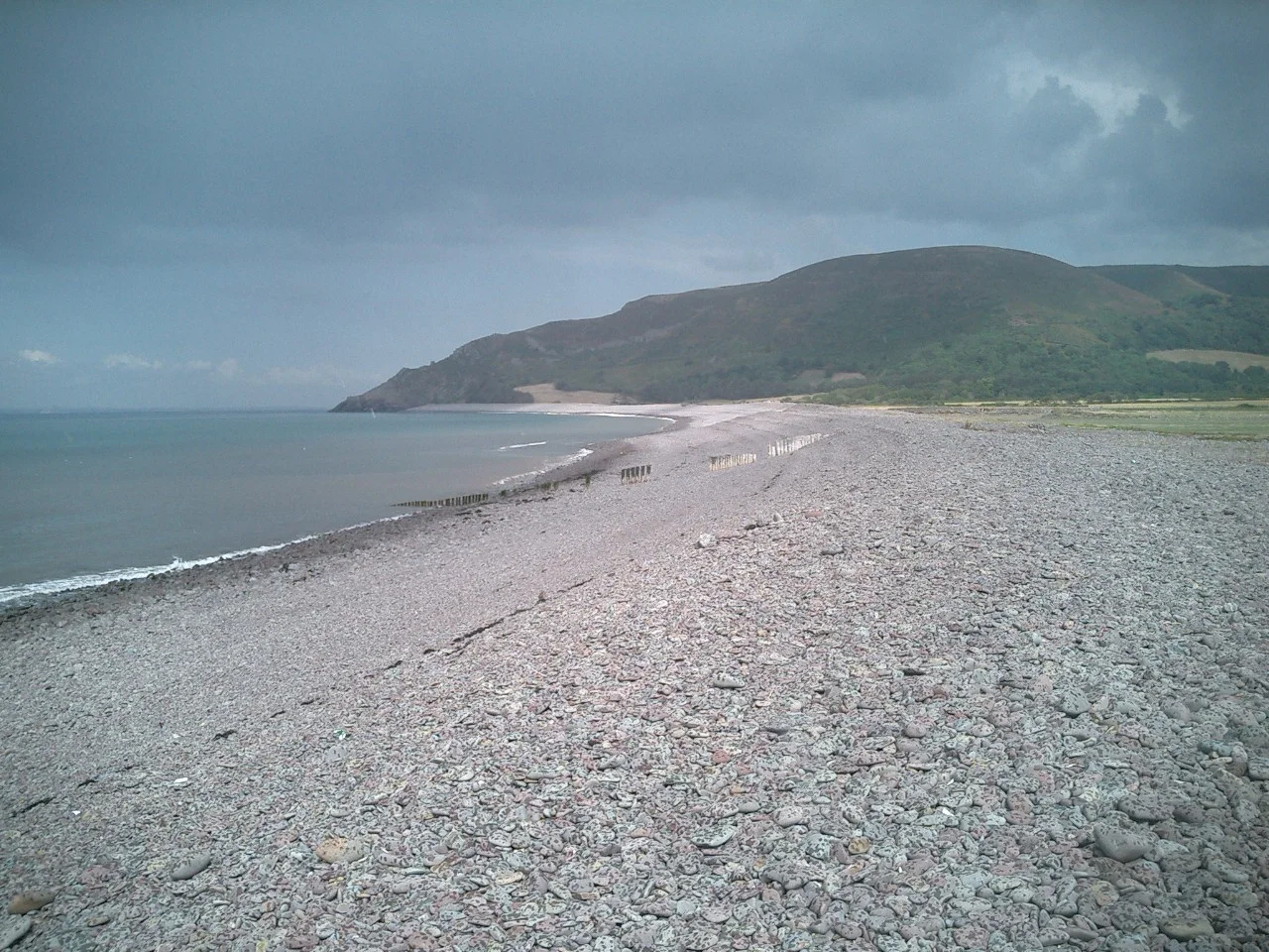
Walk Porlock Beach at low tide and you can see the stumps of trees that grew here when the Bristol Channel was somewhere else. A submerged forest, drowned 7,000 to 8,000 years ago when sea levels rose after the last ice age, still surfaces at every spring low. Walk inland and the road climbs to Porlock Hill at a gradient of one in four, steep enough that there is a paid toll road just to avoid it. Between the buried forest and the impossible hill sits a village of fewer than 1,500 people, in a position that has been quietly important since the Vikings tried to land here in 914.
An enclosure by the harbour
The name Porlock comes from Old English: port for harbour and loca for enclosure. The Domesday Book of 1086 records it as Portloc. Above the village rises Bury Castle, an Iron Age hill fort that watched over the same harbour two thousand years before the Saxons named it. Porlock was part of the Hundred of Carhampton in medieval times. The Church of St Dubricius dates from the 13th century, its spire damaged in a great storm of 1703 and never fully replaced; it is now a Grade I listed building. Inside the church is the 15th-century tomb of John Harrington, who fought alongside Henry V in France in 1417. Two miles up the coast, Culbone Church claims the title of smallest church in England. Its 12th-century structure still holds services despite having no road access at all. Worshippers walk in.
The person on business
In 1797, the poet Samuel Taylor Coleridge had retired, due to illness, to 'a lonely farm house between Porlock and Lynton.' He claimed to have fallen asleep over a book about Kubla Khan and dreamed an entire poem of two or three hundred lines, perfect and complete. He woke and began writing it down. He had reached fifty-four lines when, in his own account, he was 'called out by a person on business from Porlock' and detained for above an hour. When he returned to his writing, the rest of the poem was gone. He could not recover it. The fifty-four lines that survived became one of the most famous unfinished works in English literature. The phrase 'a person from Porlock' has since entered the language as shorthand for any interruption that destroys creative flow. Whether the unwelcome visitor was real, imagined, or a face-saving cover for writer's block is still debated. The poem is real.
Suspected spies
Coleridge was not alone in these hills. William Wordsworth lived nearby at Alfoxden, and the two friends roamed the coast and moors on long walks, sometimes at night, sometimes in pouring rain. Their behaviour seemed odd enough to local gossips that someone reported them as possible French spies. This was 1797. France was at war with Britain, and rural Somerset took intelligence threats seriously. The government dispatched an agent to investigate. He returned with a verdict that has aged into comedy: the suspects were 'mere poets.' The Coleridge Way, a modern walking trail, follows Coleridge's route from his cottage at Nether Stowey out to Porlock. Their friend Robert Southey published a poem titled 'Porlock' in 1798. The Romantic poets had, between them, put this stretch of coast on the literary map for good.
Aurochs on the beach
In 1999, walking the same beach where Bronze Age stumps protrude at low tide, someone found bones. They turned out to belong to an aurochs, the massive wild cattle that roamed Europe and North Africa for hundreds of thousands of years before going extinct in the early 17th century. An adult aurochs bull could stand 1.8 metres at the shoulder and weigh over a tonne. The bones are now on display at the Porlock Visitor Centre. The Porlock Ridge and Saltmarsh nature reserve sits beside the village, formed when a high shingle embankment was breached by the sea in the 1990s, drowning what had been freshwater pasture. Standing dead trees in the marsh, pale and skeletal, mark where the water came in. The story repeats itself: drowned forest, drowned pasture, the sea taking back what it briefly let dry.
Lorna Doone country
Porlock sits inside Exmoor National Park, and the moor above it produces the landscape that R. D. Blackmore turned into Lorna Doone: A Romance of Exmoor. The 1869 novel is half history, half legend, and most of its geography is real. The Doones of Badgworthy Water are still local lore. The South West Coast Path passes through Porlock, and many walkers stop here rather than press on toward Lynton, daunted by the climb. The harbour at Porlock Weir, a couple of miles west, was once crucial to coastal trade and is now mostly used by pleasure boats and small fishing vessels. Above the village, Porlock Stone Circle, prehistoric and weathered, marks where someone thought the high open moor was important enough to memorialise. Whoever they were, they were not wrong.
From the Air
Porlock sits at 51.2088N, 3.5956W on the West Somerset coast, just inside Exmoor National Park. The village is in a steep coastal hollow between the moor and the Bristol Channel; Porlock Hill rises immediately south at a 1-in-4 gradient. Best viewed at 1,500 to 2,500 feet AGL when the curve of Porlock Bay, the saltmarsh, and the village's position against the Exmoor escarpment are all visible. RAF Chivenor (EGDC) is 22 nm west. Cardiff Airport (EGFF) is 24 nm north across the channel. Watch for low cloud forming against the moor in any southwesterly flow.
Nearby Stories
- Hinkley Point C nuclear power station 4.1 km away
- Margam Country Park 7 km away
- Brecon and Merthyr Tydfil Junction Railway 11 km away
- Tiverton Castle 16 km away
- Whiteford Lighthouse 17 km away
- River Tamar 18 km away
- Moreton House, Bideford 25 km away
- Montacute Castle 31 km away