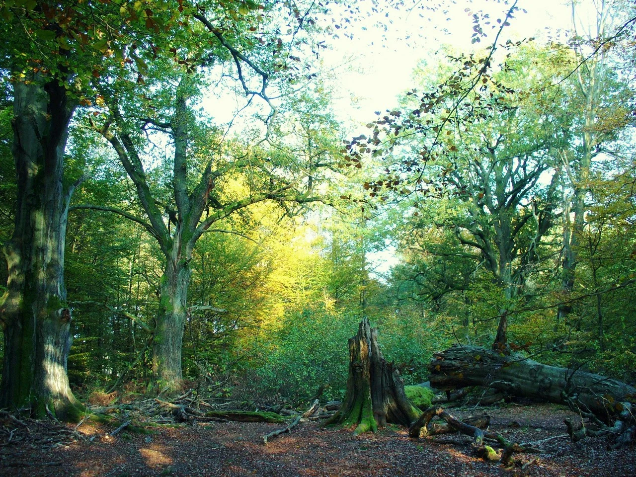

Reinhardswald
Drive north to south through the Reinhardswald and you will cover about thirty-eight kilometres of narrow, largely empty road, much of it in the south running dead straight between the trees, and you will pass exactly one village. Gottsbüren sits in the middle of the forest; after that there is nothing until you come out the far side near Holzhausen. Over two hundred square kilometres of woodland, of which 183 form an unincorporated district with essentially no municipal population at all. This is the largest continuous forest in Hesse and one of the most thinly peopled corners of Germany, and the quiet in it is not an atmosphere. It is a demographic fact.
A Plateau Tilted West
Geologically the Reinhardswald is a great slab of Bunter sandstone, gently folded, rising from around 200 metres and leaning slowly westward. Its two high points barely separate themselves: the Staufenberg at 472.2 metres and the Gahrenberg at 472.1, both so thickly wooded that neither offers much of a summit.
Water draws the boundaries. The Weser runs along the north and east in a deeply cut valley, the Fulda along the south-east and south, the little Esse to the west and the Diemel to the north-west; the last two rivers mark the border with Lower Saxony for part of their length. Look outward from the plateau and the neighbours are more of the same - the Solling across the Weser to the north, the Bramwald east, the Kaufungen Forest beyond the Fulda, and to the south-west the Habichtswald looking down into the Kassel basin.
Two Versions of Count Reinhard
Nobody knows where the name came from, so the countryside supplied explanations. Both surviving legends make Count Reinhard the villain, and both end with acorns.
In the first, he is a gambler and a drinker who sits down one night with the Bishop of Paderborn, loses his money, wagers his entire property on the next hand, and loses that too. Begging for mercy, he is granted a harvest wherever he sows acorns. In the second, harsher version he rules a forest thick with villages and is condemned to death for extortion and robbery; allowed one last sowing and harvest before execution, he destroys the villages and seeds the farmers' fields with acorns, which come up long after he is in the ground. Either way the moral is the same and slightly chilling: the trees are here because the people were removed.
The Emperor's Wood
The documented history is less colourful and more transactional. The Reinhardswald was once an imperial forest. Emperor Henry II gave the northern portion, between the Weser and the Diemel, to Helmarshausen Abbey, and the southern part went to the Bishopric of Paderborn. Landgrave Henry of Hesse bought the forest back in 1306 and pledged it to Hesse in 1355, after which Hesse never let go. Philip the Magnanimous made it his favourite ground for hunting stag.
Underneath the trees, people were digging. Brown coal was worked at the Gahrenberg, in an underground mine locally from 1842 until 1970, though evidence for mining there goes back to 1575 under Landgrave William IV. Alum ore and quartz sand were taken out early and fed the glassworks at Hann. Münden. Records of a mining trade union at Immenhausen-Holzhausen survive from around 1592.
Hutewald
Beech and oak dominate, and large stretches of the forest are Hutewald - wood pasture, where livestock grazed among widely spaced trees for centuries. Trees grown in the open put on bulk rather than height, and the oaks that survive from that regime are broad, low, hollow and enormously old, propped on their own dead limbs. The wood pastures and the scatter of old farmsteads are the visible record of a working countryside, not a wilderness.
Two signposted routes cross the plateau. The road through the north is the Weser Renaissance Road; the road through the south belongs to the German Fairy Tale Route, and is marked as the Sleeping Beauty stretch, which is the doing of the Sababurg - the ruined hilltop castle above the wildlife park that carries most of the forest's reputation and all of its brambles.
241 Metres
In early 2022 the Kassel regional council approved eighteen wind turbines in the Reinhardswald, each 241 metres tall, which would make it the largest wind farm in Hesse. The developers argue that the turbines go where the forest has already gone: storm damage, successive droughts and bark beetle infestation have opened wide clearings across the plateau, and building on ground that no longer holds trees is a reasonable trade.
Citizens' groups disagree, on the grounds that the towers threaten birds and bats and would cost the region the tourism its emptiness earns it. Both sides are describing the same forest, and neither is wrong about the state of it. The argument is really about what a damaged wood is for - whether the answer is to restore what was there, or to put the cleared ground to work while the rest recovers.
From the Air
The Reinhardswald lies at roughly 51.52°N, 9.52°E in northern Hesse, between Kassel and Bad Karlshafen. From the air it is unmistakable: a solid block of dark forest more than 200 km² in extent with almost no lights, roads or settlement inside it, bounded sharply by the Weser valley on the north and east and the Fulda on the south. High ground reaches 472 m at the Staufenberg and Gahrenberg, so plan on 2,000-4,000 ft to clear the plateau comfortably. Useful references are the Weser itself, the clearing and castle silhouette of the Sababurg near the eastern side, and the towns ringing the wood - Hofgeismar and Grebenstein west, Hann. Münden south-east, Bad Karlshafen north. Kassel-Calden (EDVK) sits about 15 km south-west and its traffic works the southern approaches; Höxter-Holzminden (EDVI) is roughly 40 km north, Paderborn-Lippstadt (EDLP) about 65 km west and Erfurt-Weimar (EDDE) some 130 km south-east. Expect valley fog in the Weser and Fulda on autumn mornings, and note that eighteen turbines of 241 m were approved for the plateau in 2022 - check current obstacle data before descending.
Nearby Stories
- Kassel 12 km away
- Unicorn Cave 15 km away
- Externsteine 15 km away
- Rammelsberg 17 km away
- Edersee Dam 17 km away
- Fagus Factory 17 km away
- 1st German Bratwurst Museum 20 km away
- Arolsen Archives 25 km away