Rheiderland
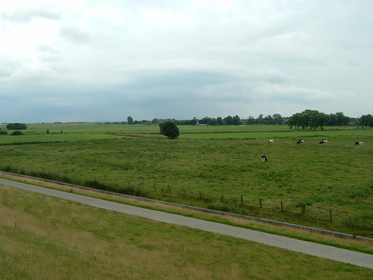
Stand on a dike along the Lower Ems in February and listen. Before you see them, you hear the wild geese — greater white-fronted, barnacle, greylag — calling from the wet grasslands stretching to the horizon. Up to a hundred and twenty thousand of them spend the winter here, in a region most travelers have never heard of and almost no one passes through. The Rheiderland is a flat wedge of marsh and polder between the River Ems and the Dollart bay, split since 1815 between Germany and the Netherlands by a border that runs through farmyards and parish registers. The Frisians who settled it spoke their own language. The farmers who reclaimed it from the sea became wealthy enough to be called polder princes. And for a few months after World War II, the entire region was something else nobody talks about now: a Dutch territorial claim against the Federal Republic of Germany.
A Border Drawn Through Frisia
Rheiderland was Frisian before it was anything else. The Frisians of this coast were a stubbornly independent people — directly subsidiary to the Holy Roman Empire, with a governing council and no feudal lords, a constitutional arrangement they referred to as Friesische Freiheit, Frisian freedom. The feudal system simply never took hold here. From 1413 the Tom Brok family, then Focko Ukena, then the Cirksena counts ruled the area in turn, but until 1600 Rheiderland remained nominally independent under East Frisian counts. The international border crystallized only after Napoleon. The Dutch-German line of 1815 cut Rheiderland in half along the Ems, but the families on both sides kept the same Low German dialect and the same Calvinist church organ tradition for generations after.
The Polder Princes
Reclamation here followed the same pattern as in Oldambt across the bay — storm surges in the late Middle Ages opened up the Dollart, and slow centuries of dike-building closed it again. The reclaimed soil was famously rich, and the farmers who claimed it became famously wealthy. Locals called them Polderfürsten, polder princes, a name that was half compliment and half complaint. Their gulf-style farmhouses still dominate the landscape: massive square brick blocks combining house and barn under a single steeply pitched roof, big enough to swallow a year's harvest. Some have been restored as country hotels. Others sit empty, slowly losing roof tiles to the North Sea wind, because the agricultural economy that built them is no longer the agricultural economy that survives here.
The Dutch Claim Nobody Remembers
In 1945, with Germany in ruins and the victorious Allies redrawing maps, the Netherlands quietly submitted a claim for the entire Rheiderland — German side included. The argument was cultural and linguistic: the dialect on both shores was closer to Dutch than to standard German, ecclesiastical Dutch had been the church language well into the 19th century, and during Napoleon's brief rule the area had belonged to the Kingdom of Holland. The Allied powers were not interested. Germany's western border stayed where it was. Within a few years the German Rheiderlanders had resumed using Dutch in church and Low German at the kitchen table, and the claim slid out of newspapers and into a footnote. Almost no one in the Netherlands today knows it was ever made.
Organs of Weener
Walk into St George's church in Weener — the largest town in the German Rheiderland — and look up. The organ pipes climbing the back wall were built by Arp Schnitger, the most celebrated organ-maker of the late seventeenth-century baroque, whose instruments survive in disproportionate numbers across this stretch of coast. Marshland soils preserve wood well. Wars passed by Weener with less damage than they did Hamburg or Bremen. The town's Roman Catholic parish — a rarity in a region that is roughly seventy percent Reformed — was an outlier worth noting in nineteenth-century Frisia, where confessional loyalty often defined which side of a village street a family lived on. The Schnitger pipes still sound. Recitals fill the small church most Sunday afternoons in summer.
Where the Geese Land
By late autumn, the freshwater wet meadows along the lower Ems begin to fill. Birds that bred in Siberian tundra arrive in waves: peewits, godwits, redshanks, curlews, golden plovers. The EU designated the area an Important Bird Area in 2000. It is now the most significant wintering ground for greater white-fronted geese in Western Europe, and farmers receive compensation for the grass the birds eat down. The compensation does not always cover the loss, and there is friction over it. But the geese keep coming, and the visitor centers near Weener and Bunde keep their telescopes pointed at the marshes through the cold months, and at certain dawns in February the noise from the dike is loud enough to wake a village.
From the Air
Centered near 53.23°N, 7.30°E, straddling the Germany-Netherlands border. The Ems River is the clearest navigation reference — a wide winding river flowing roughly north into the Dollart bay. Rheiderland is the flat agricultural land on its west bank, with Weener as the largest town. The landscape is almost treeless and parts lie 1.5 m below sea level, making the dike network distinctly visible from altitude. Nearest airports: Bremen (EDDW, ~120 km east) and Groningen Eelde (EHGG, ~55 km west). Recommended viewing altitude: 2,000–4,000 ft AGL. In winter, the wet meadows along the Ems can show enormous flocks of geese as moving white-and-grey patches.
Nearby Stories
- Bourtange moor 3.9 km away
- De Poll 6.7 km away
- Tjaskers in Germany 6.9 km away
- Westerbork 8.2 km away
- Zuiderduintjes 11 km away
- Jever Air Base 15 km away
- Bad Zwischenahn 18 km away
- Cloppenburg (district) 20 km away