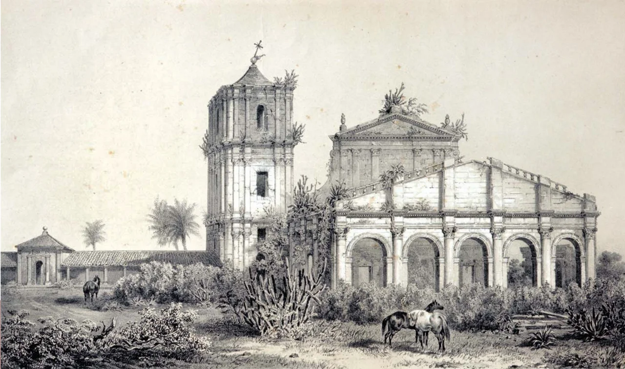

Ruins of São Miguel das Missões
The church has no roof anymore, only its towering red sandstone facade open to the sky, and at night a careful light makes the empty windows glow like memory. These are the ruins of Sao Miguel das Missoes, the most striking survivor of a vanished civilization on the plains of southern Brazil. Here, in the late seventeenth century, Jesuit priests and Guarani people built a community together, prosperous and devout, only to see it caught in the crossfire of empires and destroyed. The walls that remain are among the best-known images in all of Rio Grande do Sul, and to the Guarani who still live nearby they are nothing less than holy.
A World Built Together
Sao Miguel was one of the Sete Povos, the Seven Towns of the Missions, founded among the Guarani when this land lay under Spanish rule. The mission itself was established in 1687, planned with an order and ambition remarkable for its time and place. The Jesuits called these communities reducoes, reductions, from a Latin word meaning to lead or gather. The settlements became largely self-governing, blending European faith and craft with Guarani skill and labor. Sao Miguel grew prosperous on cattle, becoming one of the largest ranching centers in the whole Platine region, and its workshops produced sculpture and sacred art admired far beyond its walls. For a time, a genuinely new culture flourished here, neither wholly European nor wholly indigenous.
The Great Church
At the heart of the town rose its church, built between 1735 and 1750, and it was the church that carried the soul of the place. Baroque to its bones, it was designed to overwhelm: a theater of carved saints, candlelight, music, and drama meant to draw the Guarani toward the new faith through wonder rather than force alone. The Guarani who raised these walls quarried the sandstone and shaped the statues with their own hands, and the artistry that survives in the regional museums testifies to their mastery. Yet the church's completion marked a cruel turning point. Almost as soon as the mission reached its height, the forces that would destroy it were already gathering.
This Land Has an Owner
In 1750 a treaty between Spain and Portugal redrew the map and ordered the Seven Towns evacuated, handing the Guarani homeland to Portugal. The Guarani refused to abandon the world they had built. In the Guarani War that followed, their leader Sepe Tiaraju gave voice to their defiance with words still remembered today: Esta terra tem dono, this land has an owner. Sepe was killed in February 1756, and three days later, on the field of Caiboate, colonial armies slaughtered roughly fifteen hundred Guarani in a single day. The numbers are almost too large to feel, but each was a person defending a home. Sao Miguel was burned and emptied. Decades of looting followed, until the great church stood abandoned and roofless, swallowed by forest.
Sacred Stone Village
The ruins were rescued from the forest beginning in 1925, and in 1983 UNESCO named them a World Heritage Site, together with four sister mission ruins across the border in Argentina. The architect Lucio Costa, later famed for designing Brasilia, helped secure their protection and designed the museum that now shelters their surviving sculptures. A tornado damaged that museum in 2016, but it was restored and reopened the next year. For the Mbya-Guarani who live in the surrounding region, direct heirs to the mission culture, this is no mere archaeological site. They call it Tava Miri, the Sacred Stone Village, a living symbol of ancestry and survival. The story is so resonant that the 1986 film The Mission, with Robert De Niro and Jeremy Irons, drew on this very history. Standing before the lit facade after dark, you understand why a roofless church can still feel like one of the most sacred places on the continent.
From the Air
The Ruins of Sao Miguel das Missoes lie at roughly 28.55 degrees south, 54.56 degrees west, in the town of the same name in the Missoes region of northwestern Rio Grande do Sul. The site covers about 38 hectares of open ground, and the roofless red sandstone church is the dominant landmark, especially striking at dusk when it is illuminated. The surrounding country is gently rolling farmland and pasture, dotted with small towns. There is no major airport at the ruins themselves; the nearest sizeable field is at Santo Angelo, a short distance to the northwest, whose cathedral was modeled on this very church. Santa Maria (ICAO: SBSM) lies about 230 km to the south, and Porto Alegre (ICAO: SBPA) roughly 380 km to the southeast. From 2,000 to 3,500 feet above ground the bright church facade and the geometric footprint of the old mission plaza stand out against the green fields. Clear days in the drier autumn and winter months offer the cleanest views over this part of the southern plateau.
Nearby Stories
- Santo Ângelo 40 km away
- João Goulart's House 80 km away
- Paleontological and Archaeological Museum Walter Ilha 97 km away
- Santa Maria, Rio Grande do Sul 101 km away
- Jesuit Missions Among the Guaraní: Utopia, Refuge, and Ruin 121 km away
- Kiss Nightclub Fire 129 km away
- Battle of Yatay 151 km away
- Passo Fundo 170 km away