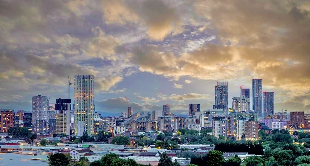

Salford
Stand on Blackfriars Bridge and the river tells you everything. On the east bank, Manchester - skyscrapers, the Cathedral, the busy thoroughfares of the centre. On the west bank, Salford - separate city, separate council, separate identity, separated by nothing more than the River Irwell's narrow loop. A Norman baron's pen divorced them in the 12th century, and Salfordians have insisted on the distinction ever since. The folk song that gives the city its nickname, Ewan MacColl's Dirty Old Town, was written about this exact strip of land. Today the smokestacks have gone and the BBC has moved in, but the line at the river still matters.
A Ford by the Willows
The name is Anglo-Saxon: Sealhford, a ford by the willows, named for the trees that lined the Irwell where Victoria Bridge now stands. Long before the Saxons, Neolithic flint workings on Kersal Moor put human activity here seven to ten thousand years ago. A Bronze Age cremation urn turned up in 1873 during construction on the Broughton Hall estate. The Brigantes, the major Celtic tribe of northern England, controlled the area until the Romans came through in AD 79 and built Mamucium across the river. In 1228 Henry III granted Salford the right to hold a market and an annual fair. Two years later, Ranulf de Blondeville made it a free borough - a status with real commercial advantages over neighbouring traders. For seven centuries Salford was a small but consequential market town.
Dirty Old Town
The Industrial Revolution arrived and Salford's population went from twelve thousand in 1812 to seventy thousand within thirty years, then to two hundred and twenty thousand by 1900. Cotton mills lined the Irwell. The Bridgewater Canal, completed in 1761, halved the cost of coal. The Manchester Ship Canal, opened in 1894, made Salford a major inland port - by 1914 the Port of Manchester, whose docks were mostly in Salford, was handling five percent of the United Kingdom's imports. But the same boom built terraces eighty homes to the acre, and when the cotton trade collapsed the city was left with overcrowding and unemployment that lasted decades. Robert Roberts wrote about it from the inside in The Classic Slum. The painter L.S. Lowry, who attended Salford School of Art and lived nearby in Pendlebury for forty years, painted it from the outside - the matchstick figures, the mill chimneys, the heavy grey sky. His Salford is still how most of the world pictures the place.
From Docks to MediaCityUK
By 1971, cotton spinning in Salford had ceased completely. The docks closed not long after. Through the 1980s and 1990s the area lived through high unemployment, organised crime in Ordsall and Pendleton, and the kind of social problems that made the Conservatives and Liberal Democrats stop contesting some wards because their workers felt unsafe. Then the regeneration began in earnest. The old dockland on Salford Quays was redeveloped from the 1980s. In 2011-12, BBC departments - CBBC, BBC Sport, Radio 5 Live, BBC Breakfast - moved from London to MediaCityUK on the Quays. ITV Granada arrived too. The Lowry Centre opened beside them, the theatre and gallery complex named for the painter, with many of his canvases on permanent display. The population had begun rising again.
Salfordians
The list of people from Salford is improbably long. The suffragette leader Emmeline Pankhurst lived here. The scientist James Prescott Joule, after whom the unit of energy is named, was born and raised here. So were the actors Albert Finney and Robert Powell, the dramatist Shelagh Delaney who wrote A Taste of Honey at eighteen, the punk poet John Cooper Clarke, and the Hollies and CSN&Y musician Graham Nash. Joy Division formed here in 1976. So did Happy Mondays. The BBC's American voice for decades, Alistair Cooke of Letter from America, was born in Salford. So was the Manchester United footballer Eddie Colman, who died in the Munich air disaster of 1958 aged twenty-one. The city that produced all of them is small - about 130,000 people - but Salford has always punched harder than its size suggests.
From the Air
Salford sits at 53.483 degrees north, 2.293 degrees west, on the western bank of the River Irwell facing central Manchester. Manchester Airport (EGCC) lies about 13 km south. Manchester Barton (EGCB) is about 5 km west. From altitude the most visible feature is the tight S-bend of the Irwell separating Salford from Manchester centre, with the MediaCityUK buildings cluster at Salford Quays to the southwest.
Nearby Stories
- National Science and Media Museum 0.2 km away
- Jodrell Bank Observatory 3.2 km away
- Siege of Lathom House 5.6 km away
- Chester Zoo 6.2 km away
- Whalley Abbey 8.9 km away
- Haddon Hall 10 km away
- Wentworth Castle 16 km away
- Blackpool 16 km away