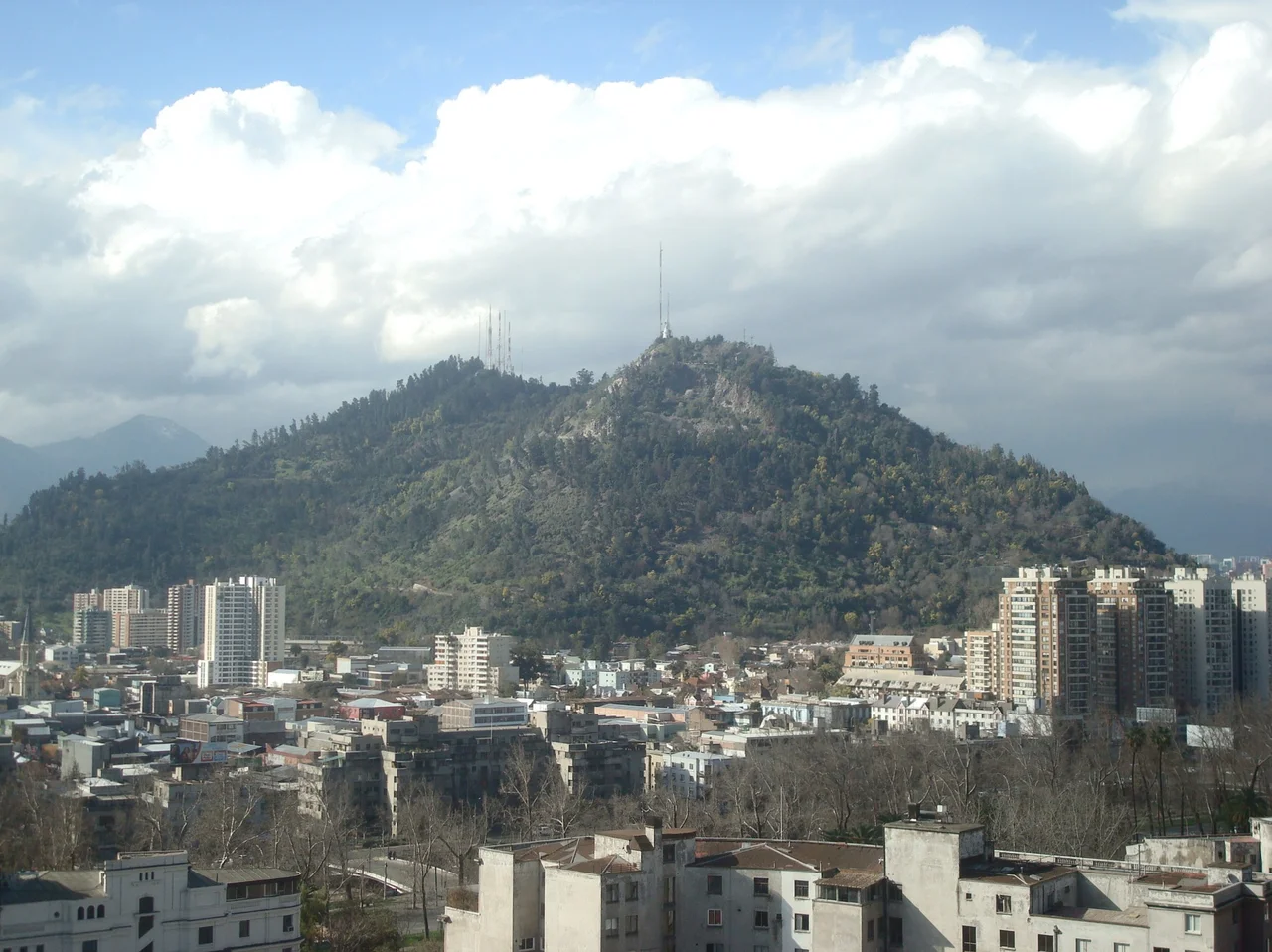

San Cristóbal Hill
The conquistadors needed a fixed point in an unfamiliar land, so they looked up and named the hill for the patron saint of travelers. Its indigenous name was Tupahue — a Quechua word, a trace of the Inca presence in the region before the Spanish arrived. The Spanish renamed it Cerro San Cristóbal, for St Christopher, precisely because it served as a landmark, a thing you could steer by. That instinct never left it. Today a 14-meter statue of the Virgin Mary stands at its summit, lit from below after dark so that she glows above the rooftops, visible from across Santiago by day and night. The hill the Spanish used to find their way is still the thing the whole city orients itself around.
The Virgin Who Watches the City
The summit belongs to a sanctuary dedicated to the Immaculate Conception, inaugurated in 1908. Its centerpiece is the white statue of the Virgin, 14 meters tall atop an 8.3-meter pedestal, weighing more than 36,000 kilograms. Within that pedestal hides a small chapel, and on April 1, 1987, Pope John Paul II knelt there to pray and bless the city spread out below him. An amphitheater at the statue's feet hosts open-air masses, the congregation seated with the entire valley as their backdrop. At night the floodlights catch her, and from the streets far below she seems to hover, a pale figure suspended over a sea of city lights.
Stars and Sanctuaries
Faith was not the hill's first calling. In 1903 astronomers arrived, installing the Mills Observatory near the summit, a southern station built as an offshoot of the famous Lick Observatory in California, funded by the philanthropist Darius Ogden Mills to survey the southern sky. Known today as the Manuel Foster Observatory, it made Cerro San Cristóbal a place for studying the heavens before it became a place for praying to them. There is something fitting in the pairing: a hill that draws the eye upward, used first to chart the stars and then to honor the divine, both pursuits asking the same thing of anyone who climbs it, which is simply to look up.
Santiago's Great Green Lung
Cerro San Cristóbal holds the city's largest public park, the sprawling Santiago Metropolitan Park, a wedge of forest and trails rising out of the dense neighborhoods around it. At its foot sit the Chilean National Zoo and a serene Japanese garden, while higher up two municipal swimming pools, Tupahue and Antilén, offer a cool plunge with a panoramic view. On weekends the slopes fill with joggers, cyclists, and families escaping the apartment blocks below. In a city pressed tight against the Andes, this single forested hill is the lung where Santiago comes to breathe.
Getting to the Top
Reaching the summit is half the experience, and there are many ways to do it. The energetic walk up in about 45 minutes, climbing 300 meters from the streets of bohemian Barrio Bellavista. Others ride the historic Funicular de Santiago, whose base sits beside the zoo at the north end of Pío Nono. A cable car offers a third route, though it has had a troubled history. The original line ran from 1980 until 2009, when the gearbox controlling its speed exploded and left the system unusable. The years that followed were a saga of frustration: a tender opened in 2011 drew only a single bid, which was rejected, and a fresh public contest had to be launched in 2013. Finally, in December 2014, officials announced a full overhaul. A 9.5-million-dollar program of works delivered a new 46-cabin network, eight of those cabins fitted to carry bicycles, strollers, or wheelchairs, each holding up to six passengers, and the cable car reopened in November 2016. Whether you climb, ride, or glide, the reward is the same, the whole of Santiago laid out beneath the Andes.
From the Air
Cerro San Cristóbal rises to 880 m above sea level, about 300 m above the surrounding city, at 33.4253°S, 70.6333°W in northern Santiago, making it the third-highest point in the city after Cerro Manquehue and Cerro Renca. From the air it is unmistakable: a forested green dome punctuating the urban grid, crowned by the white Virgin statue that catches sunlight by day and floodlights by night. The nearest general-aviation field is Eulogio Sánchez (Tobalaba) Airport, ICAO SCTB, about 7 km east-southeast; the main gateway is Comodoro Arturo Merino Benítez International, ICAO SCEL, roughly 16 km west-northwest in Pudahuel. The summit offers a natural visual reference for the whole basin, best viewed in clear morning air before afternoon haze.
Nearby Stories
- Paine Memorial 21 km away
- 1947 BSAA Avro Lancastrian Star Dust accident 23 km away
- Battle of Chacabuco 31 km away
- La Campana National Park 36 km away
- Puente del Inca 44 km away
- Casa de Isla Negra 62 km away
- Santa Cruz, Chile 103 km away
- Pierre Auger Observatory 172 km away