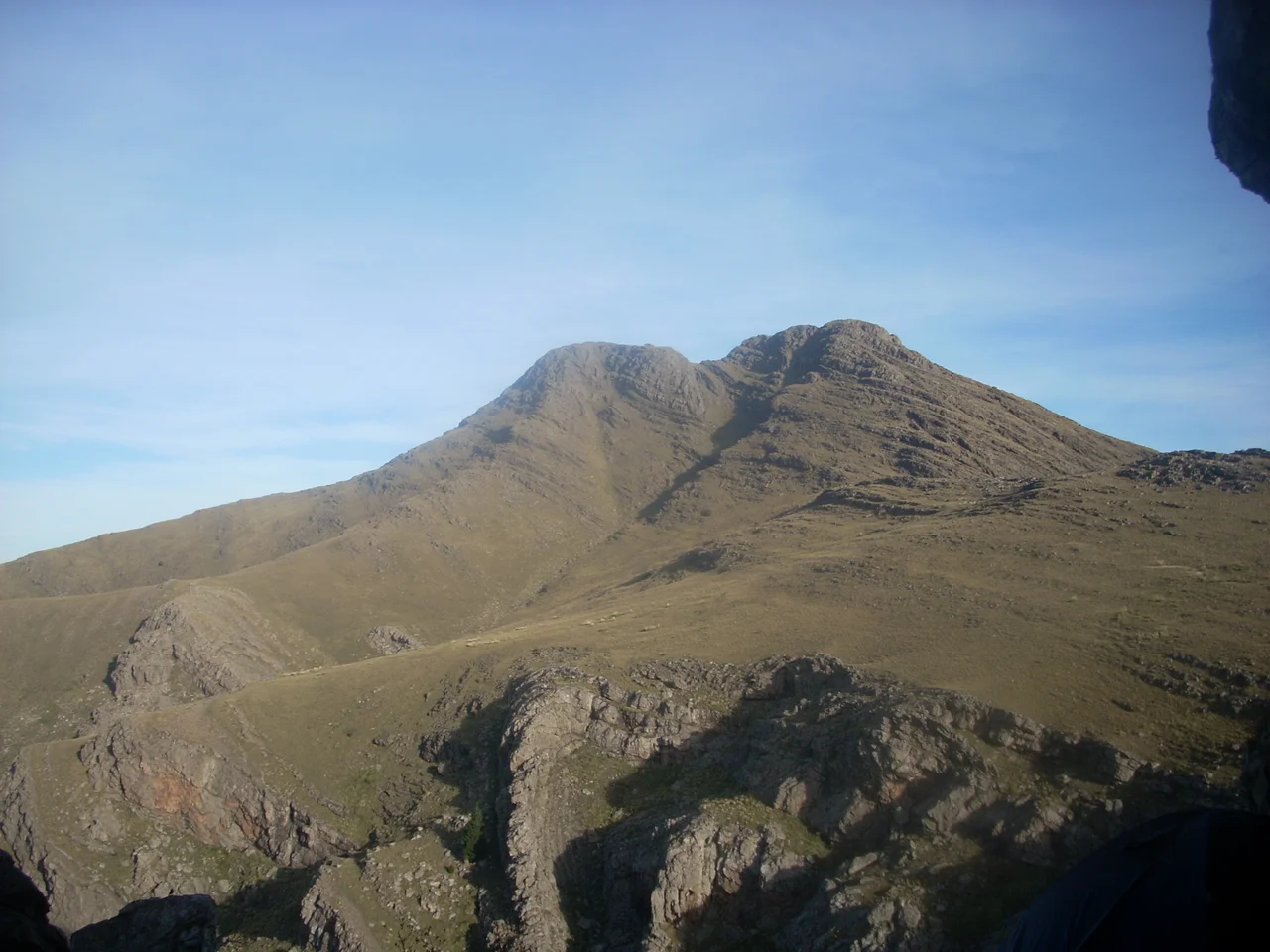

Sierra de la Ventana (mountains)
There is a hole in the mountain. High on a ridge in southern Buenos Aires Province, wind and water have worn a clean window straight through the rock, and on a bright day you can stand on the Pampas below and see sky on the far side of solid stone. That window, La Ventana, gave the whole range its name. The Sierra de la Ventana erupts from the grassland with no foothills to warn you, one of only two true mountain ranges in the vast flat heart of Argentina. Its stone is almost unimaginably old: a Precambrian basement formed roughly 2.2 billion years ago, far older than the Andes, weathered now into escarpments, caves, and grottoes that the smooth plains never produced.
Roof of the Plains
These are not tall mountains by the standards of the continent that gave the world Aconcagua. The range tops 1,000 meters at only six points, and its highest, Cerro Tres Picos, reaches 1,239 meters (about 4,065 feet). But altitude is relative. In a province whose horizon is otherwise an unbroken green line, Tres Picos is the roof of everything: the highest point in all of Buenos Aires Province and the highest in the entire Pampas region. The neighboring summits carry names that ring with history and language layered over centuries: Cura Malal, Napostá Grande, Destierro Primero, La Ventana itself. Their rough quartzite refused the wind-blown loess that smoothed the surrounding plains into prime farmland, which is why the range was always the least suited to agriculture. Today sunflower fields blaze yellow along its feet, lapping at the base of stone two billion years in the making.
Darwin's Climb
In 1832, the same young naturalist who dug fossils from the coast at Punta Alta turned inland and climbed these hills. Charles Darwin recorded his ascent of the Sierra de la Ventana in the sixth chapter of The Voyage of the Beagle, describing the steep quartzite and the effort of the climb across country that few Europeans had seen. He was far from the first to walk here. The caves and rock shelters of the Ventania hold pre-Hispanic rock art, painted by the indigenous peoples who knew these summits long before any sail appeared off the coast. Scholars have documented these painted sites on the eastern flank of Cerro Tres Picos and elsewhere in the range. For the people who made them, the high places were not merely scenery but something closer to sacred, summits charged with ritual meaning, a dimension the modern hiker can only glimpse.
An Island of Cold
The Sierra makes its own weather. Standing above the plains, the range is colder and drier than the humid Pampas to the east, yet catches more rain than the semi-arid grassland to the west, an island of microclimate marooned in the grass. Stands of lacebark pine grow along the slopes, probably introduced from Asia, their pale mottled trunks an odd note against the native scrub. Geologists who study the soils here find a horizon structure that echoes, of all places, the Appalachians of North America, a quiet reminder that these worn ancient ranges are cousins across hemispheres. Snow occasionally dusts the peaks. Mist pools in the grottoes. The window in the rock frames a sky that shifts hour by hour.
The Belle Époque Comes to the Mountains
At the turn of the twentieth century, the cool breezes and dramatic scenery turned the range into a fashionable escape. Its great early promoter was Ernesto Tornquist, a Buenos Aires rancher, banker, and developer who saw a resort in the rocks. When the Buenos Aires Great Southern Railway pushed a line past the area, it opened the door to luxury: the grand Club Hotel de la Ventana, a casino and hotel of genuine European pretension, and the leafy resort village of Villa Ventana. Much of the protected core of the range now lies within Ernesto Tornquist Provincial Park, where trails climb toward La Ventana and Tres Picos. The Belle Époque tourism faded after a 1917 ban on gambling shut the casino, but the mountains endured, as they had for two billion years, indifferent to the brief excitement at their feet.
From the Air
The Sierra de la Ventana rises near 38.16°S, 61.95°W in southern Buenos Aires Province, with Cerro Tres Picos cresting at 1,239 meters (about 4,065 feet) — the highest terrain in the province. The nearest major airport is Comandante Espora (ICAO: SAZB) at Bahía Blanca, roughly 100 km to the southwest; Coronel Suárez (ICAO: SAZC) lies to the northwest. Because these peaks jut abruptly from otherwise flat terrain, give them generous clearance and watch for orographic turbulence and rapidly forming cloud on the windward slopes. From the air the range reads as a sharp, dark spine of quartzite slicing across the green plains; look for the distinctive natural window near the La Ventana summit and the resort clearings of Villa Ventana at the foot of the range.
Nearby Stories
- Bahía Blanca 31 km away
- Pigüé 51 km away
- Monte Hermoso 58 km away
- The Works of Francisco Salamone 89 km away
- Tres Arroyos 111 km away
- Villa Epecuén 124 km away
- Yellow Fever in Buenos Aires 172 km away
- Carmen de Patagones 257 km away