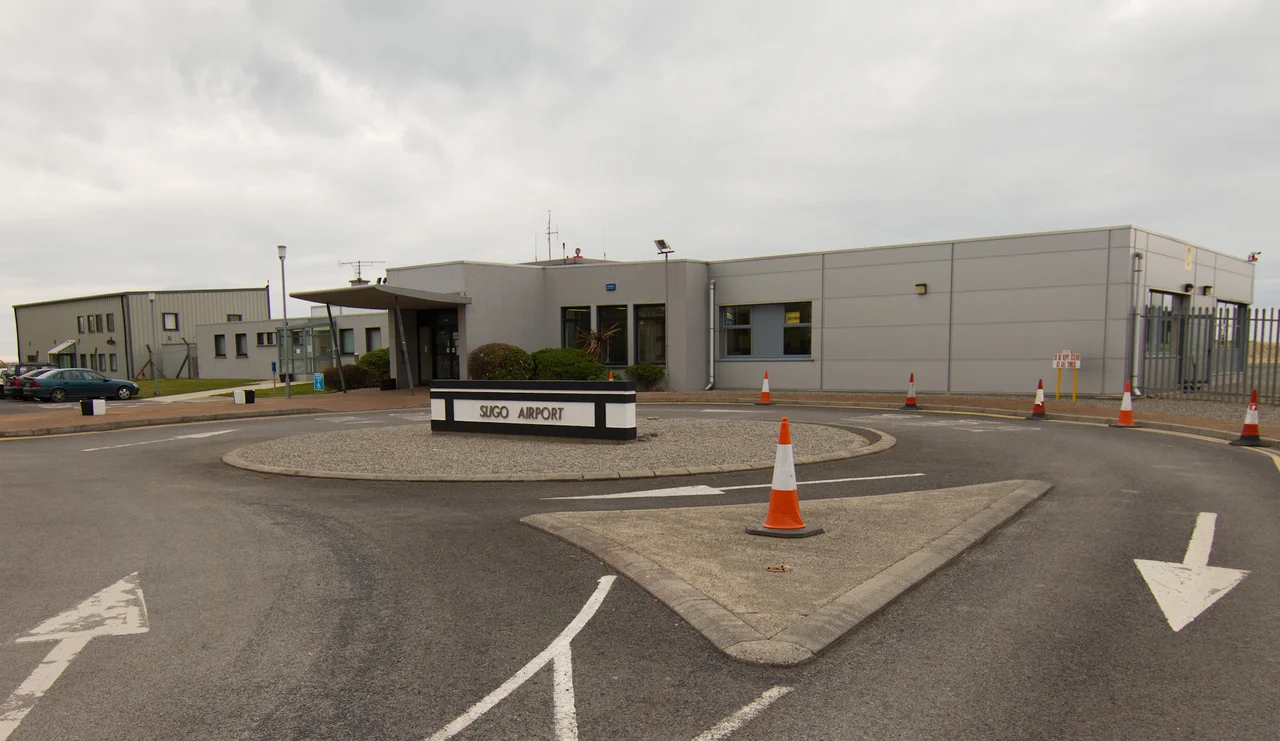

Sligo Airport
The runway at Sligo runs along a sand peninsula barely two kilometres long, with the Atlantic at one end and protected dunes at the other. There is, in pilot's terms, no margin. Like Gibraltar or Funchal, Sligo demands precision because the geography offers no second chances. In 2002, a Euroceltic Fokker F-27 came in fast and low and ended up nose-down in the sea, its main gear caught on an embankment - everyone walked away, but the plane was a write-off two weeks later from salt damage to the cockpit. The scheduled flights ended in 2011. What remained, and what still operates here today, is something arguably more important: the helicopter that comes when the sea is taking somebody's life.
Rescue 118
Sligo Airport is home to Rescue 118, the Irish Coast Guard's search-and-rescue helicopter for Ireland's northwest. It has been based here since 2004. The current aircraft is a Sikorsky S-92A, a heavy-lift twin-engine machine that replaced the older S-61N on 1 July 2013. It flies 24 hours a day, every day of the year - cliff rescues along the Donegal sea-stacks, medical transfers from islands like Tory and Arranmore, casualties pulled off fishing trawlers in the Atlantic swell. Operated under contract by CHC Ireland, the crew live with the cycle of weather and accident. When Rescue 118 launches, somebody is having the worst day of their life.
The Day the Plane Stopped in the Sea
On 2 November 2002, a Euroceltic Fokker F-27 with the registration G-ECAT was finishing a routine run from Dublin. The approach was fast and the landing was late - nosewheel first, almost halfway down the runway. By the time the brakes had any meaningful effect, there was no runway left. The aircraft came to rest with its nose in the water and its main gear hooked on the embankment that ends the strip. Passengers were evacuated safely. There were no casualties. The Air Accident Investigation Unit later found that the pilot was under restrictions following a CAA audit of the airline, and that the chief pilot had been "using an instructor tone and coaching" him through the landing. Two weeks later, the airline wrote the aircraft off. Saltwater is unkind to avionics. Euroceltic itself was gone within a year.
The Runway That Couldn't Grow
In February 2007, the Irish government announced €8.5 million in capital grants to extend the runway, add approach lighting, and improve safety margins. The plan required infilling part of the adjacent protected beach and erecting gantries over the sand. Almost 400 objections came in - from local residents, fishery groups, the Department of Environment, An Taisce, and Birdwatch Ireland. The planning permission was quashed on three successive attempts, finally by a High Court judge on justification grounds. The dunes won. Aer Arann continued the Dublin route until July 2011, when the final scheduled flight left and the government quietly dropped the airport's PSO designation, citing poor performance and the alternative transport links that had grown up in the meantime.
What's Still Here
The scheduled flights are gone but the airfield is far from dead. Sligo Aero Club operates from here. Cessnas, Pipers, and Beechcraft come and go on training flights and private trips. Occasional jets visit when their performance suits the short runway. For a stretch of years the airport's main hangar housed the Strandhill People's Market on Sundays - locally produced food and crafts under fluorescent lights where Fokkers had once parked - until the market was suspended in June 2025 to allow airport expansion. And above all of this, Rescue 118 sits on its pad, ready. Sligo Airport's commercial life ended when the last passenger walked across the apron in 2011. Its working life never paused at all.
From the Air
Sligo Airport (ICAO: EISG, IATA: SXL) sits at 54.280°N, 8.599°W on the south side of Sligo Bay at the western tip of the Coolera Peninsula in Strandhill, 5 nm WNW of Sligo town. Single asphalt runway 11/29, 1,199 m (3,933 ft). Elevation 11 ft. Beach and dune terrain at both ends; no overrun margin - precise approach speeds essential. AFIS available daytime; pilot self-announce outside hours. CHC Coast Guard S-92A operations 24/7. Knocknarea (327 m) lies 3 km east. Atlantic westerlies prevail; sea fog can develop rapidly along this coast.
Nearby Stories
- Killala 5.5 km away
- Ballaghaderreen 7.4 km away
- Townlands of Kilcommon 10 km away
- River Shannon 11 km away
- Monastery of Mohill-Manchan 15 km away
- Pettigo 18 km away
- Killybegs 19 km away
- RMS Empress of Britain (1930) 97 km away