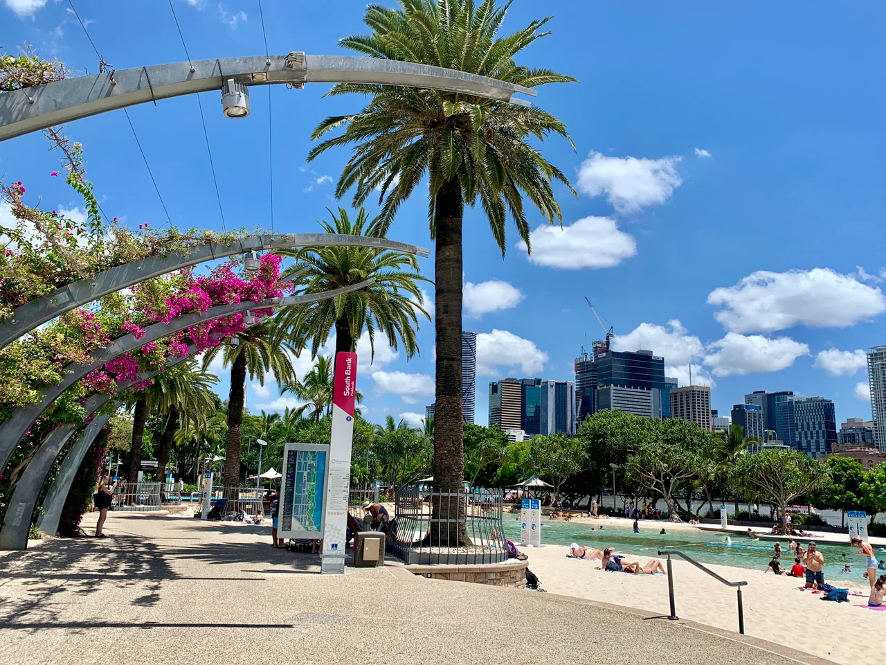

South Bank Parklands
There is a beach in the middle of Brisbane, half a kilometre from the nearest sea. Streets Beach is a lagoon of pale sand and clear water tucked against the Brisbane River, lifeguards on patrol, the city's towers rising on the far bank. It should not exist, and very nearly did not. The whole green sweep around it, South Bank Parklands, was supposed to be sold off and built over once the crowds went home. Instead the people of Brisbane decided the best thing the city had ever done was a party, and they fought to keep the grounds it was thrown on.
The Bank That the River Abandoned
Long before any of this, the south bank was a meeting place for the Turrbal and Yuggera peoples, the traditional owners of the river country. European settlers made it Brisbane's first commercial centre from the 1850s, until the catastrophic flood of 1893 drove the business district to higher ground across the water, where it has stayed ever since. South Bank slid into decades of decline, a district of vaudeville halls, run-down boarding houses and industry. For most of the twentieth century it was the part of town the city had turned its back on, low-lying and half-forgotten, waiting without knowing it for a reason to be wanted again.
Six Months That Changed a City
World Expo 88 was that reason. From April to October 1988 the world's fair filled the old industrial bank, and more than fifteen million visits poured through over six months, an astonishing number for a city Brisbane's size. When it ended, the government planned to redevelop the forty-hectare site commercially. The public said no. A campaign to keep the land as parkland gathered force, and in 1989 the South Bank Corporation was created to make a park instead of a profit. South Bank Parklands opened on 20 June 1992, and Brisbane had taken the site of its greatest celebration and refused to give it back to developers.
A Beach Made by Hand
Streets Beach is the showpiece, and it is entirely artificial. Around two thousand square metres of free-formed concrete hold a chlorinated freshwater lagoon, recirculated every six hours, rimmed by two thousand cubic metres of sand trucked in from Moreton Bay. Each year about seventy tonnes of fresh sand top it up. Almost half the lagoon sits on reclaimed ground that was once the river itself. Nearby, the Wheel of Brisbane turns sixty metres above the parkland on forty-two gondolas, raised in 2008 for Expo's twentieth anniversary, and a kilometre-long arbour of 443 curling steel columns runs the length of the park, smothered in bougainvillea that flowers all year.
The Pagoda They Would Not Lose
Among the Expo pavilions stood a Nepalese Peace Pagoda, hand-carved in traditional Nepali style. It was the one international pavilion the city could not bear to part with. When the fair closed, a fundraising campaign and a petition of tens of thousands of signatures saved it, and the pagoda was moved to a riverfront setting in the parklands, where its meditation space still stands. The instinct behind that rescue runs through the whole park. South Bank works because Brisbane kept choosing it, again and again, the pagoda, the parkland, the beach, each one a small refusal to let a good thing be taken away. Today crowds gather here by the hundreds of thousands for Riverfire and New Year's Eve, on a riverbank the city once forgot.
From the Air
South Bank Parklands lines the southern bank of the Brisbane River at 27.479°S, 153.023°E, directly opposite the CBD in South Brisbane. From the air it is one of the city's clearest landmarks: a green riverfront strip set against downtown towers, marked by the white spokes of the Wheel of Brisbane and the curving Grand Arbour, with the Victoria and Goodwill bridges crossing the river at either end. The Brisbane River's tight loop around the CBD makes the whole precinct easy to fix. Brisbane Airport (YBBN / BNE) lies about 13 km to the north-northeast; Archerfield (YBAF) is roughly 11 km to the south-southwest. Expect clear subtropical air for most of the year, with humid summer haze and afternoon thunderstorms from December through February.
Nearby Stories
- Redcliffe Peninsula 2.7 km away
- Tamborine National Park 12 km away
- Cressbrook Homestead 27 km away
- Main Range National Park 31 km away
- 2010-2011 Queensland Floods 38 km away
- Cape Byron 96 km away
- Cape Byron Light 126 km away
- HMS Porpoise (1799) 588 km away