Southeast Sulawesi: The Province That Ferries Built
There is no road in. Southeast Sulawesi, the province occupying the southeastern arm of Sulawesi's spider-shaped landmass, has no highway connecting it to the rest of the island. To arrive overland, you take a ferry across the Bone Gulf from Watampone in South Sulawesi to the port of Kolaka, a crossing that doubles as a statement about what kind of place this is: maritime, insular, stubbornly its own. The province encompasses not just the peninsula but a scatter of substantial islands, Buton, Muna, Kabaena, and Wawonii among them, each with its own ethnic identity, its own dialect, its own sense of separateness bound into a single administrative whole.
The Fortress on the Hill
Off the peninsula's southern coast, the island of Buton holds the remains of the Buton Sultanate, which endured from the fourteenth century through Indonesian independence. The Wolio Palace Fortress in Bau-Bau sprawls across roughly 23 hectares, a walled complex that the Guinness Book of Records has recognized as among the largest palace fortresses in the world. Built in the late sixteenth century for Sultan Kaimuddin, the fortress encloses mosques, royal tombs, and the sacred Popaua stone where sultans were crowned. The Butonese people, historically seafarers and traders, carried their culture across the Indonesian archipelago, and their descendants are found from Sulawesi to Papua.
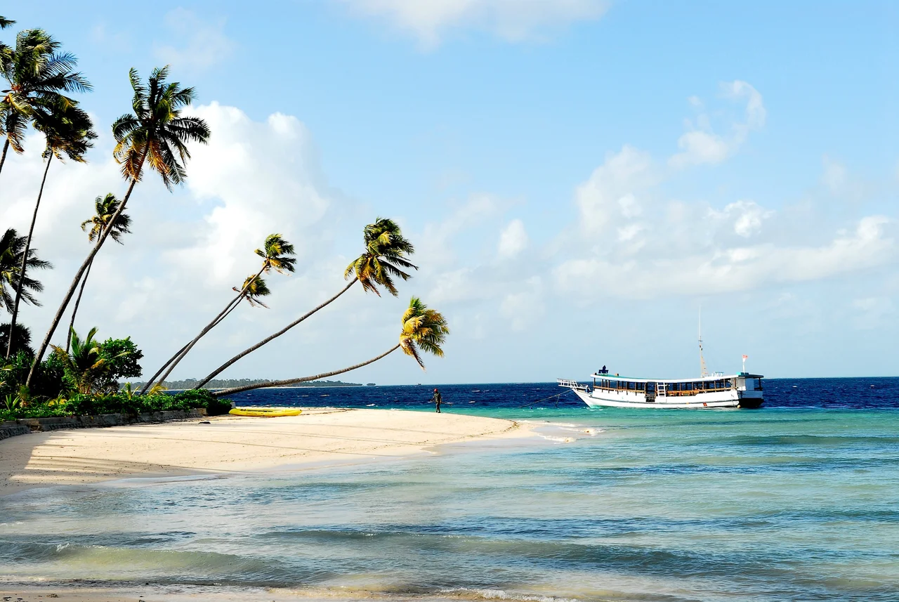
Islands Within a Province
Wakatobi, an acronym stitched from the names of four islands, Wangi-wangi, Kaledupa, Tomia, and Binongko, became its own regency in 2003 and is now better known internationally for its marine national park than for the nine indigenous communities who have fished these reefs for centuries. A third of Southeast Sulawesi's population of nearly 2.8 million lives on Buton and Muna islands alone, communities shaped by water as much as land. The Tanggeasinua and Mekongga mountain ranges define the mainland peninsula, while the Lalinda, Lasolo, and Sampara rivers drain its interior. But the geography that matters most here is the coastline, the harbors, the straits between islands.
A Mosaic of Peoples
The ethnic map of Southeast Sulawesi reads like a catalog of maritime civilizations. The Buton people, further divided into Wolio, Lasalimu, Kumbewaha, and Cia-cia speakers. The Muna, with their own cluster of subgroups: Busoa, Kaimbulawa, Liabuku. The Tolaki of the mainland, the Moronene of the southern peninsula, the Wawonii islanders. Islam arrived through trade networks and now claims 96 percent of the province's religious affiliation, but it settled onto existing cultural foundations rather than replacing them. Each group maintains distinct traditions, languages, and social structures that administrative boundaries have never fully contained.
Seventeen Regencies and Counting
Southeast Sulawesi has been subdividing itself for decades. In 1995, the province held just four regencies. By 2014, there were seventeen, plus two autonomous cities, Kendari and Bau-Bau. The splitting reflects both population growth and the political reality of Indonesian decentralization, where new regencies mean new government budgets, new administrative centers, new local power. Bombana Regency straddles the peninsula and Kabaena Island. Central Buton Regency, despite its name, sits on the southern end of Muna Island and contains no part of Buton at all. The administrative map is a puzzle that rewards close reading and resists easy summary.
Arrival by Air and Sea
Six airports serve the province, from Haluoleo near Kendari to the pair on the Wakatobi islands, Matahora and Tomia. Eighteen ports handle ferry traffic, cargo, and fishing fleets across the province's fragmented geography. The ferry network is the circulatory system: Kolaka to the mainland, Tampo and Lagasa on Muna, Batulo in Bau-Bau, Wamengkoli on Central Buton, each route a thread holding the province together across open water. In a region where the sea separates as much as it connects, these crossings are not merely transportation. They are the infrastructure of unity.
From the Air
Southeast Sulawesi is centered around 3.95S, 122.50E, occupying the southeastern peninsula of Sulawesi. From altitude, the peninsula's arm extends south and east from the main island body, with Buton and Muna islands clearly visible offshore. Haluoleo Airport (ICAO: WAWW) serves Kendari; Betoambari Airport (ICAO: WAWB) serves Bau-Bau on Buton. The Bone Gulf to the west and the Banda Sea to the east frame the peninsula. Best viewed at FL250+ for full provincial context, or descend to 5,000-10,000 feet over the Wakatobi islands for reef and island detail.
Nearby Stories
- Sulawesi's Hidden Wetland: Rawa Aopa Watumohai 18 km away
- The Nickel Furnace of the Electric Future 104 km away
- Wallace's Dreampond: Lake Towuti and Its Living Archive 116 km away
- The Coral Archipelago Spelled Out in Islands 137 km away
- The Language That Borrowed an Alphabet from Across the Sea 139 km away
- The Ninety Minutes of MV Marina Baru 2B 150 km away
- Wakatobi: Four Islands, One Name 193 km away
- The Island That Imprisoned a Nation's Greatest Writer 399 km away