
Teufelsmoor
Den Eersten sien Dood, den Tweeten sien Noot, den Drüdden sien Broot. The first gets death, the second gets misery, the third gets bread. Settlers in the Teufelsmoor said it about their own farms, and it was not a proverb about patience - it was a forecast, and an accurate one. The first generation dug drainage ditches in saturated peat and died young in damp turf huts. The second stayed poor. Only the third, with luck, ate properly. That was the deal offered to farmhands and servant girls from the villages around Bremen in the middle of the eighteenth century: come out onto the bog, take a strip of it, and you will owe no taxes and serve in no army. Thousands took it. The landscape they cut into the wet ground is still legible from the air today.
The Name Is a Mistranslation
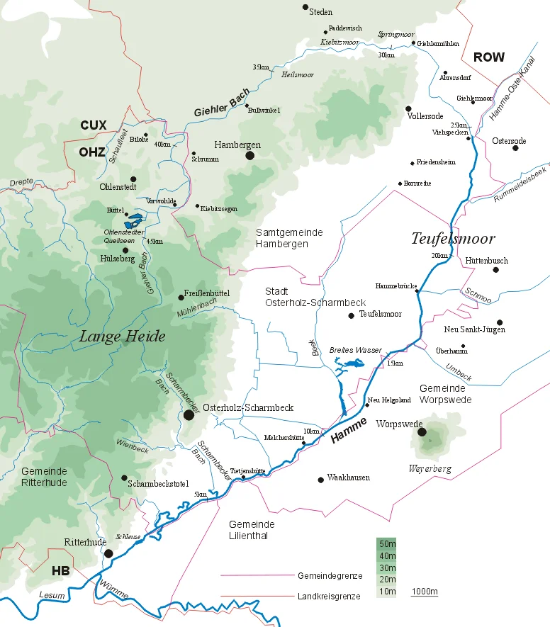
Teufelsmoor looks like devil's moor and almost nobody who hears it resists the image. The name has nothing to do with the devil. It comes from doofes Moor in Low Saxon, where doof means barren, unfertile, dead - a flat description of ground that would not grow anything. The reason sits in the chemistry. This is an ombrotrophic raised bog, fed only by rainfall and built from sphagnum moss over thousands of years, which produces peat with almost no nutrients in it; near the streams that drain the basin it grades into fen. It covers roughly 500 square kilometres north of Bremen, about twenty kilometres across at its widest, drained by the Hamme, the Wümme and the Wörpe, and hemmed between the sandy uplands of the Wesermünde Geest to the west and the Zeven Geest to the east. Around Grasberg the peat runs eleven metres deep and more.
Findorff's Forty-Two Villages
The man who organised the colonisation was born in Lauenburg on the Elbe in February 1720 and died at Bremervörde in July 1792. Jürgen Christian Findorff started laying out moor settlements around 1751 and was formally appointed Moorkommissar by decree of King George III in September 1771; over four decades he founded forty-two new villages across some 140 square kilometres of bog. The settlers were not farmers. They were farmhands and maids with no land of their own, and what pulled them out onto the moor was the offer of property plus exemption from tax and military service - a genuinely radical bargain in eighteenth-century Hanover, paid for in the currency of the proverb. Findorff argued their case against the authorities often enough that the epithet stuck: Vater aller Moorbauern, father of all the moor farmers. It is not a title many land commissioners have earned from the people they settled.
A Grid Cut Into a Bog
What the colonists built was an engineered surface. Long straight drainage ditches were dug to dry the ground, and the main ones were sized to double as canals, so that the peat cut from the strips could be poled out by barge. Houses went up in lines along the embankments - the Reihendorf, the linear village, still obvious in the layout of Grasberg and Worpswede - with each family's narrow Hufe running back from the water into the moor. Men walked the towpaths hauling loaded barges by rope, and millions of cubic metres of turf went down the canals to Bremen to be burned. That trade eventually killed itself. Peat smoke over Bremen grew so thick on still winter days that the city banned it, and coal, which carries far more heat per barge, took the market. The canals stayed. The straight lines stayed.
Improvement
The twentieth century did more damage than the peat cutters ever managed, and it did it in the name of productivity. Dairy cattle spread across the drained ground from the late 1800s, and from the middle of the next century national and European subsidy programmes funded serious melioration: deeper drainage, river regulation, and Tiefumbruch - deep ploughing that turned the peat under and brought sand up - until land that had been bog was growing maize for animal feed. This continued into the 1980s and 1990s. It worked, in the sense that the crops came, and it went far enough that ditches ran dry in summer, heath fires broke out, and during long droughts the reclaimed moor had to be watered artificially. Drained peat does not simply sit there. It mineralises and disappears, and the ground sinks as it goes.
Putting the Water Back
The rethink came in the 1990s. Land is being taken out of use and deliberately reflooded, and an old extraction site inside the Teufelsmoor reserve was rewetted in 2017, though nobody involved pretends the original bog can be recovered - it no longer exists. Even the surviving stretches are complicated: the Günnemoor is still being cut industrially, and the raised remnants that stand proud of the surrounding fields are the hardest of all to restore, because their elevation keeps them dry, mineralising and growing trees. Meanwhile the moor has become commuter country. Bremen's housing shortage pushes people north, and the settlements Findorff laid out are filling with residents who work in the city. The place has an odd second life on television, too: Radio Bremen filmed the whole story in 1982 as a series called Teufelsmoor, following several generations of a fictional farming family from the first reclamation to the end of the twentieth century.
From the Air
The Teufelsmoor spreads north and northeast of Bremen, centred at approximately 53.2833N, 8.9000E, across the Osterholz district and into Rotenburg around Gnarrenburg. From the air it is one of the most readable landscapes in north Germany: a dead-flat basin roughly 20 by 20 km, striped with dead-straight drainage ditches and canals and lined villages, the dark peat fields alternating with pasture, and only the Weyerberg at Worpswede breaking the horizon. The Hamme winds through the middle of it toward Bremen. Recommended viewing altitude is 1,500 to 3,000 feet AGL, low enough to read the eighteenth-century grid. Bremen Airport (EDDW) lies roughly 30 km southwest; Hamburg (EDDH) about 90 km east and Hannover-Langenhagen (EDDV) about 110 km south. Wet ground and still air produce dense radiation fog here on autumn and spring mornings, often well after the surrounding Geest has cleared.
Nearby Stories
- Stadland 9.3 km away
- Hatten 9.5 km away
- Schnoor 11 km away
- Hohe Weg Lighthouse 17 km away
- Hurricane Festival 21 km away
- Ahlden House 37 km away
- Großer Knechtsand 47 km away
- Lilleø 194 km away