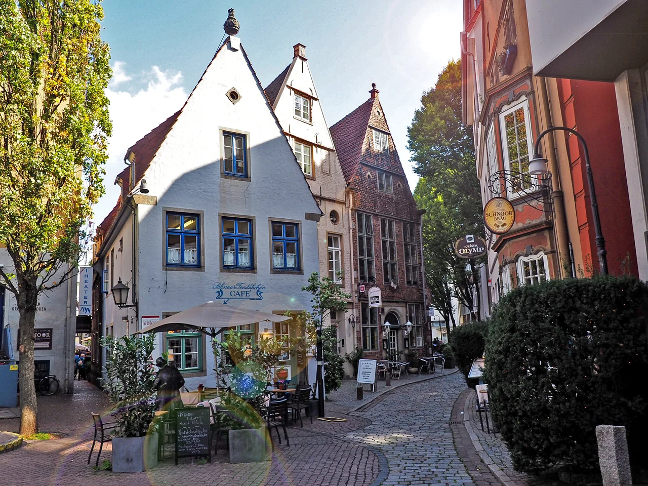

Schnoor
The quarter is named after string. Not a saint, not a founding family - Schnoor is Low German for cord, and the lane took it from the ropemakers who once stretched hemp along it into ship's rope, just as the neighbouring alley took the name Wieren, wire, from the men who forged anchor chains there. Bremen names things by what was made in them. Walk the lanes now and the scale is the first shock: houses set shoulder to shoulder on plots of barely sixty square metres, gables leaning over passages two people wide, a whole neighbourhood built to the dimensions of people who had almost nothing. That is precisely why it is still here. Everything else medieval in Bremen was pulled down by somebody with the money to improve it.
The Wrong Side of the Ridge
Medieval Bremen sorted itself by elevation, and the sorting was social as much as geological. The wealthy merchants took the Obernstraße, the upper street, along the crest of an old dune, or the Langenstraße running beside the Balge, the arm of the Weser that served as the city's first harbour. What was left was the low ground: a scrap of island between the Balge and the river, where from about the tenth century fishermen threw up thatched cottages and lived with the consequences. High water came through regularly in those first centuries. This was the poor corner of a Hanseatic city that was not otherwise poor, and it stayed the poor corner for the next nine hundred years - which turns out to be the single most important fact about it.
A Round Tower and a Bridge
Small does not mean unimportant. Bremen's first ferry crossing worked from here, and around 1240 the first bridge over the Weser was thrown across near this bank, which for a river city is the moment everything changes. Fragments of the period are still embedded in the fabric: an old stretch of wall and part of a round tower raised around 1200 stand near the lane called Marterburg. In the thirteenth century Franciscan friars settled in the quarter and began the church of St. John, brick, aisled and famously towerless, which is still in use and still listed. The friars have a modern echo - a small Bridgettine convent, the Birgittenkloster, was founded in the Schnoor in October 2002, which makes it one of the newest religious houses in Germany sitting inside one of the oldest streets.
Poverty as a Preservation Method
The oldest surviving houses go back to around 1400; most of what stands is seventeenth and eighteenth century. By the nineteenth, the lanes were hopeless for traffic and the quarter had become one of the poorest parts of Bremen, which meant that renovation was simply out of reach. Nobody widened the streets. Nobody replaced the gables with something modern. Then came the war, and the Schnoor took only slight damage while the city around it was flattened - so slight that after 1945 the owners of these undamaged houses were liable for the Lastenausgleich, the levy that redistributed wealth from the spared toward the bombed out. They had escaped the RAF and were taxed for it. By the mid-1950s the houses were in a pitiable state and looked like the next thing to come down.
The Decision Nobody Else Was Making
In 1959 the Bremen Senate chose to rebuild the quarter rather than clear it, inviting house owners to restore their wrecks with money from the state. Set that against what was happening everywhere else. Across Germany and much of Europe into the late 1970s, the standard treatment for a decayed medieval district was demolition and a road; Bremen went the other way two decades before the argument was settled. The Venice Charter for the Conservation and Restoration of Monuments and Sites in 1964 changed the climate, and in 1973 the Schnoor was designated a historic district under the State Monument Authority. A planning decision in 1981 went further and capped the number of bars and restaurants at fourteen, on the reasoning that a quarter full of tourists and no residents is a stage set.
What Is Behind the Doors
Names are painted on the houses because the houses are old enough to have them. The Concordenhaus dates from 1630, the Amtsfischerhaus from 1759, and the Schifferhaus on Stavendamm is the one preserved closest to its original state. There is a Landherrnamt of 1856, built for the officials who administered the state of Bremen, and an old tea house on the lane called Hinter der Holzpforte, and a Katzencafé whose sign is the most photographed thing in the neighbourhood. Craftspeople and small dealers work out of ground floors that were built for fishing families. It is unquestionably a tourist quarter now, and the crowds thin the moment it rains. Stand in one of the passages then, with the gables closing overhead and water running off four hundred years of brick, and the fishermen's island is not hard to find.
From the Air
The Schnoor lies at approximately 53.0728N, 8.8097E, in the southeast corner of Bremen's Altstadt, between St. Petri Cathedral and the Weser embankment. The lanes themselves are far too narrow to resolve from the air, but the block is legible as an unusually fine-grained patch of small roofs against the larger footprints around it. Navigate to the Altstadt: a compact oval inside the ring of the old ramparts, with the Weser curving along the south side, the Marktplatz and cathedral towers at the centre, and the Schnoor immediately southeast of them. Recommended overview altitude is 1,500 to 2,500 feet AGL. Bremen Airport (EDDW) is roughly 4 km south of the centre with the old town near the approach path; Hamburg (EDDH) lies about 100 km northeast, Hannover-Langenhagen (EDDV) about 100 km southeast. River fog and low cloud are common in the Weser valley from October to March.
Nearby Stories
- Teufelsmoor 4.9 km away
- Hatten 6.3 km away
- Vechta 10 km away
- Hurricane Festival 18 km away
- Stadland 19 km away
- Herrenhausen Gardens 41 km away
- Schöma 42 km away
- Neuengamme concentration camp 52 km away