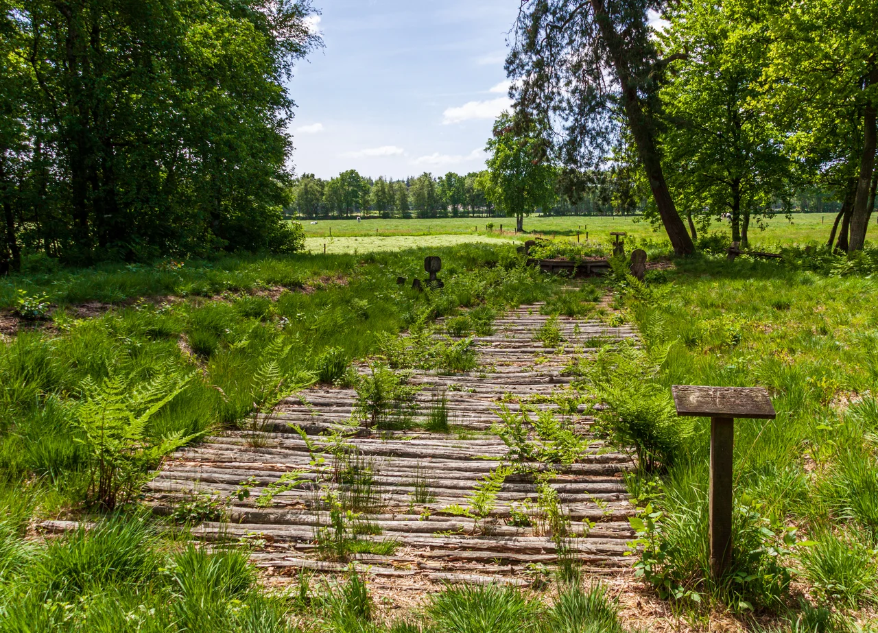

Wittemoor Timber Trackway
Most prehistory comes with a shrug attached - a century, a range, a give-or-take of two hundred years. The trackway laid across the Wittemoor bog comes with a year. Tree rings in the oak give 135 BCE, which means that in a single season somebody in the marshes south of the Weser felled timber, split it, hauled it out onto ground that would not hold a footprint, and built a road on top of the bog rather than around it. And where that road crossed a small stream, they set up a man and a woman cut flat out of oak planks, one on each bank, with no faces at all.
A Road Laid on Nothing
A Bohlenweg - a log causeway, or corduroy road in the American term - is what you build when the ground between where you are and where you need to be is liquid. Timbers are laid crosswise, sometimes on longitudinal runners, and the whole raft floats more than it rests. Dozens of them have been found across the North German Plain and they cluster thickly in the Weser-Ems country, because that is where the peat is.
This one runs north to south. At the southern end sat an Iron Age settlement beside a spring, in the Lintel part of what is now Hude, up on the geest - the higher, sandy, ice-age ground that stands above the wet. The northern end reached the River Hunte. In between lay the Wittemoor, and the trackway is simply the shortest line across it. Archaeologists catalogue it as trackway XLII (IP): number forty-two in a regional list that keeps growing.
The Two at the Stream
Six wooden figures came out of the excavations, and two of them are among the very few Iron Age carvings anywhere in northern Europe to have survived at all. They are silhouettes, cut from oak planks only a few centimetres thick, and they are severe. The male figure stands about 105 centimetres tall with a plain rectangular body. The female is about 95 centimetres, with breasts or shoulders suggested by a single slanting cut, broad hips, and a vulva.
Neither has a face. That was not carelessness - whoever made these had the skill to indicate a hip and chose not to indicate eyes. They stood facing each other across the trackway at the point where it crossed the stream, the man slotted into a plank to hold him upright, the woman set on a small mound of her own. Between the pair and the water there was an archway of poles that anyone using the road had to pass beneath.
Fires on Both Banks
The crossing was not simply marked. It was equipped. Fire sites were found on either side of the track, one at each end of the crossing. Just north of the female figure, two plain cult poles stood surrounded by stones and worked alder sticks, the sort of deposit that usually means offerings were made and left.
The interpretation archaeologists reach for is apotropaic: the figures were there to turn something away. That fits what these landscapes meant to the people living in them. A bog is not neutral ground. It swallows animals, it swallows people, it gives nothing back, and a wooden road across it is a thin and provisional thing. The stream crossing was the weakest point of the weakest structure in a dangerous place, and it got a man, a woman, an arch, two fires and a pole shrine.
Laid Flat
When they were found, every one of the figures was lying down. One reading is that they were deliberately laid flat - taken out of service and put beyond reach rather than left standing to be defaced by whoever came next. It is a small detail with a large implication: somebody decided the road's working life was over and closed it properly.
The other four poles are harder to place. They were found at points where the causeway itself had been damaged, and one was shaped like a hatchet. They might be warning markers, telling a traveller in poor light where the timbers had gone soft. They might be objects of the same kind as the figures, set at the injuries. There is no way to choose between those readings from the evidence, and the honest answer is that both are plausible.
Why Anything Is Left
None of this should exist. Oak in open air is gone within a human lifetime. What preserved the trackway and its figures is the same thing that made the road necessary: waterlogged peat, sealed from oxygen and mildly acidic, in which wood can sit for two thousand years without rotting. Bogs destroy the living and keep the made.
The site was excavated in 1965 and again in 1970, at Neuenhuntdorf in the parish of Berne, in the district of Wesermarsch. A stretch of the causeway has since been reconstructed on the ground with copies of the two figures back in position at the crossing, so that you can stand where the arch stood and look at the pair of them. They are still not looking back.
From the Air
The Wittemoor trackway lies at 53.124 degrees N, 8.404 degrees E, at Neuenhuntdorf in the municipality of Berne, Wesermarsch, in the low country between Oldenburg and Bremen. From the air the region is a mosaic of drained peat and marsh grazing, cut by the River Hunte running north to the Weser, with the higher wooded geest around Hude standing out on the southern side. The reconstructed causeway itself is a short line in a boggy clearing and needs low, slow flight to find. Nearest major airport is Bremen (EDDW), about 25 km east; Bremerhaven lies north down the Weser, and Münster Osnabrück (EDDG) is roughly 110 km south. Best viewing altitude 1,000 to 2,000 feet. Ground mist forms readily over the moor in still weather at dawn and dusk.
Nearby Stories
- Marcardsmoor 3.7 km away
- Jade Bight 6 km away
- Stickhausen Castle 7.8 km away
- Visbek 9.3 km away
- Worpswede 11 km away
- Hümmling 14 km away
- Ahlden House 54 km away
- Lilleø 240 km away