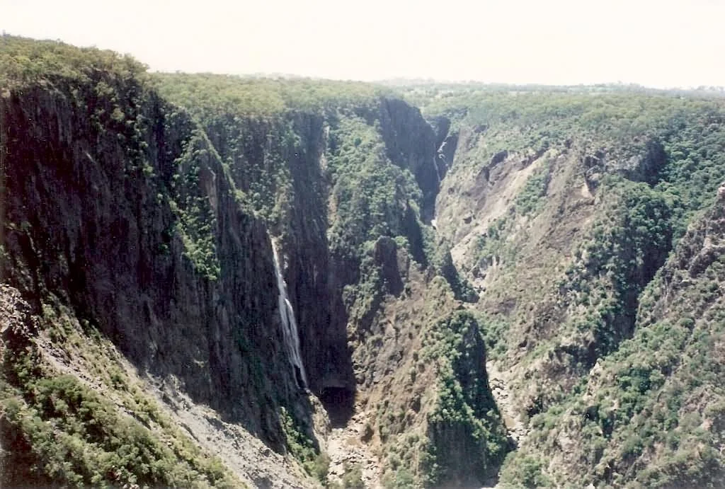

Wollomombi Falls
There is a moment on the Northern Tablelands where the flat, grassy world simply stops. The Wollomombi River, a modest tableland stream, runs to the lip of a cliff and falls away into nothing, plunging into a gorge so deep that the bottom is hard to make out from the lookouts above. In a single clean drop the water falls a hundred metres, and as the gorge steps down toward the Chandler River it keeps falling, for a combined descent of around 220 metres that ranks Wollomombi among the very highest waterfalls in Australia. After heavy rain the cascade roars white against dark rock. In a dry spell it can dwindle to a silver thread. Either way, the void it carves is permanent and enormous.
The Edge of the Tableland
Wollomombi sits about 40 kilometres east of Armidale in Oxley Wild Rivers National Park, just a short turn off the aptly named Waterfall Way, the road that strings together a whole series of these tableland cataracts. The geography here is the whole story. The Northern Tablelands form a high, gently rolling plateau, and along its eastern margin the land breaks away in a great escarpment toward the coast. Rivers that meander lazily across the top suddenly find themselves at the edge and drop hundreds of metres into steep, forested gorges. Wollomombi is the most dramatic expression of that collision. The river is nothing remarkable until the instant it runs out of tableland, and then it becomes one of the great waterfalls of the continent.
A Waterfall and Its Companion
Wollomombi does not fall alone. Right beside it, the Chandler River makes its own plunge as the Chandler Falls, and the two gorges meet just below, their waters joining in the depths. From the right vantage you can take in both at once, twin ribbons of water dropping into the same vast amphitheatre of stone. The naming convention of this country, full of unfamiliar local words and stockmen's labels, gives the place its strange music: Wollomombi, Chandler, the long list of lookouts strung along the rim. Each viewpoint frames the spectacle a little differently, and the sheer scale takes a moment to register. What looks at first like a tidy waterfall reveals itself, as your eye finds the bottom, to be something on a far grander order.
Walking the Rim
The falls are best understood on foot. The Wollomombi Walk leads upstream past a lookout platform and across the river on a long steel footbridge, then on to a second platform that gazes down on the falls from the opposite wall of the gorge, with a further spur opening views into the Chandler gorge where the two canyons merge. For those who want to go deeper, the Chandler Walk drops steeply from the rim, passing Checks Lookout, set about a third of the way along with a view back along the gorge to the falls, before reaching Chandler Lookout and winding down toward the gorge floor, ending some 400 metres below the clifftop. Edgars Lookout offers an easier, accessible view from the western side. Each track trades effort for a different angle on the abyss.
Quiet Camp Above the Void
For all its drama, Wollomombi rewards those who linger. The picnic ground and bush campsites sit on the tableland near the rim, equipped with the simple comforts of the back country: drinking water, pit toilets, a shelter shed, a fireplace, and an information display. Spend a night here and the place changes character. At dusk the gorge fills with shadow and the falls become a sound more than a sight, a steady distant rushing rising out of the dark. Eastern Australian birdsong threads the morning. To sleep within earshot of a hundred-metre cliff, with the Milky Way wheeling overhead in the clear tableland air, is its own kind of grandeur, quieter than the waterfall but no less memorable.
From the Air
Wollomombi Falls lies at 30.53 degrees S, 152.04 degrees E, in Oxley Wild Rivers National Park, about 40 km east of Armidale along Waterfall Way. From the air the signature is unmistakable: the abrupt eastern escarpment of the Northern Tablelands gashed by the deep Wollomombi Gorge, with the Wollomombi and Chandler rivers converging in shadow below the falls, which break from a rim near 1,000 m. Nearest airport is Armidale Regional (YARM / ARM), roughly 40 km west at 1,084 m elevation; Coffs Harbour (YSCH / CFS) lies to the east beyond the escarpment. Flow varies enormously with rainfall, so the falls show best after wet weather; the gorge can trap cloud and turbulence, and tableland mornings are frequently frosty.
Nearby Stories
- Uralla 16 km away
- Waterfall Way 20 km away
- Guy Fawkes River National Park 33 km away
- Apsley Falls 42 km away
- Wing Hing Long & Co. Store 43 km away
- South West Rocks Pilot Station Complex 46 km away
- Woolgoolga, New South Wales 61 km away
- Manly, New South Wales 338 km away