Alfsee
The Hase had a habit of swallowing fields. Every wet autumn, the slow river west of Bramsche would slip its banks and pool across the Bramgau lowlands, soaking pasture and farmland and reminding everyone in the Osnabrück district that geography keeps its own ledger. So in 1971, the engineers came with their drawings and started digging. What rises out of the flat fields north of the city today is not a natural lake at all - it is a 2.2-square-kilometre answer to a centuries-old problem, an artificial sheet of water that doubles as a holding pen for floodwater and a place to learn to sail.
The Engineered Lake
The Alfsee is a working machine disguised as scenery. A 4.5-kilometre channel siphons water off the Hase north of Bramsche and feeds it into a settling basin, where it spills over a long overflow dam into the main reservoir. From there, a second channel returns it to the river system via the Ueffelner Aue. The lake holds twenty million cubic metres at a depth of only two metres - shallow enough to warm pleasantly in summer, deep enough to absorb a swollen Hase when winter rains pile up in the catchment. Nearly all of it sits within the parish of Alfhausen on the western shore, which is where the name comes from. The eastern bay belongs to Rieste, and that small geographic accident shaped everything that came next.
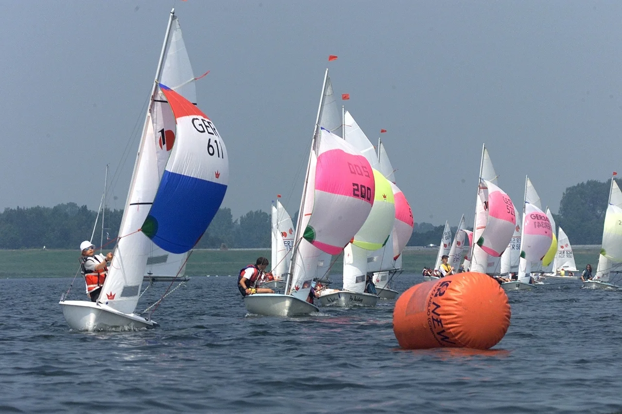
Holiday Park on the East Shore
By 1976, just five years after construction began, someone had spotted the opportunity. The parish of Rieste opened a holiday park on the eastern shore, and the reservoir's second life began. Today there are campsites and holiday homes scattered along the bank, a boating harbour with its own sailing school, and a marked-off zone where waterskiers carve white scars across the surface. Anglers come for the tench - bronze, slab-sided fish that prefer exactly the kind of warm, shallow, slow-flowing water the Alfsee was accidentally engineered to provide. A satellite basin to the east, the small Dubbelausee, and a reserve basin further north now sit inside a nature reserve, and birdwatchers have made the wider Alfsee complex one of the better-known stops on this stretch of the Hase corridor.
Getting There
The lake sits a few hundred metres east of the B 68 federal road and is reached from the Neuenkirchen-Vörden junction of the A 1 motorway that runs along its eastern flank. Trains from Bremen and Osnabrück stop hourly at Rieste station, about 1.8 kilometres from the water. The combination - flood-control infrastructure with parking, beach access, and a railway connection - is so quietly German that it almost passes without notice. The lake exists because the Hase needed somewhere to overflow. That it also became a place where children learn to tack a sailboat into a north wind is, in the engineers' minds, a bonus.
What the Water Means
Twenty-five kilometres north of Osnabrück, the Alfsee marks the seam between two ways of using the land. To the west rise the Ankum Heights, ancient glacial moraine; to the east stretches the flat agricultural country toward the Dümmer. The reservoir is younger than most of the people now sailing on it. But it has already become part of the landscape's working order, the kind of place where a Saturday afternoon means somebody is loading a kayak onto a roof rack, somebody else is checking tench rigs, and an unbroken line of cyclists is making the seven-kilometre loop around the shore.
From the Air
Located at 52.49 degrees N, 7.97 degrees E in north-central Lower Saxony, the Alfsee is a distinctive elongated reservoir about 25 km north of Osnabrück and 8 km north of Bramsche. From cruising altitude its dam-rimmed western edge and the smaller satellite basins to the east and northeast make it easy to identify against the surrounding agricultural pattern. Nearest major airports: Münster Osnabrück International (EDDG) roughly 35 km southwest, Bremen (EDDW) about 90 km north-northeast. Best viewing altitude 3,000-6,000 feet in clear weather; the A 1 motorway runs parallel to the lake's eastern side as a strong linear reference.
Nearby Stories
- Steinfurt 7 km away
- Siege of Lingen (1597) 7.3 km away
- Bad Iburg 11 km away
- Haren, Germany 12 km away
- Cloppenburg (district) 12 km away
- Gardelegen Massacre 202 km away
- Ludwigslust Palace 214 km away
- Memleben Abbey 235 km away